Nation’s Biggest Prehistoric Site to Get Face Lift : Illinois Seeking to Reclaim Much of Ancient Indian Cahokia Mounds
COLLINSVILLE, Ill. — Not long ago, you could stand atop giant earthen mounds built by prehistoric Indians and see the screen of an adult drive-in, ramshackle houses and a discount shoe store.
But attitudes are changing, and so is the landscape around the Cahokia Mounds, one of the richest archeological sites in the world.
The Mounds Drive-In has been cleared away. The run-down subdivision and shoe outlet are soon to go. The property has been purchased by the state to reclaim and restore as much as possible of the 1,000-year-old city.
The Cahokia Mounds World Heritage Site is the largest prehistoric site on the continent north of the Mexican border, said Bill Iseminger, curator of the museum there. Monks Mound, which stands 100 feet and covers 14 acres, is the largest prehistoric earthwork in the New World, he said.
Reasons Unknown
Mississippian Culture Indians built the mounds sometime between 900 and 1200. For reasons still unknown, the Indians disappeared before the first visit by European explorers, who believed the mounds to be natural formations.
Most archeologists conclude that there was a major city at the site, but they disagree on its size.
The majority believe that 20,000 to 40,000 Indians lived there at the peak of the settlement’s history, but others say it was more of a trading center with a permanent population of 10,000 or fewer. The higher figure would make the city larger than London was at that time.
Few Burial Sites
One of the arguments against the large city is put forth by archeologist James Porter of the University of Illinois, who believes that there could not have been a major city there because so few burial sites have been found.
Most of the mounds contain no graves and were found to be platforms for ceremonial buildings and homes for the ruling class.
But Iseminger disputes Porter’s argument.
“Only 1% of the site has been excavated,” Iseminger said. “The burial mounds we have explored were reserved for the elite. The common people would have been buried in cemeteries, and we just haven’t found them yet.”
Large Labor Pool
Iseminger also said that the work force needed to construct the mounds and a 1 1/2-mile-long wooden stockade around the “downtown” area required a large labor pool and a political structure that could only be found in a large concentration of people.
“You’re talking in terms of huge amounts of earth to be moved and, in the case of the stockade, the cutting of 15,000 logs the size of telephone poles and moving them to the site,” he said. “There must have been a complex social system that gave one man power enough to order the work to be done.”
Early farming and later construction of homes, highways and businesses along U.S. 40 a few miles east of St. Louis destroyed much of the city.
Beyond Reclamation
Parts of the site are beyond reclamation, but new programs and fresh money are enabling the Illinois Historic Preservation Agency to save what is left and reclaim much that had earlier been feared lost. And construction is due to begin this year on a new museum.
Iseminger said the state bought 144 acres for the park in 1925, but recent buy-outs of private property have increased the size of the site to 2,300 acres.
Even that is not all of the ancient Indian city that once stretched for more than 1 1/2 miles in all directions from Monks Mound.
Aside from the mounds themselves, one of the most striking features of the site is a circle of logs set upright with an observation post near the center that permitted the city’s priest-astronomer to announce the vernal and autumnal equinoxes and the summer and winter solstices.
Agrarian Society
Called “Woodhenge” after similar structures made of slabs of stone in Britain (Stonehenge), the 410-foot-diameter circle tells scientists that the mound people belonged to an agrarian society that needed to know the growing cycle.
Even with the limited digging that has been done, Iseminger said, enough material has been unearthed to give scientists a good idea of how and why the city existed.
The Indians of Cahokia Mounds were apparently at the center of a vast trading network that linked the Gulf Coast area with northern Minnesota and stretched from the Rocky Mountains eastward to the Appalachians.
Excavation of the burial mounds of chieftains has turned up marine shells from the Gulf of Mexico, mica from the mountains of North Carolina and West Virginia, copper from Lake Superior, lead and other goods not naturally found here.
Rivers Used as Highways
The mounds are located on two creeks that formed a link with the Mississippi River near the confluences of the Missouri and Illinois rivers. The Indians used the rivers as their highways.
Iseminger said there are no plans to excavate the entire site.
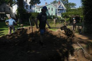
“Work is being done nearby where the new highways are going in,” he said, “and the site of the new museum will be dug. But most of the digging from now on will be limited to ‘problem solving’ digs”--attempts to prove or disprove theories about the city and its structures.
What is not known is why the Indians deserted the city or where they went.
“There is some evidence of a climate change about the time the civilization disappeared,” Iseminger said. “That could have affected the growing of corn, one of the staples of their diet. But the need for the stockade also suggests that there may have been some social unrest or attacks from outsiders. It’s all still very unclear.”
More to Read
Sign up for Essential California
The most important California stories and recommendations in your inbox every morning.
You may occasionally receive promotional content from the Los Angeles Times.


