Science / Medicine : Forest Ranger in Space : Satellite Monitors Burning of Amazon Jungle
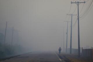
SAO JOSE DOS CAMPOS, Brazil — The image captured by an American satellite shows a constellation of points of light arching across the Amazon River basin--thousands of fires burning at once in an area larger than Europe.
Marcos Costa Pereira, 28, looked at the closely clustered dots on the black-and-white print and agreed that they resembled the Milky Way. Each point of light, he explained, was made by infrared rays coming from fire covering at least 300 acres, the smallest surface unit registered by the weather satellite’s sensors.
Pereira, a physicist with a boyish face and curly black hair who specializes in remote sensor technology, works on a special project that monitors burning in the Amazon region. Monitoring the fires is a first step toward controlling the slash-and-burn destruction of the region’s natural vegetation, which includes the largest tropical rain forest in the world.
In recent years satellite observation of the Amazon has shown extensive deforestation, triggering international fears of irreversible ecological devastation and alterations in world climate patterns.
Pereira is among those who hope to see Amazon deforestation controlled, and he believes his project at Brazil’s National Institute for Space Research can help make that possible.
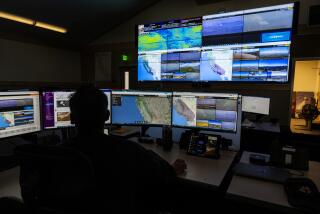
The institute is a complex of red brick buildings arranged around grassy quadrangles, shaded by shaggy Australian pines, at Sao Jose dos Campos in the state of Sao Paulo--far from the Amazon jungle. Recently Pereira and his project teammates were preparing for a new Amazon dry season, when they will pore over daily satellite images of the region, trying to determine how much of the jungle is on fire.
Although the project does not produce enough information for full and precise calculations of forest burning, it gives scientists a basis for estimating rapidly what seems to be an alarming amount of ecological damage.
Beginning in the early 1970s, the Brazilian government helped landless peasants settle along new Amazon roadways and gave cheap credit and tax breaks for the creation of big cattle ranches in the region.
The most common method of clearing Amazon forest for farming and ranching is to fell the trees with chain saws and, after the foliage has dried, to set it afire. The ash enriches the poor tropical soil, nourishing pastures and crops for two or three years. Farmers and ranchers also burn secondary-growth brush and weeds that spread on cleared land.
But much of the Amazon’s soil has proven too weak to sustain pasture or crops over a long period without heavy fertilizing. Large areas of deforested land have been left depleted and useless. Often, small farmers simply move on to slash and burn a new section of forest.
The progressive destruction of Amazon jungle worries ecologists and other scientists for many reasons. Most of the world’s living species are found in the complex ecosystems of tropical forests, and the Amazon is by far the largest remaining on Earth. Biologists say that disturbing a forest ecosystem risks the extinction of uncounted species of plants and animals that have never been studied.
Destruction of large forest areas also leads to erosion and changes in rainfall patterns. The changes may affect climatic conditions outside of Brazil, and air pollution from Amazon burning may also have dangerous consequences, some ecologists fear.
In recent years, some researchers have challenged the notion that the Amazon provides large amounts of the world’s oxygen. But they do not contend that there is any less reason to preserve the forest.
In 1987, Pereira’s project analyzed images from satellite sensors between July and October, the season when most of the burning takes place. Based on those readings, the institute estimated that fires covered a total of 78,700 square miles during the season.
The scientists calculated that about 60% of the fires were lighted to burn brush and weeds from land that had been cleared for agriculture in previous years. But they said the remaining burned area, nearly equal to the size of Austria, was probably newly felled forest or natural scrub growth called cerrado .
According to estimates issued recently by the institute, Amazon burning dropped off sharply in 1988, to 46,700 square miles. But the 40% attributed to newly cut forest or cerrado in 1988 was still far from negligible: an area larger than Denmark.
As a new dry season begins and the space institute keeps its daily fire watch, there are important changes in the drill. For the first time, data from the satellite images showing fires is being rapidly relayed to a government agency that plans to use it to enforce restrictions to prevent deforestation.
The institute captures the images at its satellite ground station south of here at Cachoeira Paulista. Pereira said that within three hours after an image comes in, the data can be fed into a computer and transferred electronically to Brasilia, the nation’s capital.
From there, map coordinates of fires can be sent by computer or telex to a network of control centers being set up around the Amazon region, and mobile teams will be dispatched to check for unauthorized deforestation.
The agency in Brasilia responsible for the new Program to Combat Burning is the Brazilian Institute for Environment and Renewable National Resources, headed by Fernando Cesar Mesquita. In a telephone interview, Mesquita said the program will begin with about 200 inspectors of its own, and also work with police and environmental agents employed by the Amazon states.
The Brazilian congress recently allocated $5 million for the program, and Mesquita said the government is negotiating with the World Bank for an additional $5 million.
Under a series of ecological measures called “Our Nature,” the government has at least temporarily withdrawn tax breaks and other incentives for agricultural development in the Amazon.
By law, landowners must leave at least half their land in forest. Mesquita said the Program to Combat Burning will be used to encourage keeping more than half in forest.
One way of doing this, he said, will be to strictly enforce a regulation that requires approval of an environmental impact assessment before any area larger than 2,500 acres can be cleared. “I believe it will reduce the burning a lot, much more than last year,” Mesquita said.
Almost all Amazon deforestation has taken place since the mid-1970s, and the last few years have been the worst. As millions of settlers poured into the vast region, no accurate and systematic tally was kept of damage to the forest.
Now a controversy has flared up over a new study by the space institute that attempts to quantify deforestation so far. Called Operation Deforestation, the study concluded that since 1960 humid and dry forest has been razed from 5.1% of the Brazilian Amazon region, defined as an area of 1.89 million square miles.
President Jose Sarney cited that percentage in arguing that critics of Brazil’s Amazon policy exaggerate damage to the forest. But a study done for the World Bank last year estimated that 12% of the Amazon region had been deforested.
Brazilian newspapers accused the institute of “cooking” its figures.
“Scientists Underestimate Devastation to Benefit Sarney,” said a headline in the daily Folha de Sao Paulo.
Roberto Pereira da Cunha, a geologist who coordinated the space institute’s study, said the president’s office did not influence the results.
But unlike the space institute’s annual satellite observation of Amazon burning, Operation Deforestation did not count the removal of cerrado as deforestation. Much of the land in the southern reaches of the Amazon Basin is cerrado and grassy savanna.
Operation Deforestation has been challenged even by researchers in the space institute at Sao Jose dos Campos. Geographer Vitor Celso de Carvalho, 39, gave up a managerial title at the institute in a dispute over the study.
Carvalho contends that it would be more realistic to calculate all types of vegetation cleared from the Amazon region, including cerrado , because an important portion of the region is not densely forested.
Philip Fearnside, an American ecologist who works with Brazil’s National Institute for Amazon Studies, said the Operation Deforestation estimates are unexplainably low. Fearnside has made his own study of deforestation based on recent satellite images from all nine states in the Amazon region, finding major discrepancies with the space institute study.
Fearnside calculates that 8% of the Amazon region has been deforested, not 5.1% as Operation Deforestation concluded. But he added that both studies confirm a worrisome trend of forest damage.
Even if Operation Deforestation’s figures are underestimated, they show a startling fact: From 1975 to 1988, deforestation multiplied by a factor of at least nine. In 13 years, Brazil’s Amazon forest lost an area at least as large as Czechoslovakia and Hungary combined.
Satellite Monitors Burning of Amazon Jungle
1. Satellites register points of light in the Amazon River basin made by infared rays coming from fire covering at least 300 acres, the smallest surface unit registered by the weather satellite’s sensors.
2. The institute captures the images at its satellite ground station at Cachoeira Paulista.
3. Within three hours after an image comes in, the data can be fed electronically to Brasilia, the nations’s capital.
4. From there, map coordinates of fires can be sent by computer or telex to a network of control centers being set up around the Amazon region.
5. Mobile teams will be dispatched to check for unauthorized deforestation.
More to Read
Sign up for Essential California
The most important California stories and recommendations in your inbox every morning.
You may occasionally receive promotional content from the Los Angeles Times.


