Survey Ship Runs Into Traffic Jam at Mooring
HUNTINGTON BEACH — A week-long federal survey to determine if ocean depth was a factor in the American Trader oil spill got off to a slow start Tuesday, in part because of electronic interference from a boat that was taking measurements for the owner of the mooring where the accident occurred.
By the time officials of the National Oceanic and Atmospheric Administration got that sorted out, they were forced to restrict work again when a fuel barge anchored at the mooring and began unloading oil into its undersea pipeline.
As a result, NOAA officials said they accomplished very little survey work, in which sophisticated sonar and computer equipment is used to paint a three-dimensional picture of the ocean bottom.
“The timing really stunk,” NOAA Lt. Cmdr. Samuel P. DeBow Jr. grumbled aboard a Coast Guard observation boat.
But DeBow said his agency should be able to finish its survey as scheduled by Friday so the results can be forwarded to the Coast Guard.
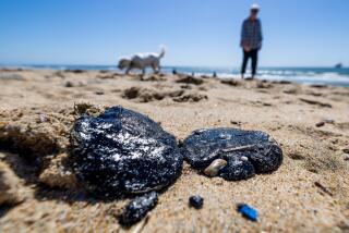
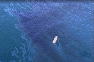
Investigators with the Coast Guard are trying to determine how the tanker managed to puncture its hull with its own anchor on Feb. 7, resulting in an oil spill of 394,000 gallons of crude off Huntington Beach.
At the Coast Guard’s request, NOAA is attempting to verify the accuracy of navigational charts that show the ocean depth in the area to be at least 51 feet at low tide.
Coast Guard officials have received preliminary indications that the water may have been only 46 feet deep. The American Trader’s draft at the time of the accident was 43 feet, and its anchor measures 4 feet wide by 10 feet long.
Coast Guard Capt. James Card, who is heading the investigation into the oil spill, said the NOAA charts have not been resurveyed and updated since 1975.
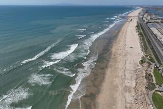
Shifting sands, unreported boat wrecks or a number of other factors could have created underwater obstructions around the mooring terminal, which is located about 1 1/3 miles offshore from Huntington Beach Pier, according to DeBow, whose agency makes the nautical charts.
Using a device called a “side-scan scanner,” DeBow said, NOAA’s research boat is able to take diagonal sonar measurements that detect any bottom obstructions. The three-man crew is also taking depth measurements with a device called an “echo sounder” that shoots beams of sound to the ocean bottom and measures how long it takes for them to bounce back.
The survey boat must criss-cross a square-mile area above the mooring terminal at evenly spaced, 320-foot and 160-foot intervals. In addition to the federal survey, British Petroleum, which owned the spilled oil, and American Transportation Trading Co., which owns the vessel, have completed their own depth survey. But the two firms have not yet released their results.
And Tuesday, a boat chartered by Golden West Refining Co., whose Santa Fe Springs refinery was to have received the spilled crude, was conducting its own survey alongside NOAA’s 21-foot Sea Ark.
As DeBow arrived to lead a press tour about 11 a.m., the three crew members of the Sea Ark complained to him that they were having difficulty establishing their position in relation to the spill area because of electronic interference from the refinery’s vessel, the Sea Watch.
Coast Guard officials explained that both vessels were using the same type of equipment to establish their positions. The equipment receives radio transmissions from three microwave platforms that officials have erected in Huntington Beach to fix the exact position of the spill and the surrounding one-square-mile area that is being surveyed.
Radioing a Coast Guard commander aboard another vessel in the area, DeBow asked that the Sea Watch be asked to cease its surveying so the NOAA survey could continue.
“I have to get this (survey) while the weather is nice,” DeBow radioed to the Coast Guard official.
Calm seas and clear skies Tuesday made for ideal surveying conditions, DeBow explained.
Shortly thereafter, DeBow stepped into a Coast Guard inflatable boat and motored over to the Sea Watch to discuss the situation with that boat’s crew. After meeting there for about 30 minutes, DeBow returned about noon to the Coast Guard observation vessel with the news that the Sea Watch was almost finished with its surveying and planned to leave the area in another hour.
As the Sea Watch finished its work, DeBow noticed that a fuel barge had pulled in to offload at the mooring terminal. So the NOAA survey boat began to work around the barge, which was expected to take up to 14 hours to pump its fuel into the pipeline.
More to Read
Sign up for Essential California
The most important California stories and recommendations in your inbox every morning.
You may occasionally receive promotional content from the Los Angeles Times.


