Satellites Explore Arctic Wilderness
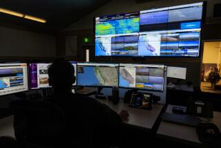
ANCHORAGE, Alaska — Arctic scientists exploring the icy wilderness and its effects on the rest of the Earth are discovering that they can get a pretty good view and never leave their chairs, with help from two new foreign satellites.
The satellites--one launched in July, 1991, by the European Space Agency and the other sent up early this year by Japan--follow north-south orbits that converge over Alaska. The information they collect is vast, coming to receivers on the ground in a torrent of numbers.
But when those numbers are translated into photo-like images on a computer, they tell U.S. scientists in Fairbanks the ice density and moisture content of soil in the far north--crucial clues to changes in global weather.
The numbers also tell about crop production and even how forests recover after wildfires. The Japanese satellite stores information collected on its passes around the Earth, showing soil moisture that can help forecast worldwide crop yields. Forests devastated by wildfire could be watched in this way to see how fast vegetation returns.
The center of the operation is the Alaska Synthetic Aperture Radar Facility operated by the University of Alaska, Fairbanks at its Geophysical Institute. Supported with $3.5 million a year from the National Aeronautics and Space Administration, the facility is the only one of its kind in this country.
The old computer pictures were relatively primitive, said Willy Weeks, a professor of geophysics who is also the facility’s chief scientist. “You’d look at them and throw some salt over your shoulder,” he said.
The new satellites are equipped with antennas that, because they move, mimic what a larger but too-costly antenna would pick up.
For the scientists, the antenna is an aperture, as in a camera’s eye, but like a sweeping camera that takes in a panoramic view. Synthetic, as in synthesis, refers to the total picture that results.
The satellites’ radar can also “see” through clouds and darkness, a boon in the arctic. They can do this because the satellites send long radio waves to Earth in pulses and get the information that bounces back. This in turn is transmitted to the ground station.
About 500 miles above the Earth, the satellites make 14 orbits a day. Fairbanks’ location allows the scientists to collect data from up to 10 of those daily orbits.
The purview for the Alaska researchers is an area bounded on the north by the northern tip of Ellesmere Island, in the Canadian high arctic, on the south by Oregon, on the west by central Siberia, and east almost to Greenland.
Weeks is an expert on sea ice, a key to studying global warming.
Before synthetic aperture radar, sea ice scientists relied on computer-generated pictures that showed the ice as a giant white slab. But they didn’t show the cracks that act like big heat exchangers between the relatively warm ocean and the arctic air.
This warming is critical because it thins the ice, reducing its insulating properties and releasing more of the ocean’s warmth and moisture. That would cause further warming, Weeks said.
For UAF geophysicist Martin Jeffries, the satellite images are among the best ways yet to monitor ice shelves, hunks of Arctic Ocean ice that, like receding glaciers, could signal a change in the Earth’s weather.
Jeffries said ice shelves have been disintegrating for a century. “Climate is very much involved,” he said. A steady stream of pictures helps monitor where the shelves are breaking up--and how fast.
Researchers also use the satellite images to study arctic soil as a source of methane, a naturally occurring gas suspected of contributing to global warming.
Prof. Doug Kane, who teaches water resources and civil engineering at the UAF, said earlier studies were limited to relatively small soil samples.
Kane wants to know how much methane northern Alaska soils produce. To do that over hundreds of miles of Alaska’s sparsely populated North Slope would be expensive, and time-consuming.
With information the new satellites provide, he can get pictures that distinguish patches of moist soils from drier ones.
And researchers studying the lake-pocked North Slope permafrost say they can tell from the satellite photos which shallow lakes do not freeze all the way to the bottom. That could reveal important year-round water sources.
“Anywhere we’re looking, processes do not stop through the winter but it used to be too hard to look then,” Kane said. “Now we have that capability.”
More to Read
Sign up for Essential California
The most important California stories and recommendations in your inbox every morning.
You may occasionally receive promotional content from the Los Angeles Times.


