At Capistrano, Sanderlings Come to Roost
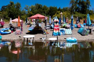
While San Juan Capistrano attracts swallows and tourists, Capistrano Beach draws a different crowd--sanderlings and locals who find the strand a mellow place to saunter.
In 1887, developers laid out a subdivision called San Juan-by-the-Sea on the mesa by San Juan Creek. Years later, the partly built community began to fade as businesses pulled out and residents abandoned their properties. In 1925 it was revived as Capistrano Beach.
The neighborhood, part of Dana Point, lies in the middle of a fine stroll that starts at Doheny State Beach to the north, continues south through Capistrano Beach and ends in San Clemente. Begin the walk just south of Dana Point Harbor on a stretch of Doheny State Beach, which is good for family swimming and body boarding because jetties subdue the surf. It attracts many campers, though those seeking peace and quiet complain that the campground is too close to the highway.
Be sure to visit the Doheny visitor center, which features an impressive tide pool exhibit, aquariums and a photo gallery that highlights Orange County’s long-board surfing era during the 1950s and ‘60s. The interpretive center, open 10 a.m. to 4 p.m. daily, is close to the beach entry station.
Directions to trail head: From Interstate 5 in San Juan Capistrano, exit at Camino las Ramblas and drive a mile west to California Highway 1. Turn north and soon you’ll reach Harbor Drive; turn left, then make another quick left to Doheny State Beach. The day use fee is $3.
The hike: Go down to the shoreline and walk south along the white sand beach. After a quarter-mile you’ll reach the mouth of San Juan Creek. In summer, a sandbar closes off the creek and forms a small lagoon patrolled by ducks and egrets. If possible, walk across the sandbar.
During winter or when the sandbar has been breached and water is too high to cross, detour inland to the park road and follow it over the creek. Walk through the campground to the beach.
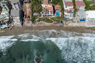
After about a mile, you’ll reach the end of Doheny and the beginning of Capistrano Beach, identified by a long row of houses facing the ocean. Rocks have been dumped near the tide line in an attempt to stabilize the beach and protect the houses from surging waves. Beach hikers are left with an awkward, less-than-beautiful passage.
About 23/4 miles from your starting point, you’ll reach undeveloped Poche Beach, a county park. Continue a half-mile to a point crowded by development, where walking is a challenge and passage is all but impossible at high tide. Detour inland by walking south along El Camino Real, returning to the beach by the MetroLink station.
Resume walking south and cross the brown sands of San Clemente. The city pier and nearby refreshment stands make a good turnaround point.
Gung-ho hikers can continue two more miles or so down-coast, across San Clemente State Beach and to San Mateo Point, the border between Orange and San Diego counties.
*
For more of John McKinney’s tips, visit https://www.thetrailmaster.com.
More to Read
Sign up for The Wild
We’ll help you find the best places to hike, bike and run, as well as the perfect silent spots for meditation and yoga.
You may occasionally receive promotional content from the Los Angeles Times.


