Meadow larks
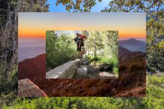
Santa Ysabel, Calif. — A hikers’ highway-in-the-making stretches before us, curving upward through the spring-green grass, enticing us to follow it.
The song of the meadowlark and the whoosh of an occasional car fade. We ascend to the rim of the sloping meadow and climb more vigorously up a grass- and shrub-covered rampart offering an ever-widening view of the oak-dotted Santa Ysabel Valley below.
Few have heard of the spectacular slice of northern San Diego County known as the Santa Ysabel Open Space Preserve, which welcomed its first public visitors last summer. Maybe it’s the label “open space” rather than “park” that keeps places like this under most visitors’ radar. Other lesser-known nearby spots -- Sycamore Canyon in Poway or the little woodlands at Oakoasis Open Space Preserve in Lakeside -- also offer wonderful hiking.
My hiking buddy Don Endicott and I are following the West Vista Loop trail at the Santa Ysabel preserve for the first time. The loop and other trail segments stretching east-west across the preserve are links in the roughly 55-mile Coast to Crest Trail, which aims, within a few years, to connect the beach at Del Mar with the mile-high summit of Volcan Mountain near Julian.
A ranger truck rattles by. (Its driver ends up being the only other human we see on the visit.) The day is a perfect 10, with cool, dry air and just enough of a delicate cover of cirrus clouds to slightly mute the sun’s warming rays. Don gets busy with his Global Positioning System gadget, marking waypoints and noting elevation contours, and we pause to record the mini and macro scenery with his compact digital camera and my bulkier, old-fashioned 35mm camera loaded with fine-grained slide film.
We reach the loop part of the trail after a long mile and go left, or clockwise, around it to take advantage of maximum morning shade. Several head of cattle barely take notice of us as we saunter by. We snap a few mug shots of their quizzical expressions.
We plunge into agreeable woodland consisting of two kinds of oak trees: the dark, taciturn coast live oaks, which prefer the bottoms of canyons and ravines, and the light-trunked, gray-green-leafed Engelmann oaks, which survive better on higher and drier slopes. Lichen-encrusted grayish granite boulders and an occasional blue-blossoming wild lilac bush compete for our photographic attention.
After we swing sharply around a bend and climb to a saddle, the high point of the loop, we start to see a patch of raw-looking landscape. This neck of the Julian woods was partly swept by the Cedar Fire of October 2003, a severe blaze that almost incinerated nearby Cuyamaca Rancho State Park. We spot the burned hulks of Engelmann oaks, their branches like arthritic fingers gesturing toward the blue sky.
Then we arrive at a junction, with the Coast to Crest Trail going east. We realize -- with the help of some map gazing -- that we are virtually on top of a divide between the drainage basin of the San Diego River and that of the diminutive-sounding (but just as significant) San Dieguito River. Which way would a raindrop go to reach the ocean? Toward the Diego or the Dieguito?
We keep to the right at the trail junction, heading back. Then we come upon the perfect spot for lunch: an intimate grass-covered swale rimmed with Engelmann oaks. I stand perfectly still for what feels like 10 minutes and contemplate a landscape that seems frozen in time, save for the slow westward march of the sun across the sky. The air barely moves. A few of the oaks look like giant broccoli florets sticking straight up.
Some flying insects drone, and there’s an occasional piping from a mourning dove in the trees. From the wooded area at the far end of the meadow comes a once-every-five-minutes moo, courtesy of the cattle.
We return to the foot of the trail just in time to hear the noontime tolling of bells at Santa Ysabel Mission, just up the highway. It’s been a great day -- and it’s only half over.
*
(BEGIN TEXT OF INFOBOX)
Hitting the dirt
BASICS
The trails of Santa Ysabel Open Space Preserve are open to hikers, mountain bikers, equestrians and leashed dogs from
8 a.m. to sunset Saturdays and Sundays. In the spring and early summer, wear sun-protective clothing and take plenty of water.
DRIVE TIME
From downtown L.A., it’s a two-hour drive to the preserve. Take Interstate 10 east to Interstate 15 south to California 79 south. The West Vista Loop trailhead lies along the eastern shoulder of California 79, 1.2 miles north of Santa Ysabel, a few miles west of Julian in central San Diego County.
HIGH POINTS
Mule deer and flocks of wild turkeys can best be seen in the morning hours. Wildflowers will be more sparsely displayed this season because of scant rainfall. Dudley’s Bakery, a Santa Ysabel fixture for many decades -- open 8 a.m. to 5 p.m. on weekends -- is a worthwhile stop before or after visiting the preserve.
THE HIKE
The West Vista Loop measures 4.4 miles. A detailed map of the preserve’s trails is posted at the trailhead and can be printed from the preserve’s website.
INFO
San Diego County Parks and Recreation, (858) 694-3030, www.co.sandiego.ca.us/parks/openspace/santaysabel
More to Read
Sign up for The Wild
We’ll help you find the best places to hike, bike and run, as well as the perfect silent spots for meditation and yoga.
You may occasionally receive promotional content from the Los Angeles Times.


