First storm of the season expected to bring widespread precipitation to Southern California this week

- Share via
After a warm, dry day on Monday, the first winter storm of the season is expected to arrive in Southern California on Tuesday night through Thursday, the National Weather Service said.
Cool ocean breezes will return on Tuesday, replacing the warm, dry flow from the inland deserts that came with the Santa Ana winds over the weekend.
Temperatures are expected to soar into the 90s but dip Tuesday as a storm arrives. The rain won’t be enough to erase the fire danger, forecasters say.
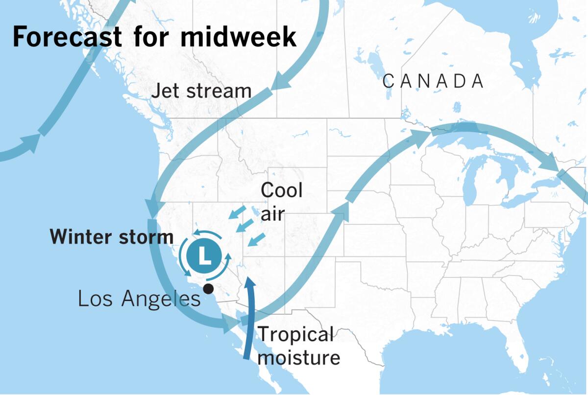
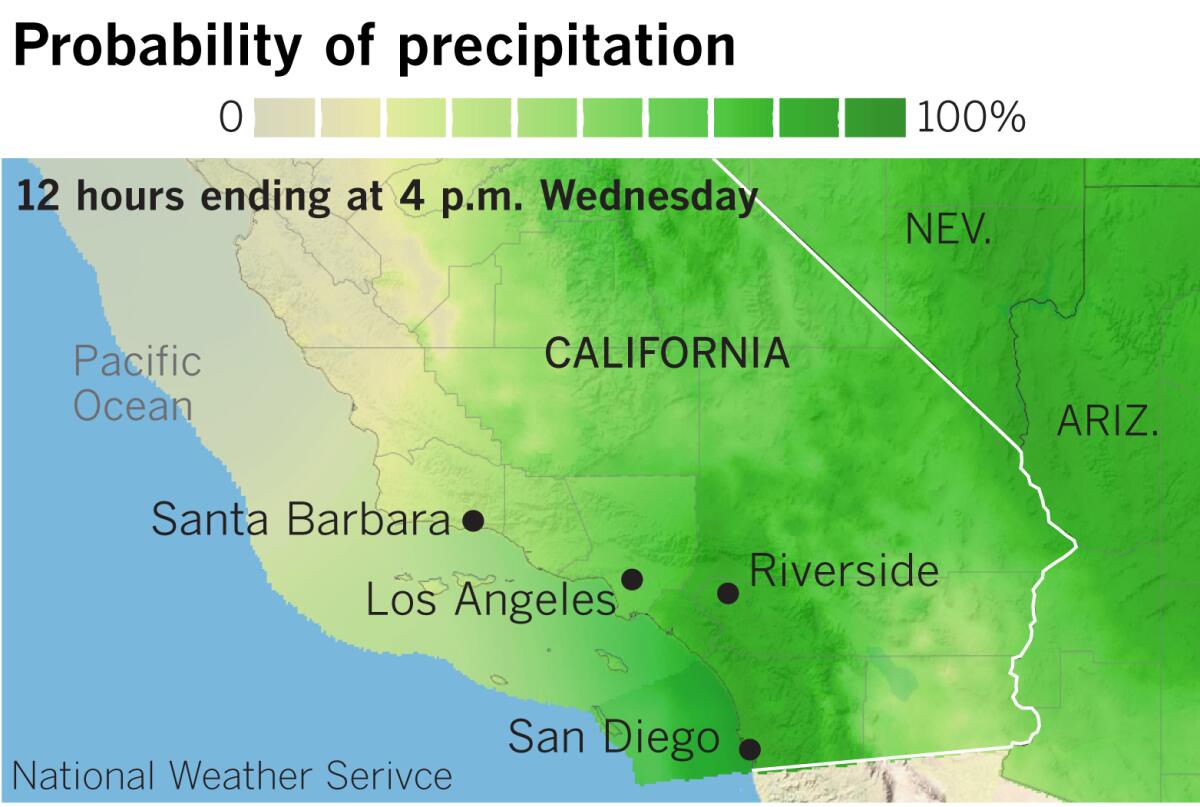
Skies will turn mostly cloudy, and moisture from the remnants of Tropical Storm Raymond will be pulled northward from Baja California with the passage of a cutoff low. Light showers will probably develop in Southern California, but thunderstorms can’t be ruled out in the southern part of the area, particularly in San Diego County.
Then, a winter storm will slide into the region from the north, and chances of rain will increase Tuesday night. The majority of the precipitation from this storm will fall on Wednesday into early Thursday morning, then showers will linger on Thursday.

Snow levels will start at 10,000 feet on Tuesday evening, but then are expected to lower to 6,000 feet by Wednesday evening. Elevations above 7,000 feet could get 6 to 10 inches, and elevations from 6,000 to 6,500 feet could get 1 to 2 inches.
The weather service expects rainfall to be widespread and “beneficial,” with a low risk of flash flooding. If thunderstorms develop, locally heavier rain is possible, however.
Rainfall of this kind can wet down tinder-dry vegetation, making wildfires a little less likely in coming weeks.
Dry weather and gradually rising temperatures will return late in the week.
More to Read
Sign up for Essential California
The most important California stories and recommendations in your inbox every morning.
You may occasionally receive promotional content from the Los Angeles Times.


