‘Dangerous’ heat wave forecast for Southern California’s Labor Day weekend
- Share via
Mother Nature will crank up the temperature across Southern California over the Labor Day holiday weekend, the National Weather Service said.
A dangerous heat wave is likely as upper-level high pressure over the Southwest strengthens and expands across the Western third of the country. Temperatures could reach record levels, especially Saturday and Sunday, the weather service warned.
This weather will be “just as hot, or maybe a little hotter, and potentially more dangerous” than the last heat wave, although it isn’t expected to be as sticky and humid, according to Joe Sirard, a meteorologist with the National Weather Service in Oxnard.
“This is at the high end of heat waves for our area, with highs of 115 possible in the San Fernando Valley,” he said.
Sirard urged caution, noting that “bad things can happen with this kind of heat.” He urged people to curtail outdoor activity because heat stroke is a real possibility.
Very warm overnight lows will provide little relief, and officials urged people to check on loved ones, especially older people. He also “highly recommended” that people curtail hiking in the mountains, including the Santa Monicas.
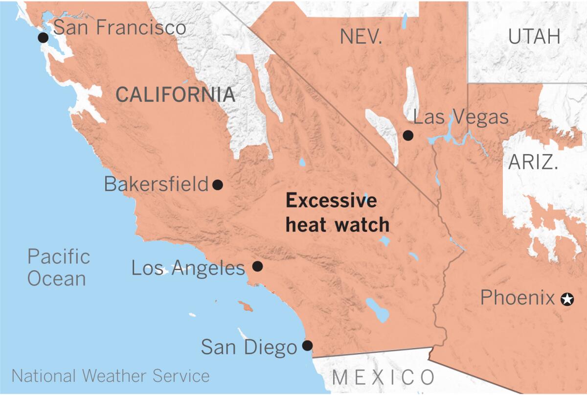
The National Weather Service has issued an excessive heat watch for the valley and interior areas for Friday morning through Monday evening, and beginning Saturday morning in the coastal areas.
Gusty northerly winds and dry conditions will promote elevated to near-critical fire weather as firefighters continue to battle historic blazes across the state.
The San Fernando Valley may see highs of 108 to 115 degrees, while the San Gabriel Valley could reach 103 to 112. Santa Clarita and the Antelope Valley could see temperatures as high as 112 degrees, and downtown Los Angeles will probably be in the low 100s, Sirard said.
High pressure will suppress the marine layer, and the beaches will reach temperatures in the mid-80s to 90 degrees.
Although there will be a little monsoonal moisture, and cumulus clouds may form over the mountains, but no thunderstorms are anticipated, forecasters said.
Sirard described conditions as “moderately dry” with some offshore flow — not as humid as the last hot spell, but not as dry as Santa Ana conditions.
“This high-pressure ridge is the first North Pacific system we’ve seen this season,” climatologist Bill Patzert said. “This is Santa Ana-ish. This is a three-day, triple-digit, dangerous event.
“Extreme heat waves are killers, especially for those who don’t have or can’t afford air conditioning,” he said.
More to Read
Sign up for Essential California
The most important California stories and recommendations in your inbox every morning.
You may occasionally receive promotional content from the Los Angeles Times.
