NASA turns technology back toward Earth to focus on climate change

After decades of gazing into space, NASA is turning its technology back toward Earth to study the effects of drought, fire and climate change on the Blue Planet.
At the Jet Propulsion Laboratory in La Cañada Flintridge earlier this month, scientists and state officials gathered to discuss how satellite data, 3-D imaging and new radar and laser technologies can provide invaluable insights into Earth’s rapidly changing systems.
Some said the meeting marked a sea change for previously siloed agencies, and underscored the need to work together to solve the climate crisis.
“I don’t want to be overly dramatic, but in truth, this discussion is about saving our planet,” NASA Administrator Bill Nelson told the group of attendees, which included Earth and space scientists from NASA and JPL, local congressional representatives and California environmental secretaries Wade Crowfoot and Jared Blumenfeld.
Upcoming Earth-centric missions will provide a more precise look than ever before at “everything that’s happening” with the oceans, the land and the atmosphere, Nelson said. Among the big-ticket items were new tools to measure snowpack and groundwater, satellites to monitor methane emissions and remote sensing assets to assess the impact of hazards such as wildfires, earthquakes and mudslides.
“We’re facing an existential crisis on this planet,” said Crowfoot, the state’s natural resources secretary. “These challenges are intense. ... But there’s no better place than California to do this work, because we understand the gravity of the threat.”
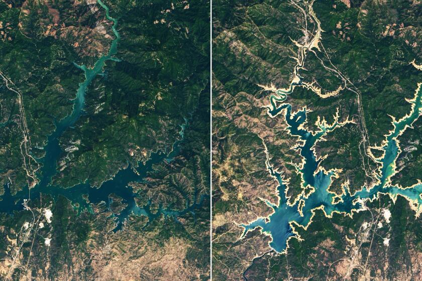
Shasta Lake, once full and surrounded by green banks, is now bordered by a “bathtub ring” that indicates just how far the water has fallen.
The meeting between California and federal officials was a far cry from 2018, when — frustrated by the Trump administration’s efforts to scuttle climate research — then-Gov. Jerry Brown insisted that California would launch “our own damn satellite, to figure out where the pollution is and how are we going to end it.”
Now, three years later, Californians need only look out their windows to get a sense of what scientists can observe from above. Wildfires are burning record acreage across the West, while worsening drought is draining the region’s water supplies to unseen levels. The state also recorded its hottest summer ever in 2021.
Many at the meeting hoped NASA and JPL’s findings would help combat global warming by informing decision-makers as they determine the best paths forward.
“It’s really a game-changer to be able to have this data,” NASA Deputy Administrator Pam Melroy said, noting that the U.S. can also lead the rest of the world in utilizing the same tools. “Because we’ll never solve climate until everybody is a participant.”
Many of the projects have been in development for years, but a recent memorandum of understanding between the state and JPL helped get additional projects off the ground, Crowfoot said — including critical items focused on water resiliency. The Western U.S. in recent months has seen such severe drought conditions that officials closed Lake Oroville’s hydroelectric power plant for the first time and declared the first-ever water shortage on the Colorado River, among other actions.
One new web-based platform, OpenET, will provide satellite-based information on evapotranspiration, the process through which water leaves plants, soils and other surfaces, which could help state officials understand water usage in agricultural areas and assist farmers with precision irrigation.
“As states, we do our best to manage this resource of water, but we’re never going to do it with the sophistication we need to without partners like NASA,” Crowfoot said, adding that the agency could be the “tip of the spear” when it comes to combating climate change.
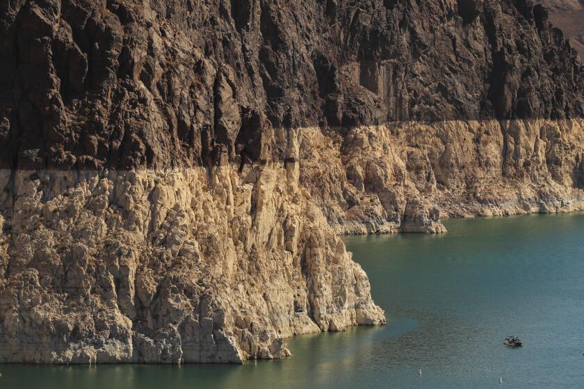
Lake Mead is at the lowest water levels in its 85-year history. Federal officials who manage the lake expect to soon declare a water shortage.
Other water-related items include surface water and ocean topography tools known as SWOT that will contribute to NASA’s first-ever global survey of Earth’s surface water. Every 21 days, SWOT will survey almost 600,000 miles of global rivers at least twice, aiding drought forecasters and hazardous-flood preparations, officials said. It is set to launch in 2022.
JPL interim Director Larry James said the next generation of water-measuring spacecraft will also allow scientists to measure freshwater body heights and flows for the first time, while laser-imaging spectrometers will help study snowmelt and snow volume.
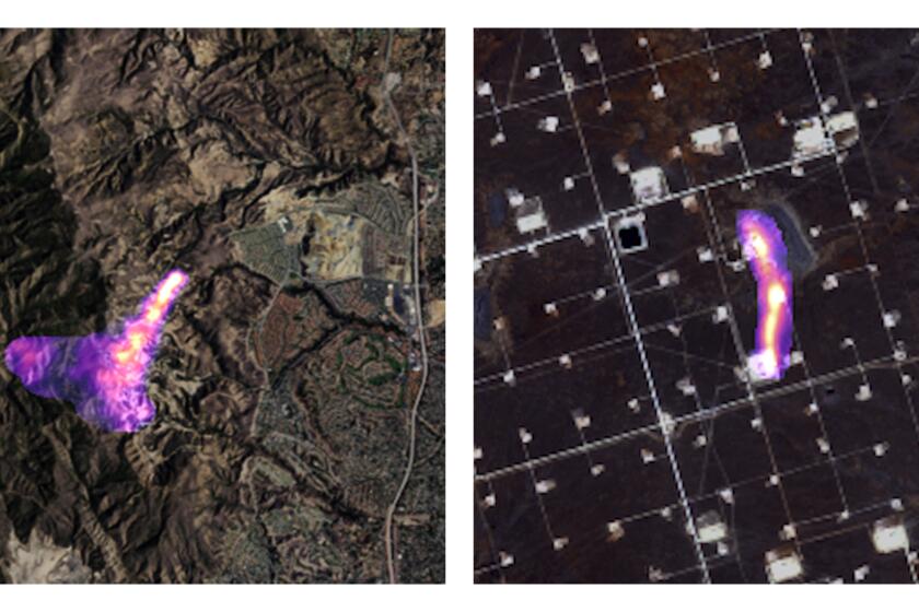
But scientists aren’t studying only water. Methane was also a focus of discussion, with a new satellite due to launch in 2023 that will help monitor concentrations of the harmful emission, the second largest contributor to greenhouse warming after carbon dioxide.
Blumenfeld, California’s secretary for environmental protection, said the three largest producers of methane in the state are the oil and gas industry, landfills and agriculture (particularly, large animal operations and dairies). The new tool will enable anyone to see whether an oil refinery, for example, is leaking methane.
“It gives accountability, which is a critical element we need to get to in order to deal with the climate crisis, and it would not happen without NASA and JPL,” Blumenfeld said. “Globally, and living in California, this is a really big deal.”
But space missions have also come under scrutiny for their own environmental impact, as propellants required to launch rockets can expel carbon dioxide, liquid hydrogen, kerosene or other chemicals into the atmosphere.
The launch of a Falcon Heavy rocket from SpaceX, Elon Musk’s privately owned space transportation company, burned about 400 metric tons of kerosene and emitted more carbon dioxide in a few minutes than an average car would in more than two centuries, reports found — and the number of commercial spaceflights is expected to increase tenfold in the coming years.
But NASA administrators say that the scale of their projects is getting “smaller and smarter,” with one official noting that the methane satellite is “the size of a shoebox.”
“It’s an absolutely minuscule part, but it is a real concern,” Melroy said of rocket emissions, noting that the agency is working on developing more sustainable fuels.
Cutting the greenhouse gas methane quickly and dramatically is the world’s best hope to slow and limit the worst of global warming, a U.N. report says.
And though many of the new tools provide big-picture views of massive global challenges, some are much more local. Nelson said people don’t have to be scientists to understand the effect of wildfires, drought, sinkholes or floods.
“There are places in the country, and represented in the halls of government, that are going to be very resistant, so we have to tell the story,” he said. “We’ve got to educate the people, and unfortunately, increasingly, all of these disasters are helping us to do that.”
Nearly 2.5 million acres have burned in California’s wildfires so far this year — a number second only to 2020, the state’s worst wildfire season on record. Entire towns have been leveled by flames.
Some of NASA’s tools can help identify where wildfires are spotting, or shooting out embers that could potentially endanger firefighters and ignite new blazes, officials said. Others can employ sophisticated radar systems over disaster areas to assess damage and assist first responders.
“We’re right smack in the middle of wildfire peak season,” Cal Fire Chief Thom Porter said. The outlook for the rest of the year includes more heat and dryness.
JPL Earth science and technology director Jim Graf said they can also fly over the 1,100-mile levee system in the Sacramento-San Joaquin River Delta to quickly identify sinking or weaknesses. That information could help officials make decisions on critical infrastructure, such as roads, bridges and aqueducts.
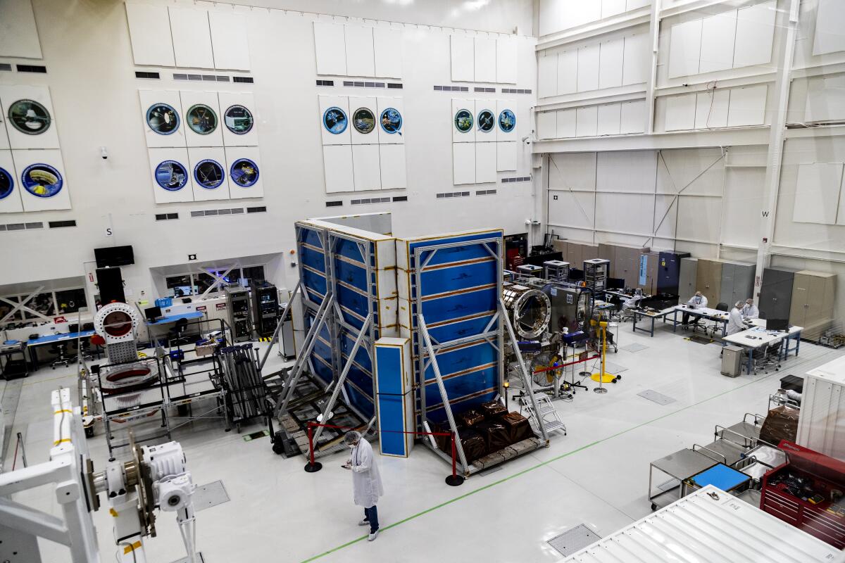
Officials on Thursday also showed off their NASA-ISRO Synthetic Aperture Radar satellite, or NISAR, which is still under construction and will “provide an unprecedented view of Earth” when it launches in 2023, they said. The satellite will monitor the entire globe as it scans for disturbances in glaciers, volcanoes and other systems.
“Basically, it’s going to use two radar instruments that will look at changes in the Earth’s surface,” said Susan Owen McCollum, deputy project scientist for NISAR. “That actually can tell you a lot: how fast the ice sheets are melting, how fast the ground is moving.”
Another aspect of the radar will enable officials to monitor how forest biomass is changing through carbon containment or other processes, McCollum said, which could be essential for studying places like the Amazon.
“Radar is a very powerful imaging tool — it sees the Earth in a way that’s different,” she said.
Perseverance, NASA’s newest rover, completes its 7-minute descent and lands safely on Mars to begin a mission that will last at least one Martian year.
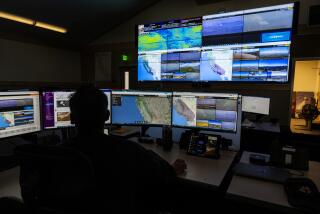
But NASA and JPL also haven’t lost sight of the final frontier, and officials on Thursday offered a tour of the control room for the Mars Perseverance rover. The rover, which landed on Mars in February, is collecting rock samples that will be returned to Earth for closer study.
The Ingenuity helicopter that arrived with the rover has also completed more than a dozen flights, they said, demonstrating for the first time that powered, controlled flight on another planet is possible.
Yet though the challenges of space exploration may seem a world away from those here on Earth, Perseverance project scientist Ken Farley said much can be learned from the red planet. Some of the rocks his team is studying are 3.5 billion years old and come from a time when liquid water flowed on the surface of Mars.
There is no liquid water on the Martian surface today, he said, and there is essentially no atmosphere.
“It is an example of massive climate change — from a planet that we believe would have been inhabitable to a planet that, at least on the surface, is not,” Farley said. “It is a clear example that climate changes, and it can change enormously.”
Nelson, the NASA administrator, echoed those sentiments when he addressed the rover’s control team.
“That’s one of the profound things that I think happens to every person that’s had the privilege of looking out the window of a spacecraft when you orbit the Earth,” he said. “You see how beautiful it is, but how fragile.”
More to Read
Sign up for Essential California
The most important California stories and recommendations in your inbox every morning.
You may occasionally receive promotional content from the Los Angeles Times.
