Heavy rain unleashes mud, debris flows in Northern California areas burned by wildfire
- Share via
Northern California was battered record rain, causing flooding, debris flows after a year of drought conditions and destructive wildfires.
Downtown Sacramento hit an all-time record with 5.44 inches. The torrential rainfall had shut down at least one crucial highway as mud, rocks and unshackled debris flushed down denuded hillsides. Flash flood and excessive rain warnings blared across road signs and phone screens, with some officials declaring that for those in the Dixie fire burn area who had not yet evacuated, it could be too late.
“If you are near a burn scar, it may be too late to evacuate,” officials at the National Weather Service in Sacramento said on Twitter, along with a list of safety warnings. “Do not attempt to cross a debris flow. Take shelter in the highest floor of your home.”
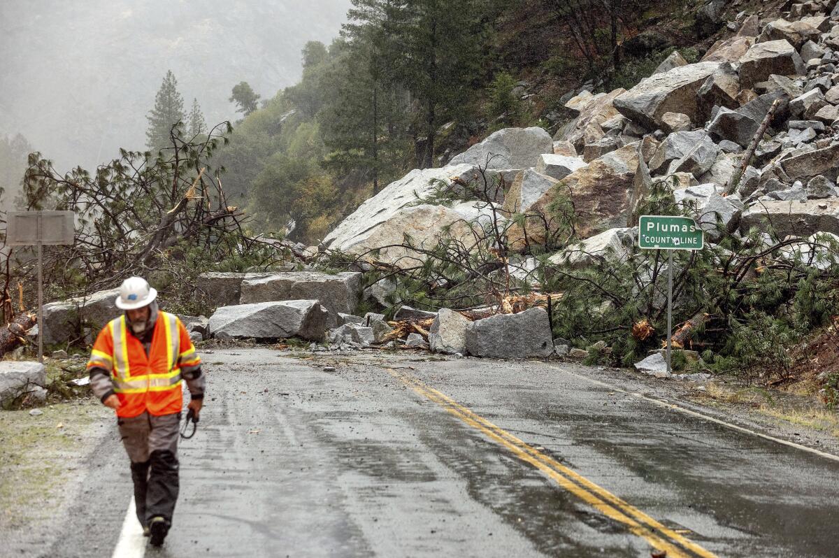
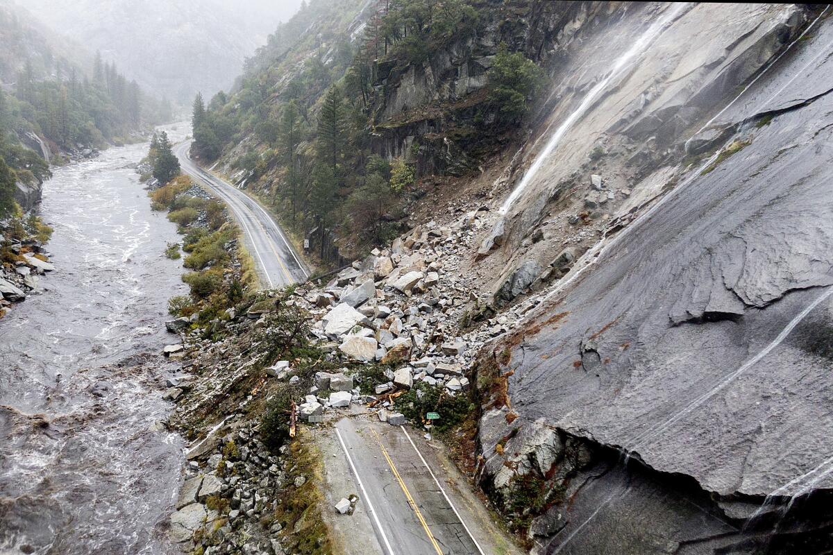
By 7:30 a.m. Sunday, multiple debris flows had shut down Highway 70 between Jarbo Gap and Greenville, a historic mountainside community in Plumas County that had already lost so much to the Dixie fire. A photo circulating on social media showed a dramatic slide near the community of Tobin, where a huge pile of rock, trees and debris collapsed onto both lanes of the highway.
Transportation and California Highway Patrol officers rushed all morning to collisions and reports of fallen trees and overturned vehicles. Numerous roadways are flooded, they noted, including portions of State Route 99. Drivers should avoid areas near creeks and drainages that are particularly prone to flooding during intense rain.
Rain in the Dixie fire region has been pouring at 0.4 to 0.7 of an inch per hour — a rate that could intensify through Sunday, said Katrina Hand, a weather service meteorologist based in Sacramento.
“We’re looking at pretty heavy steady rain through the rest of today into the evening,” Hand said Sunday morning. “It will still be raining a decent amount into Monday, but it looks like the heaviest will make its way out by later tonight for that area.”
An atmospheric river could unleash debris flows and flash flooding across Northern California, especially in areas scorched by fire.
South of the Dixie burn area, along where the Caldor fire scorched the Highway 50 corridor, officials remained on high alert for life-threatening flash floods and debris flows. Heavier precipitation started moving in around midmorning and is expected to continue its march south. The rain here is expected to pour as much as an inch per hour throughout Sunday and into Monday.
Crews last week were busy building barriers along rivers and streams, constructing retaining walls and fencing off unstable hillsides that could collapse. Deep-water rescue vehicles have been positioned in high-risk areas, according to the state’s Office of Emergency Services, and crews have been deployed to monitor key burn areas.
Flash flood warnings for both the Dixie and Caldor regions are in effect until 3 a.m. Monday. More than a foot of rain could fall in the Sierra Nevada, with up to 3 feet of snow possible at higher elevations through Tuesday, forecasters said.
Residents in the San Francisco Bay Area also reported intense flooding, power outages and fierce winds as the storm made its way down the state. In Marin County, all roads in downtown San Rafael had to shut down Sunday afternoon due to flooding. Motorists who braved the rain gawked at a large truck that had flipped over on the Richmond-San Rafael Bridge.
In San Francisco, Marina Boulevard between Laguna and Baker streets was closed Sunday afternoon while emergency crews responded to pooling water. The entrance to Golden Gate Park at 25th Avenue was also closed due to flooding and a downed tree.
In counties such as Sacramento and Fresno, first responders prepared shelters amid evacuation warnings. In Santa Barbara County, people living in certain areas of the Alisal burn scar were ordered to evacuate Sunday evening. All told, the National Weather Service has issued a flash flood watch for the scars of 13 fires that burned since 2018.
Rain is expected to reach Southern California by Monday — peaking in Los Angeles around midday with as much as half an inch to an inch of rain in downtown and higher amounts over the mountains to the north and east of the city.
Parts of Los Angeles got rain overnight, with more on the way Monday. Northern California braces for a drenching and heavy snow.
A debris flow, often referred to as a mudslide, is a crashing torrent of mud, rocks and tree branches. These rumbling, sudden movements of land and water can overwhelm homes and crush any vehicles in their path.
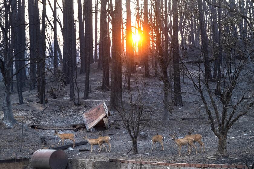
Areas recently burned by wildfires are particularly susceptible during intense rain. Vegetation on a healthy hillside typically anchors the soil even when it rains. But when a fire consumes this vegetation, the slopes — now stripped of this natural protection — become vulnerable to erosion and fast-moving flows of water.
Through five years of severe drought, El Capitan Canyon above the Pacific Ocean near Goleta endured bone-dry conditions that at times seemed like they would never end.
Wildfires also make it harder for water to infiltrate the top layer of soil: Ash and other particles tend to clog the soil, and oily substances can affect the ground’s ability to absorb water. As a result, the soils become repellent to rain. (Imagine the water hitting the surface like rain rushing down a slippery playground slide.)
Burn areas are generally more prone to debris flows for three to five years after a fire — the amount of time usually needed for vegetation to grow back. But with increasingly dramatic swings between severe fires and intense precipitation, with essentially no transition period in between, the risks continue to compound for California.
Scientists have long warned that this whiplash would become more common as the consequences of a warming planet continue to intensify.
California gets enormous floods roughly once a decade, says geologist Jeff Mount. He says that now is the time to prepare.
Although this latest bout of rain is not enough to end California’s record-breaking drought, the precipitation has been a welcome relief to those fighting another extreme fire season: The Dixie fire, burning at almost 1 million acres, is now 97% contained, and Jeff Knudson, the incident commander for the Caldor fire, announced Sunday that his team is handing command back to local fire officials.
The Caldor fire, now 100% contained, had threatened the Lake Tahoe Basin and Eldorado National Forest for two months. Firefighters carved a total of more than 400 miles of containment line across the landscape, and authorities said repair operations will continue for quite some time.
“The communities along the west slope of the Sierra have been gracious hosts, and we wish them nothing but the best as they and the land continue to heal from the Caldor fire,” Knudson said.
The blaze will continue to creep and smolder within the containment area long into the winter, Knudson said. Other dangers in the fire area include falling trees and debris, heavy fuels that continue to burn, and hazardous materials from scorched structures.
Times staff writer Rong-Gong Lin II contributed to this report.
More to Read
Sign up for Essential California
The most important California stories and recommendations in your inbox every morning.
You may occasionally receive promotional content from the Los Angeles Times.
