October’s torrential rains brought some drought relief, but California’s big picture still bleak

- Share via
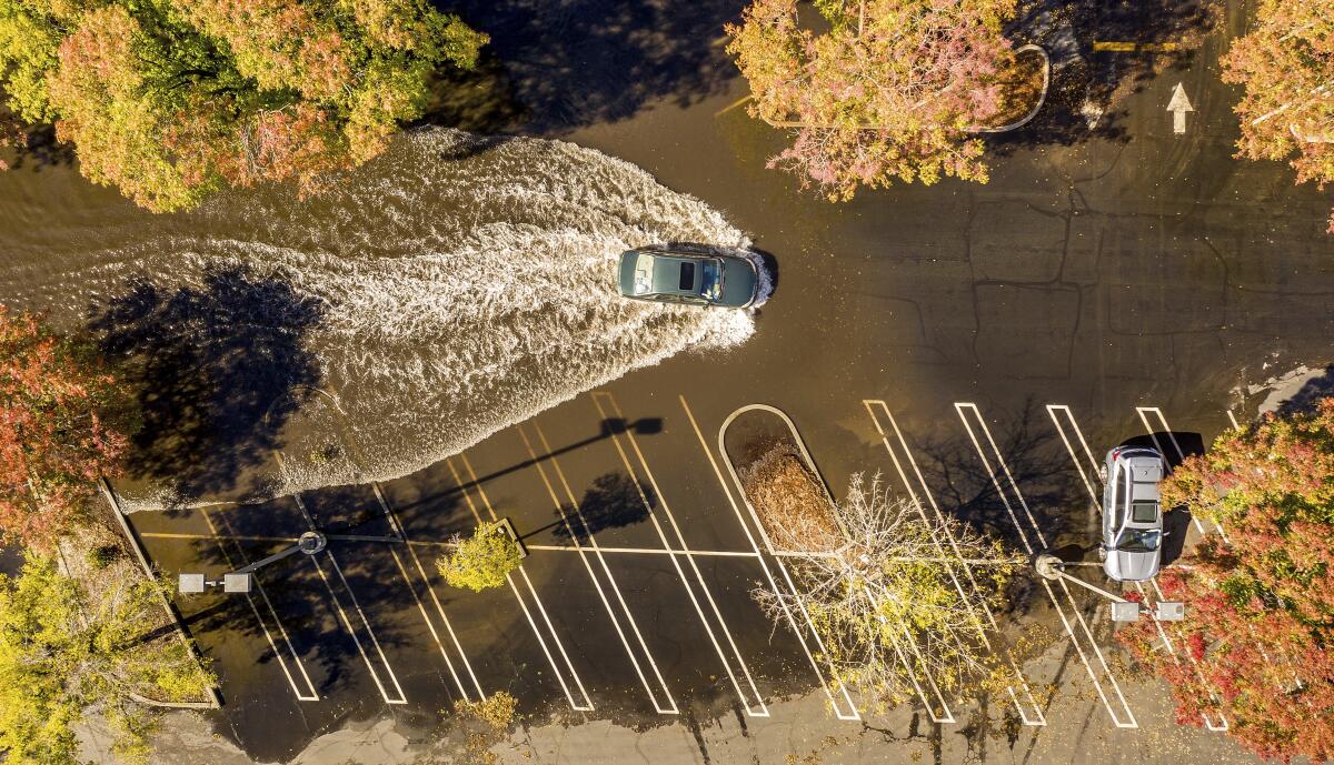
When a fierce early-season storm drenched parts of Northern California last month, some experts said it was in the nick of time.
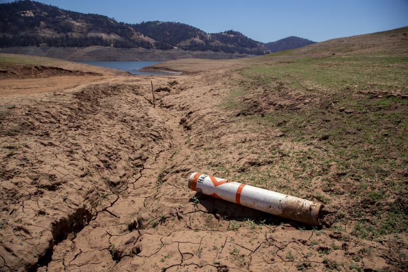
Reservoir levels were critically low. Soils were parched. Fires rampaged through dry forests.
There was general consensus among climate experts that not even the record-breaking downpour would end the two-year drought plaguing the state. There was too much of a deficit, and a single storm — even of biblical proportions — would not be able to solve it in one fell swoop.
Still, climate experts expressed hope that the atmospheric river that landed in late October could improve the drought in parts of Northern California, where some areas experienced rain that sank hundred-year records. But those expectations didn’t extend to Southern California, which saw only modest precipitation during the storms and is projected to receive below-average rainfall this winter amid a second year of La Niña weather pattern.
While the powerful rains did bring some relief to the northern and central parts of the state — and more moisture is on the way — climate experts and weather officials said it’s not clear how long those positive influences will last. They stressed that the moisture did little to move the dial on the bigger drought barometer; the majority of the state remains in extreme or exceptional drought.
The average accumulation of rain and snowfall across the state totaled only 11.87 inches during the 2021 water year, which ran Oct. 1, 2020, through Sept. 30.
“It was a deposit into the bank account just before it was overdrawn,” said Daniel Swain, a climate scientist at UCLA.
“It doesn’t solve a long-term problem,” he added. California could be back in the same boat in a few months as things dry out, “but it was a substantial injection of water just in time to help ecosystems get through the fall, that otherwise would have been hard to get through.”
The benefits, however ephemeral, were significant.
Desiccated soil lapped up the moisture, and streams quickened their pace. Depleted reservoirs began to fill. After an onslaught of ferocious blazes, fire season in the northern part of the state was extinguished.
Some northern coastal areas, including parts of Sonoma and Mendocino counties, dropped from exceptional drought — the worst category — to extreme drought based on short-term improvements such as enhanced soil moisture and stream flow, said Adam Hartman, a meteorologist with the National Oceanic and Atmospheric Administration and an author of the U.S. Drought Monitor. Parts of Shasta County and the northern Sierra Nevada also saw improvement, he said.
By late last week, San Francisco and Sacramento were 649% and 675% above average, respectively, for their rainfall tallies since the water year began Oct. 1, according to officials with the National Weather Service. Sacramento reported a record 24-hour rainfall total of 5.44 inches during last month’s storm, surpassing a mark set in 1880.
Still, forecasters in San Francisco and Sacramento hesitate to make too much of the high rainfall totals given how early it is in the season.
As Swain put it, “It’s a big number, but it’s kind of skewed by the fact that the denominator is really small.”
The region typically records its most rainfall December through March.
“What really matters is, how many of those storms do we get before the end of March? And it’s a long time until March,” said Jay Lund, a professor of civil and environmental engineering and director of the Center for Watershed Sciences at UC Davis.
Gov. Newsom declared a statewide drought emergency Tuesday, as officials announced that Californians reduced water use an average of 5% in August.
La Niña tends to signal warmer, drier winters in Southern California, but the association between the weather phenomenon and the state’s northern regions is less clear.
While nothing is set in stone, some weather experts are bracing for a potentially drier-than-normal winter, even to the north.
Roger Gass, a meteorologist with the National Weather Service’s office in Monterey, said projections indicate below-average rainfall for the Bay Area. Swain seconded that notion.
Although the state’s water year started with an “active pattern,” it “doesn’t mean that we’re not going to turn dry during the peak of our winter season,” Gass said. “There’s still a lot of unknowns.”
A weak storm rolled through the central and northern parts of California Friday into Saturday, and a stronger system is expected Monday. Sacramento and San Francisco could receive up to half an inch of rain from the stronger system, with coastal ranges and mountain areas potentially receiving up to two inches, forecasters said.
“It’s going to move through rather quickly,” Gass said. “But nonetheless, it will provide some more beneficial, widespread rainfall to the region.”
There’s a relatively slim chance that parts of Southern California north of Santa Barbara will get light rain as the system heads south. Precipitation would probably amount to an inch or less, said Ryan Kittell, a meteorologist with the weather service’s Oxnard station.
Unlike Northern California, where rainfall is far above average for this time of year, Southern California is “right around normal,” Kittell said. By late last week, roughly three-quarters of an inch had fallen on downtown Los Angeles since the water year began. Typically, the area gets .63 inches of rain by that time.
Regardless of how the season unfolds, experts point to troubling long-term drought conditions that will require more than a few storms — or even an entire wet winter — to erase.
Although many reservoir levels ticked up after the October downpour, Lund said the large ones — including Folsom Lake east of Sacramento — remain below where they were this time last year.
Bill Patzert, a retired climate scientist at NASA’s Jet Propulsion Laboratory, estimates it would take 17 years of above-normal rainfall and snowpack to refill Lake Mead, an important water source for the West, which has fallen to critically low levels.
Groundwater levels remain low in other areas as well, said Hartman, the meteorologist with NOAA, noting that precipitation hasn’t “seeped deep enough into the ground to recharge those water tables.”
“There are still longer-term drought impacts that are being felt,” he said.
More to Read
Sign up for Essential California
The most important California stories and recommendations in your inbox every morning.
You may occasionally receive promotional content from the Los Angeles Times.


