California ‘storm train’ may rival notorious El Niño winter of 1997–98
- Share via
SAN FRANCISCO — The parade of severe storms slamming into Northern California could lead to one of the strongest seasons since the wild El Niño-fueled winter of 1997–98, given the relentless pace of weather systems marching in with little relief.
And this isn’t even an El Niño year.
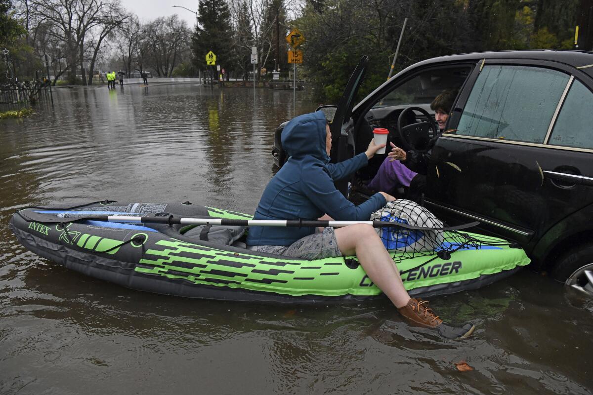
Already, Northern California and the Central Valley have been hit by a number of history-making storms, pouring floodwaters into homes, cars, restaurants, a nursing home, freeways and underpasses. At least four deaths have been reported: a 72-year-old struck by a falling tree in Santa Cruz on New Year’s Eve, two people found near where the Cosumnes River flooded in Sacramento County, inundating Highway 99; and another person west of Galt.
Relief from the pounding storms is not in sight. More storms are expected through mid-January, even after Wednesday’s powerful event, expected to hit hard in the afternoon through the night. The National Weather Service for the San Francisco Bay Area issued a rare warning that the storm Wednesday and Thursday would bring “extreme” risk, the worst category — colored purple — on a five-level scale. The Sacramento region’s valleys and foothills are forecast to endure “extreme” risk on Wednesday.
The atmospheric river due to hit California in the coming hours is likely to compound the damage wrought by a deadly storm on New Year’s Eve.
The Los Angeles area, meanwhile, is expected to see “major” risks from the storm on Wednesday and Thursday, the second-highest risk level.
“We’ve already gotten quite a burden of precipitation over the last week and a half. So the grounds are saturated,” said Warren Blier, science officer with the National Weather Service office for the San Francisco Bay Area. “Essentially, none of that is going to percolate into the soils and all of it’s going to run off,” raising the flood risk.
Wind gusts of up to 60 miles per hour could hit some locations in the Bay Area and the Sacramento area, and up to 80 miles per hour in the coastal hills. Power lines are expected to be blown down, and could cause widespread blackouts.
“In addition, this storm looks like it’s going to be accompanied by quite strong winds, and potentially even stronger than with the last storm. And that combination of saturated soils and strong winds can result in quite a few trees blowing down,” Blier said. “It’s hard to imagine a scenario that’s potentially more impactful — and also something that could realistically occur — than what we’re looking at with this incoming system.”
Many trees’ root systems have been weakened because of the recent rainfall. On New Year’s Eve, there was a two-hour period where gusts of about 60 miles per hour downed many trees, leading to power outages, said Craig Shoemaker, meteorologist with the National Weather Service office in Sacramento.
The intense downpours — coming after an earlier deluge days ago — pushed some rivers toward flood stage, prompting a string of evacuations from towns along the Russian River to communities in Santa Cruz County and beyond.
In this storm, “winds will be just as strong but a longer duration,” Shoemaker said. “And so we’re expecting quite a few number of [downed] trees and power outages.”
Landslides and mudflows are expected, and officials issued a coastal flood advisory. “Flooding of lots, parks and roads is expected,” the weather service said.
Wednesday’s event won’t be a “one-and-done” storm. Forecasters said “a storm train of systems looks to march across the Pacific and impact much of NorCal through at least next week, and possibly through [the Martin Luther King Jr. holiday] weekend.”
Another storm is expected this weekend, followed by a moderate-to-strong atmospheric river Monday into Tuesday, and another storm at the end of next week heading into the three-day weekend.
“The cumulative effects of these storms could be quite debilitating,” the weather service said.
The current pattern of storms is shaping to be quite unlike anything Northern California has seen in years. By the time it ends, downtown San Francisco may have recorded among the highest three-to-four week precipitation totals in the modern record, Blier said. One such memorable train of storms occurred during the historic 1997–98 El Niño winter, a season that ended with 17 deaths and more than half a billion dollars in damage in California.
There is no El Niño this year, and there’s instead a weak La Niña, which involves waters off the Pacific coast that are cooler than normal. La Niña tends to result in drier conditions in California, but — as is plausible for this winter — the correlation between the two doesn’t always happen.
The most dangerous part of the storm was expected for Wednesday afternoon and the overnight hours into Thursday, with “heavy rain rates that will lead to urban and small stream flooding, with basins getting overloaded,” the weather service said.
Karla Nemeth, director of the California Department of Water Resources, called the latest series of storms the most powerful set since 2017, the same robust season that nearly caused the failure of a retaining wall in California’s second largest reservoir, Lake Oroville.
“The most vulnerable places in California right now are rural levees — they are not required to meet the same standards as the levees that protect our more urban communities,” Nemeth said.
“Please stay home,” pleaded San Francisco Fire Chief Jeanine Nicholson at a news briefing. Government officials across the region reported shortages of sandbags as residents rushed to prepare for flooding.
The city of San Jose and San Mateo County declared a state of emergency and Santa Cruz County declared a local disaster in advance of Wednesday’s storm. San Jose officials ordered homeless people living along several creeks — Coyote, Guadalupe and Penetencia — to be evacuated. San Jose neighborhoods along Coyote Creek suffered significant flooding in 2017.
San Mateo County officials said the New Year’s Eve storm has already put sewer treatment plants at risk of failure, forced firefighters to move fire engines away from floodwaters, and caused the evacuation of a trailer park and a farmworker housing community. An evacuation advisory is in effect for the rural southern coastal areas of San Mateo County, particularly the area that burned in the CZU Lightning Complex fire of 2020, one of the most destructive fires in state history.
A flood warning has been issued for the Russian River near Guerneville in Sonoma County. Officials forecast the river will see moderate flooding Thursday. The city of Watsonville in Santa Cruz County has issued a mandatory evacuation order for areas close to the Pajaro River and Salsipuedes Creek. Santa Cruz County has already suffered $10 million in damage from the preceding storms.
The San Francisco Bay Ferry suspended service Wednesday on lines serving South San Francisco and Harbor Bay in Alameda, citing the forecast of big winds from the south threatening terminals. Ferry service to Angel Island was also canceled.
The prior storms have already been impressive. For the 36-hour period that ended 4 a.m. on New Year’s Day, the weather service had expected 1½ to 2 inches of rain for San Francisco. In fact, 5.46 inches of rain fell on downtown San Francisco on New Year’s Eve — the second-wettest day in the historical record, which dates back to 1849.
When will California storms hit hardest and how long will they last?
Downtown Sacramento recorded one of its wettest Decembers on record — 9.5 inches. That’s about half the rainfall the city gets on average in an entire year, 18.2 inches. Stockton and Modesto set all-time records for December rainfall, Shoemaker said.
And the flooded Cosumnes River — which flows for 53 miles from the Sierra Nevada to the Central Valley — posted its second-highest river flow on record. By the afternoon of New Year’s Eve, a section of the Cosumnes River about 25 miles southeast of downtown Sacramento was flowing at 65,143 cubic feet per second.
“We had a tremendous amount of rain with with that system — we’re talking about two-day totals that were in the seven- to 10-inch range across a lot of our Sierra foothills areas,” Shoemaker said.
That easily topped the previous second-highest flow record, of 49,700 cubic feet per second, set on Feb. 10, 2017 — which came the same week that heavys storm runoff threatened the stability of a retaining wall at Lake Oroville, California’s second largest reservior, 75 miles away, forcing large evacuations.
The record for the highest river flow on the Cosumnes River came a year before the 1997–98 El Niño winter. The winter of 1996–97 brought deadly New Year’s floods and billions of dollars in damage, and on Jan. 2, 1997, the Cosumnes River reached a peak flow of 93,000 cubic feet per second.
Luckily, Wednesday’s storm is not expected to flood the areas around the Cosumnes River. For the Central Valley, the heavier rains are aimed farther north, Shoemaker said.
One potential complication is a higher risk of thunderstorms in Wednesday’s storm “that could cause a quicker burst of heavy rainfall,” Shoemaker said.
The main concern for the Sacramento area, like for the Bay Area, is the line of storms prepared to march through mid-January.
“We’re very concerned about continuation of the threat of flooding and strong winds going into the future. And that could begin to affect some of the larger rivers, as this rain piles up,” Shoemaker said.
While the back-to-back nature of these storms is impressive, the cumulative precipitation recorded so far in the northern Sierra — a key indicator of the health of California’s reservoirs — is nowhere near enough to suggest the end of the drought is in sight.
Water levels in many California reservoirs remain significantly below their historical averages.
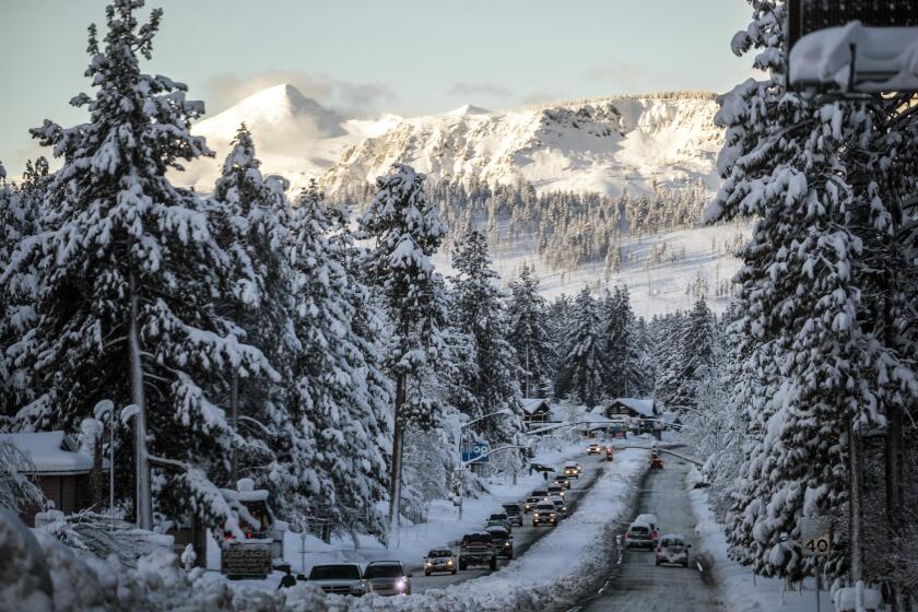
California snowpack is 174% of average for this time of year, but state officials caution that the drought isn’t over.
More to Read
Sign up for Essential California
The most important California stories and recommendations in your inbox every morning.
You may occasionally receive promotional content from the Los Angeles Times.
