A chunk of Rancho Palos Verdes is sliding into the sea. Can the city stop it?
- Share via
A drive along the ocean on the Palos Verdes Peninsula is Southern California at its finest. Sunlight dances on the water. Coves are pristine, unsullied by development. Catalina Island appears so near you can almost spot the bison.
Look a bit closer, though, and you’ll see signs of a disaster waiting to happen.
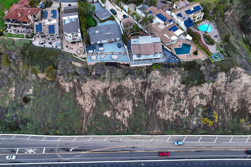
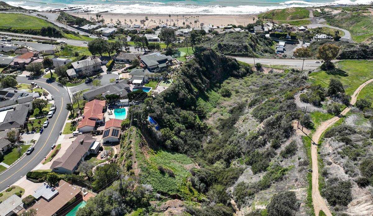
An above-ground sewage pipe snakes along the road. The pavement on Palos Verdes Drive South is rutted and warped, jutting up and down like an asphalt roller coaster. The hills are strewn with houses on makeshift foundations, perched on haphazard stilts and shipping containers.
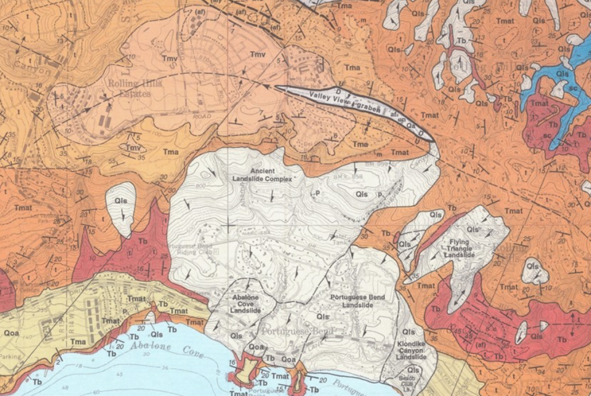
The problem: A dormant landslide complex that shaped the south side of the Palos Verdes Peninsula for hundreds of thousands of years was reactivated 67 years ago, and it’s threatening to destroy homes and infrastructure.
The solution: a $25-million series of wells that will suck water out of the ground and spit it into the ocean, effectively drying up the lubricated landscape enough to stop the land from sliding.
Palos Verdes Peninsula has long been prone to landslides, and the most dramatic one is affecting Portuguese Bend, an area named after a Portuguese whaling operation, now known for its natural beauty and native vegetation. The geological phenomenon has hit a 240-acre area hard over the last seven decades, causing fissures to open in the earth and homes to strain, buckle and drift, sometimes outright wandering onto adjacent properties.
City officials are mounting a plan to mitigate the landslide before it’s too late.
“Something catastrophic is imminent,” said Ara Mihranian, a city planner. Since being named city manager in 2019, he has made slowing the landslide a primary focus.
“Doing nothing is not an option.”
How did this happen?
The Portuguese Bend landslide was triggered in the summer of 1956 — nearly two decades before Rancho Palos Verdes became a city — when a Los Angeles County road crew was constructing an extension of Crenshaw Boulevard that would run from Crest Road to Palos Verdes Drive South.
The crew dug up thousands of tons of dirt for the project and dropped it on top of the ancient landslide zone, which hadn’t moved in 4,800 years. The extension was never completed, but the weight and movement of the dirt shifted the balance of the earth enough to reactivate the slide, sending the land into a slow-motion descent toward the sea.
The slide did the majority of its damage just a few months after it began. The primary victim: Portuguese Bend Club, a beachfront paradise envisioned by Kelvin Vanderlip, son of Frank Vanderlip, who helped develop the Palos Verdes Peninsula in the 1920s.
The coastal complex included a clubhouse, pool, pier and hundreds of homes that occupied the hills above. A few months after the landslide started, it slowly tore up 130 of the homes. The pool was damaged, and the clubhouse was deemed unsafe, closing two years later, according to the Daily Breeze.
The land moves sometimes horizontally, sometimes vertically. Sometimes inches, sometimes feet. Mihranian said it moves at a pace of roughly eight feet, in a southwesterly direction, per year. Over the last 15 years, sections of land have moved anywhere from 100 to 225 feet horizontally and dropped eight to 18 feet vertically.
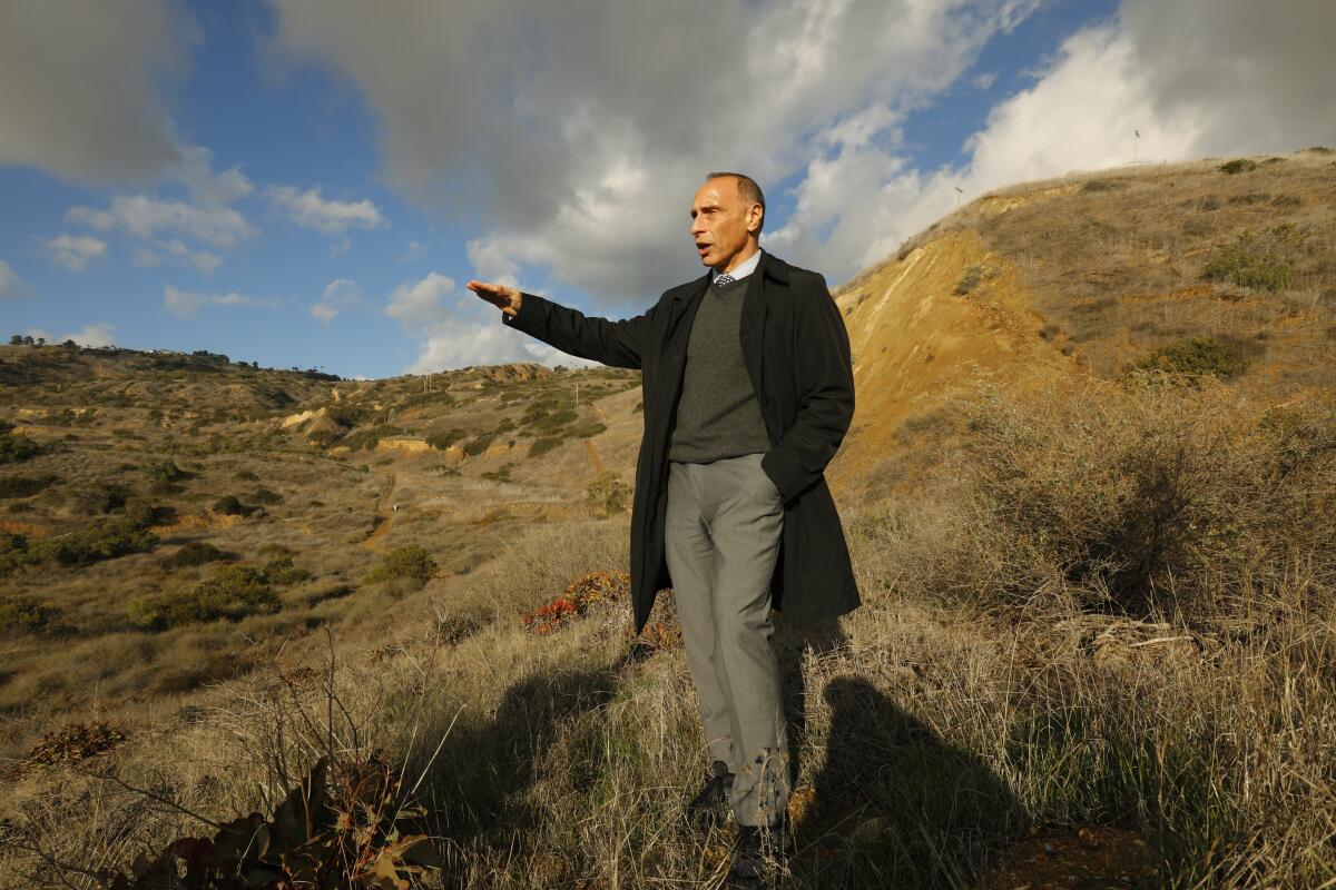
Landslides are common, but what makes Portuguese Bend’s extraordinary is how slowly but surely it persists — the Aesop tortoise of natural disasters. Scientists and geologists have flocked to the area over the years to study the slide because of its rare combination of size and scope.
Thomas Oommen, professor of geological sciences at Michigan Technological University, said it’s an interesting case study because there are only a few landslides with such significant movement every year. What distinguishes Portuguese Bend is that the slope has not failed catastrophically — yet — and the humans atop are largely staying put, riding the slow-moving land for as long as they can.
The landslide today
In recent years, the landslide’s harm has been more incremental than the initial destruction in 1956. The most noticeable damage is dealt to Palos Verdes Drive South — the road that winds along the coastal cliffs — warping it into a crooked, hilly mess with dips that make your stomach jump. The city has to send a crew once a month to fill cracks, maintenance that costs roughly $1 million per year.
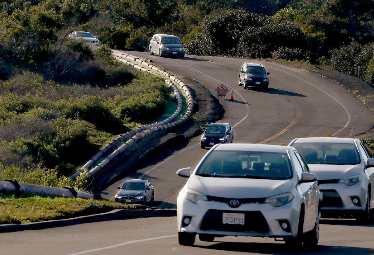
The road is a high-traffic thoroughfare that connects the southern end of the peninsula to the rest of L.A. County, and if the landslide ever severs it — like the one that fissured Paseo del Mar in San Pedro in 2011, sending sections into the sea — it will create a 15-mile detour and cut off a major evacuation route from the fire-prone hills.
“There’s a real risk here,” Oommen said. “If no mitigation measures are taken, it could lead to the destruction of that road.”
Oommen, co-author of a 2019 report on the landslide, said several factors could cause a complete failure of the hillside. An earthquake would be the obvious culprit, but even a major rainstorm could trigger it.
The slide shifts the land so much that most utilities can’t be buried underground, so the city has installed an eyesore: an above-ground sewage line that runs along the side of the road. It’s rigged with flexible pipes that can move along with the land. If the landslide ever ruptures the line and the city is delayed in shutting down the valves, it would dump raw sewage onto the beaches, coves and tide pools, said Mihranian.
Why feel sorry for people who can afford to move away from the ravages of climate change and who have historically never cared about the issues affecting O.C.’s poorer cities?
The homes along and above the road, meanwhile, suffer cracked walls and foundations, busted pipes and crooked windows and door frames. One ranch in the Seaview neighborhood has a roof that’s slowly caving in. Another, in the gated community of Portuguese Bend, is perched on eight feet of timber cribbing, a makeshift remedy that essentially suspends the property on supersize Jenga blocks.
Kyle Tourje, a structural assessor with Alpha Structural, works on homes around Portuguese Bend and is shocked by the solutions people come up with.
“It’s so Mickey Mouse, so substandard,” he said. “You have a luxury community with world-class golf courses and amazing views of the ocean, but some homeowners are literally living in Third World conditions.”
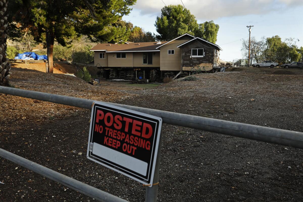
Claudia Gutierrez, a longtime resident and director of the Portuguese Bend Community Assn., said the shifting has cracked her home’s concrete foundation and interior walls and jammed windows and doors. Kent Attridge, another resident, recently had a water pipe break.
Since the subterranean land is in a state of flux, homeowners can’t build a deep foundation or it’ll get sheared apart by the layers of movement. So homes sit on top of the land, bobbing on the surface, wherever it goes.
Residents are unable to make permanent repairs because the city has placed a building moratorium in the active landslide zone. On many calls, Tourje’s hands are tied.
“This is right up our alley of work, but the moratorium forbids us from doing anything,” he said. “So you get homeowners supporting their properties with pipe jacks or steel beams, because they’re tired of getting vertigo from the inside of their house being so crooked.”
Locals who have rigged DIY fixes suffer in silence, keeping it quiet from city officials and journalists for fear of losing their homeowners insurance.
Assessing a mobile, er, moving home
It’s one thing for the landslide to damage a house, but what happens when it moves the home entirely off of its property? That’s the conundrum L.A. County Assessor Jeffrey Prang has been tasked with solving.
“When we assess property parcels, the legal description is based on fixed points of reference that are stationary. But in Portuguese Bend, we have property parcels that remain in the same place [on the map], while the house has moved off that fixed parcel onto someone else’s property,” Prang said. “There’s no precedent for this.”
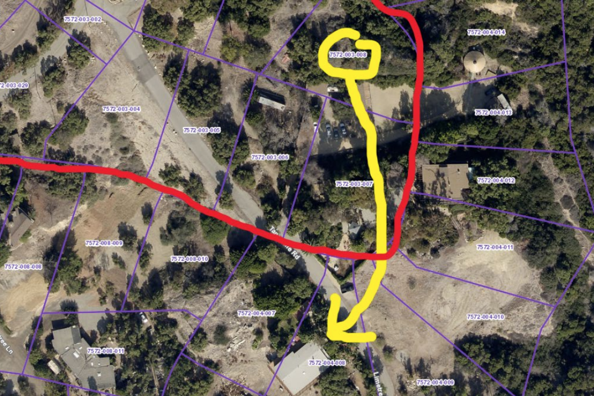
Aerial imagery shows how significant the movement has been, with homes shifting over multiple lots and roads in completely different places. There’s no legal basis for such a situation, so Prang has relied on judgment and departmental policy. For now, he’s treating each home as if it hasn’t moved.
That system is working, but the landslide is making the real estate market much more difficult to navigate.
“How do you sell a property and get title insurance if you can’t guarantee the land that you’re on is yours? Their ability to sell is compromised because of the movement,” he said.
One resident tried to take advantage of the crisis and scheme a way into a free house by buying up vacant land and trying to claim that a home had moved onto it. The same buyer even tried, unsuccessfully, to get a longtime homeowner evicted, claiming that the house was now technically on his land, Prang said.
Lawsuits have been filed over property lines and trespassing allegations.
Much of the confusion is because the city of Rancho Palos Verdes in the early 2000s adopted a Geographical Information System, or GIS, which maps property lines over aerial imagery. It’s a common system but one that doesn’t account for land that’s moving. The map even has a disclaimer on the city’s website that says property lines may not be accurate in the landslide zones.
Portuguese Bend residents generally favor a system more in tune with metes and bounds, a mapping method that uses physical landmarks such as trees, walls and roads to measure parcels. Gutierrez describes it as common sense.
“There are 96 properties on the east side of Portuguese Bend. If you go by GIS mapping, every single one is incorrect,” she said. “So then you have someone buying a piece of empty land for $38,000, realizing there’s technically a house on it, according to GIS, and then claiming it’s worth $1 million.”
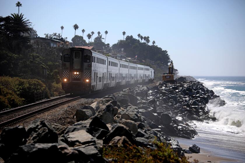
Officials with Metrolink are still responding to recent movement detected in the railway’s foundation near San Clemente after Tropical Storm Kay.
Disputes often break out between neighbors about who owns what. Cars and RVs are parked straddling property lines. In one case, a resident cut down someone’s wood fence over a property dispute.
Sometimes, the confusion can be dangerous.
Ben Zask, who also serves in the community association, said that when an ambulance was looking for a senior citizen using the GIS map, it went to the wrong address twice before finding the right house.
“A 10-minute delay in an emergency like that can be costly,” Zask said.
The plan to slow the slide
The science behind the landslide is fairly straightforward: Rainwater and irrigation water are absorbed into a particularly absorbent layer of earth.
El Hachemi Bouali, assistant professor of geosciences at Nevada State College, said it all comes down to clay — bentonite and montmorillonite, to be specific. The clay, upon which the main body of the slide sits, swells and becomes soft and slick when mixed with water.
So even though Portuguese Bend’s slope dips toward the ocean at an angle of roughly 5 degrees — less than the 15- to 20-degree slopes of typical landslide areas — the clay becomes slippery enough for the land to ride downward with the force of gravity, as if it were on an icy driveway.
“Everyone looks forward to rain because we’re in a drought. But for a community like ours, we cringe, because we know it’s going to accelerate the landslide at some point,” Mihranian said.
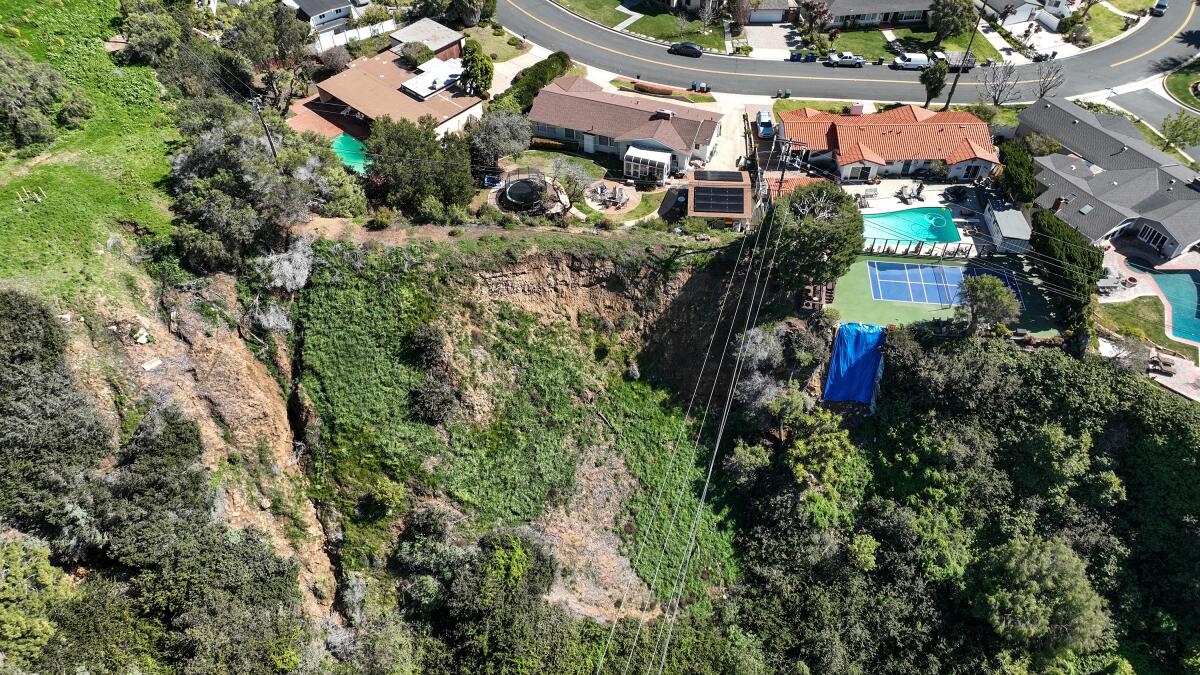
In 2017, the city of Rancho Palos Verdes started exploring efforts for long-term stabilization, forming a subcommittee, holding community meetings and hiring a consultant to find the optimal solution. In February, it released a draft of the environmental impact report laying out a possible plan.
The plan hinges on two tactics: stopping rain from getting into the ground and extracting the water that’s already there.
To do this, the city is proposing a three-pronged approach: infilling fissures in the earth that let in rain, creating a surface drainage system to send rainwater into the ocean and installing horizontal dewatering wells to suck water out of the ground.
New winter storms are expected to bring even more snow and rain to Southern California through Wednesday.
The plan is based on measures taken in Abalone Cove, a nearby landslide complex that, thanks to dewatering wells, has slowed land movement to a much more manageable one to two inches per year.
“It’s absolutely a viable solution,” said Tourje, who often installs similar dewatering systems when fixing landslide repair. “It’s a lot of work, but it’s the only feasible way to mitigate this. You can’t beat this, only slow it down.”
The plan, which is open for public review and will be the focus of a March 21 City Council meeting, will require a budget of $25 million for the wells and $8 million for fissure infilling and surface water drainage systems. Although the city is known to be generally affluent, it doesn’t have the tax base to handle such projects on its own.
As a result, the city has applied for $23.3 million from the Federal Emergency Management Agency through its Building Resilient Infrastructure and Communities grant funding program, and Mihranian is doing everything in his power to secure the money.
“These grants are designed to put measures in place to prevent a catastrophe, and that’s what we’re trying to do here,” he said.
He’s hoping to get the remaining $10 million needed for the project from the county and state, claiming that the crisis isn’t just a local issue but regional, since the landslide poses risks to county roads and beaches.
“There’s an imminent threat to the environment. Homes are in jeopardy. Lives are in jeopardy,” he said.
If all goes according to plan, the city hopes to start installing the wells in 2024, a process that would take roughly a year.
Most residents are staying put.
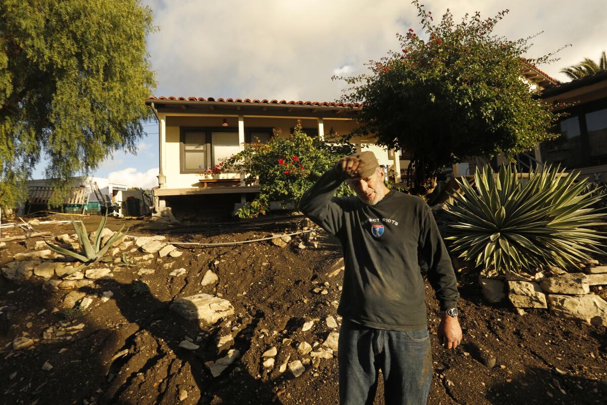
“It’s a testament to the people here. Most situations like this are declared a disaster,” Gutierrez said. “But we’re resilient. We’ve learned how to adapt.”
Times staff writer Hailey Branson-Potts contributed to this report.
More to Read
Sign up for Essential California
The most important California stories and recommendations in your inbox every morning.
You may occasionally receive promotional content from the Los Angeles Times.
