Deadly bomb cyclone storm slams California, causing intense winds, blackouts, havoc
SAN FRANCISCO — At least one person was killed as a wet and windy storm arrived in California on Tuesday, delivering more rain, snow and hazards to residents of the Golden State on the second day of spring.
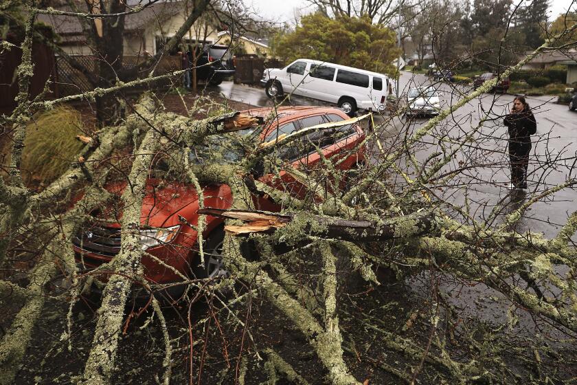
The person, who has not been identified, was killed when a tree fell onto a vehicle on Alpine Road in Portola Valley, according to the California Highway Patrol. Falling trees injured multiple people in the San Francisco Bay Area, some of them critically, San Francisco Fire Department spokesman Jonathan Baxter said Tuesday night.
The remarkable ‘bomb cyclone’ storm is losing energy as it moves southeast, but it could still cause damage and flooding, especially in the already soaked Central Valley.
The toll was reported as the low-pressure system rocked the Bay Area and the Central Coast, with widespread rain and damaging wind gusts snarling traffic, knocking glass out of skyscrapers and leaving tens of thousands without power.
The storm came in much stronger than expected, particularly in the southern half of the San Francisco Bay and Monterey Bay areas, UCLA climate scientist Daniel Swain said in a briefing Tuesday. He said the system had reached the benchmark for a phenomenon known as bombogenesis, or a “bomb cyclone,” which indicates a rapid drop in pressure.
Unlike an earlier bomb cyclone this winter — which occurred about 1,000 miles southwest of San Francisco — “this is very close to the coast,” Swain said. “So the impacts are actually more immediate and greater than they were back then.”
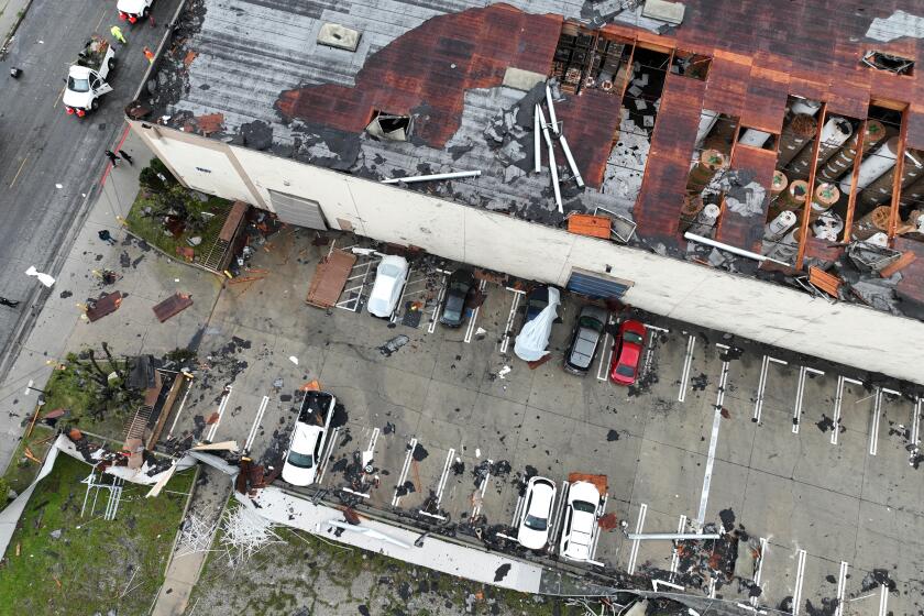
The National Weather Service confirmed Wednesday that a tornado was responsible for tearing the roof from a building in Montebello.
Baxter said his dispatch board had been lighting up with emergency calls: “It’s call after call after call after call.”
Mary Ellen Carroll, executive director of San Francisco’s Department of Emergency Management, said on Twitter that 911 was being inundated with so many calls that it was causing “long delays for pending calls.” She asked residents to use 311 for storm-related calls and save 911 for life-threatening emergencies.
The National Weather Service on Tuesday issued high wind warnings for the coast from San Francisco to San Diego, as well as inland areas, including Palmdale, Lancaster and other parts of the Antelope Valley.
Heavy rain was forecast to lead to rapid runoff and areas of flooding as the storm moved south Tuesday. Heavy snow was expected to pose hazards in the mountains of Southern California as well as the central and southern Sierra Nevada, where up to 4 feet could accumulate at higher elevations.
The weather service issued special statements covering large swaths of Ventura and Los Angeles counties, citing the potential for pea-size hail as well as the possibility of landspouts Tuesday.
Though recent storms have cut California’s drought by half, record snowpack will increase the threat of spring flooding, forecasters say.
Landspouts are similar to tornadoes, but the circulation from the funnel starts at ground level and is pulled up into towering cumulus clouds, according to the National Oceanic and Atmospheric Administration.
On Tuesday afternoon, as the storm approached the Bay Area, the system developed two “eyes,” or areas of low pressure, which intensified winds as they danced around each other, said Brian Garcia, a National Weather Service meteorologist in the Bay Area.
The phenomenon, known as the Fujiwhara effect, was contributing to peak wind gusts “upward of 60 to 75 mph in the Santa Cruz Mountains,” said Rick Canepa, a National Weather Service meteorologist in Monterey County, along with strong 50- to 60-mph winds across Santa Cruz and Santa Clara counties.
The winds felled trees and downed power lines, and driving was a dismal experience across Santa Cruz County. Officials on Tuesday afternoon shared a map showing dozens of reported roadway incidents and traffic hazards — many along Highway 9 north of Santa Cruz.
“The current status of roads throughout Santa Cruz County is ... not good. Avoid travel if at all possible, especially in the San Lorenzo Valley,” officials wrote on Twitter.
Up and down the San Francisco Peninsula, heavy rains were flooding streets and high winds were knocking down trees and causing power outages — just a week after a similar high-intensity storm rocked the generally weather-placid area.
Lashing winds pushed water up to the sidewalks around Oracle Park, and high waves made it impossible for a Golden Gate Ferry to take passengers from Larkspur to San Francisco.
“Conditions for docking in San Francisco were too dangerous; the winds and the chop were too high,” said Paolo Cosulich-Schwartz, communications director for the transit service.
Visibility was minimal on Interstate 280, which follows the peninsula from San Francisco to San Jose. Ferocious gales blew rain horizontally across the freeway, turning the high-speed interstate into a slow-motion crawl.
In Menlo Park, trees were toppled across small side streets and major arteries such as Santa Cruz Avenue, where a crew was summoned to chainsaw a 60-foot cedar that had been uprooted and was blocking two lanes of traffic. The city’s high school lost power, prompting teens to call their parents to see whether the lights were on at their homes.
In Contra Costa County, a downed tree derailed an Amtrak train carrying 55 passengers southeast of Port Costa. No injuries were reported, according to local fire officials.
By late Tuesday afternoon, about 246,000 Californians were without power, primarily in the Bay Area, according to an outage tracking website.
David King, a meteorologist at the weather service in Monterey, said the storm had developed a “sting jet,” or a localized acceleration of winds next to a center of low pressure.
UCLA’s Swain said that was part of the reason that winds were so strong from Santa Cruz to Monterey County, and he likened the phenomenon to “a scorpion’s tail descending from the sky.”
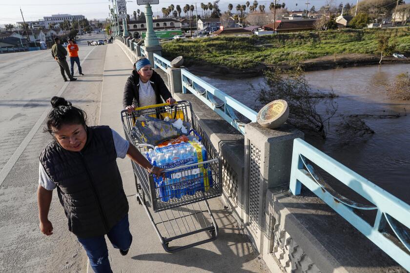
Founded as a labor camp for agricultural workers, the small community of Pajaro has long languished in the shadow of nearby Watsonville.
The cold system was expected to gain some subtropical moisture as it moved toward Southern California — a recipe for heavy rain. Flood watches and advisories were in effect across the Southland, and roadway flooding and traffic jams were reported in Los Angeles.
High temperatures in Southern California were expected to drop into the 50s — about 10 to 15 degrees below normal for this time of year, said David Sweet, a weather service meteorologist in Oxnard.
“There could be some excessive rain when the strongest part of the storm moves through, so we’ll be concerned with flooding,” Sweet said. “We’re also going to be concerned with strong winds. Winds are really picking up in the coastal waters now — they’re seeing gusts on the order of 40 and 50 mph — so it looks like the storm’s going to deliver on the winds.”
In the Los Angeles area, up to 3 inches of rain was possible along the coast and in the valleys, and up to 5 inches in the foothills, Sweet said.
By midday, flooding and debris flows had spurred road closures along sections of the 5 Freeway in Anaheim, Santa Ana and near Elysian Park in L.A., as well as Pacific Coast Highway in Huntington Beach and Dana Point, according to Caltrans.
Weather conditions also led to the closure of several roads in Angeles National Forest, including portions of Highways 2 and 39, with no estimated time of reopening.
The CHP began conducting escorts on Interstate 5 over the Grapevine shortly before 5:30 p.m. because snow was sticking to the roadway, according to Caltrans.
A brief break in the rain around Los Angeles was expected to “destabilize the atmosphere and increase heavier showers and thunderstorms coverage” later Tuesday, the weather service said.
Despite an already solid soaking in the Southland, forecasters said an additional 0.5 to 1.5 inches of rain could fall in coastal and valley areas through Wednesday, with higher totals of 1.5 inches to 3 inches expected in lower mountains and foothills.
The storm arrives after a season of wet and destructive weather, including a series of nine back-to-back atmospheric river storms in January, which contributed to the deaths of nearly two dozen people.
In late February and early March, historic snowstorms dropped fresh powder at elevations as low as 1,000 feet — including at the Hollywood sign — and trapped residents under feet of snow in the San Bernardino Mountains, where at least 13 people died.
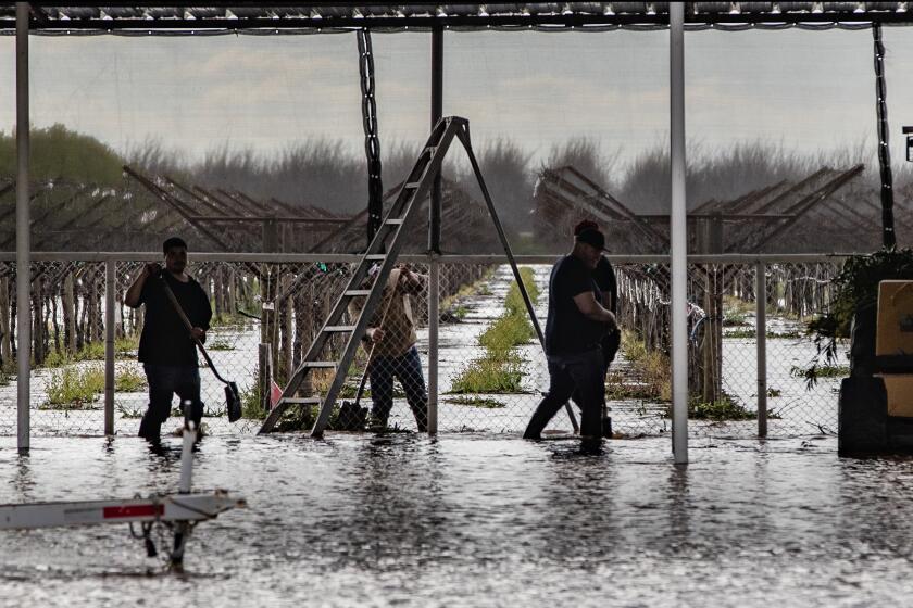
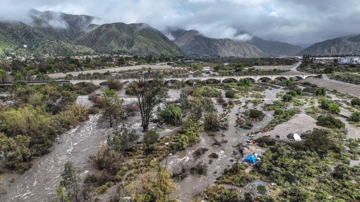
More storms in recent weeks brought levee breaches and devastating floods, including in Pajaro and in Tulare County communities near the Tule River, both of which endured evacuations and widespread property damage as floodwaters streamed from swollen rivers.
Thousands of residents in Tulare remained under evacuation orders Tuesday, including the areas of Alpaugh and Allensworth and portions of Porterville along the Tule River, where officials continued to be concerned about rising river levels as they released water from Lake Success to make room for incoming flows.
The lake was at about 96% of capacity, and officials were “continuing a high output to get it lower in anticipation of today’s rainfall and future snowmelt,” said Daniel Potter, a spokesman for the California Department of Forestry and Fire Protection, which is assisting with emergency operations and flood response.
Hundreds of small levee breaks have been reported, including a breach that sent floodwaters onto properties near Allensworth. At least seven structures have been destroyed, more than 652 have sustained major damage and 177 took minor damage. Nearly 24,000 structures remain threatened, according to Cal Fire.
Multiple small breaks have been temporarily repaired with “super sacks,” or bags of sand and rocks, Potter said. “We’re keeping an eye on some other areas, but as of right now, everything is looking good — we’re maintaining right now,” he said.
Tulare County Emergency Operations spokeswoman Carrie Monteiro said the county was vulnerable to flooding in part because of the severe drought that has gripped the region for more than a decade.
“And so our waterways had not been tested with this kind of water — the water that is going through them right now,” she said. “So we’re preparing for the next storm. We’re preparing to have tools and the resources we need on the ground. And ready to go in a significant way.”
In parts of California’s Central Valley, farmlands are being used to soak up storm water and replenish depleted groundwater.
The storm was also expected to bring up to 3 inches of rainfall in Orange County and the Inland Empire and up to 8 inches in the San Bernardino Mountains, along with higher-elevation snow.
“It’s a high amount of rain — the storm is a really strong one,” said Casey Oswant, a meteorologist at the weather service in San Diego. She added that strong winds from the south could produce a lot of rain over the mountains.
Such winds are uncommon for the region, which typically sees winds from the west, northwest or southeast, said Jonathan Porter, chief meteorologist at Accuweather.
When damaging winds originate from uncommon directions, it increases the risk of toppling trees because many root systems “build up” over time to support more typical wind directions, Porter said. That’s especially concerning given how saturated the ground is from recent rainfalls, which can also make trees more susceptible to falling.
The confluence of factors — including the bomb cyclone, Fujiwhara effect and sting jet — is remarkable, said Swain, the UCLA scientist.
“The storm is really raking Santa Cruz and San Mateo counties in particular,” he said as he reviewed radar images. “I have never seen anything quite like it.”
Conditions are expected to clear in most of the state Thursday into Sunday, forecasters said. But another storm could arrive as early as next week.
More to Read
Sign up for Essential California
The most important California stories and recommendations in your inbox every morning.
You may occasionally receive promotional content from the Los Angeles Times.
