El Niño has officially arrived, signaling a warmer world and possibly a wetter SoCal

After months of anticipation, El Niño has officially arrived.
The National Oceanic and Atmospheric Administration announced El Niño’s emergence on Thursday, advising that the climate pattern could signal another wet winter in Southern California and increased temperatures across the globe, among other effects.
“Depending on its strength, El Niño can cause a range of impacts, such as increasing the risk of heavy rainfall and droughts in certain locations around the world,” Michelle L’Heureux, climate scientist at the Climate Prediction Center, said in a statement.

Indeed, the climate pattern is a major driver of weather conditions worldwide.
It is the warm phase of the El Niño-La Niña Southern Oscillation pattern — sometimes referred to as ENSO — and is marked by warmer-than-average sea surface temperatures in the central and eastern Pacific Ocean, which occurs on average every two to seven years.
A strong El Niño could augur yet another wet winter for California, as well as drive the global average temperature to a record high, experts say.
In the United States, El Niño’s influence is typically weaker during the summer and more pronounced in late fall through early spring.
There is an 84% chance the system will be of moderate strength, and a 56% chance it will become a strong event at its peak, forecasters said.
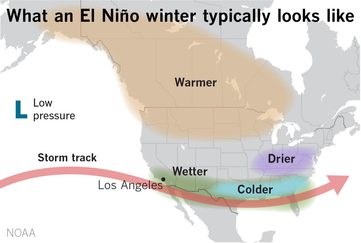
“Typically, moderate to strong El Niño conditions during the fall and winter result in wetter-than-average conditions from Southern California to along the Gulf Coast and drier-than-average conditions in the Pacific Northwest and Ohio Valley,” the advisory said. “El Niño winters also bring better chances for warmer-than-average temperatures across the northern tier of the country.”
But human-caused climate change can exacerbate or mitigate some of its effects, L’Heureux said, including setting new records for temperatures.
Eric Boldt, a meteorologist with the National Weather Service in Oxnard, said it’s not a coincidence that the Earth’s warmest year on record, 2016, was an El Niño year.
“There’s a lot of talk that this coming year could be one of the warmest on record,” Boldt said.
The World Meteorological Organization recently predicted there is a 98% likelihood that at least one of the next five years — and the five-year period as a whole — will be the warmest on record.
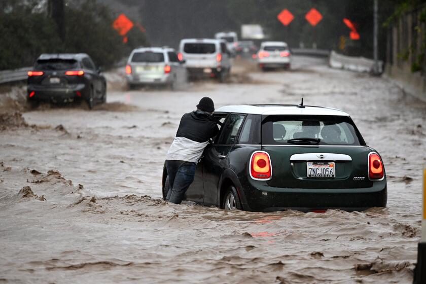
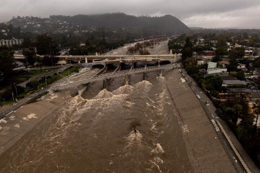
In Southern California, just about any category of El Niño — weak, moderate or strong — can bring above-normal precipitation in Southern California, Boldt said, meaning there is potential for two back-to-back wet years following this year’s unexpectedly soggy winter.
However, he added that it is not a guarantee.
“Any time we talk about El Niño, historically, rainfall totals in Southern California have been above normal in most cases — but not all,” Boldt said.
He noted that the 2015-16 El Niño was one of the strongest on record, but failed to deliver significant rain, flooding and other anticipated effects in Southern California, ultimately dropping only about 6 inches of rain.
The rare ‘triple dip’ of La Niña was the first time in the 21st century the system appeared three years in a row. Now it could give way to El Niño.
But El Niño can also have knock-on effects in California and across the world, including economic and agricultural effects.
A study published last month found that the 1982-83 El Niño contributed to an estimated $4.1 trillion in global income losses in the five years that followed, and the 1997-98 El Niño contributed to an estimated $5.7 trillion in losses.
Median losses from the incoming event could be at least $3 trillion by 2029, the study found.
Warmer winter temperatures can also affect crops in California and other agricultural regions, particularly crops that require a higher chill during winter dormancy, such as pistachios, cherries and pears.
Earlier bud-breaks and flowering, longer growing seasons and more pressure from agricultural pests are also possible, researchers said.
UCLA climate scientist Daniel Swain noted that El Niño may already be exerting some influence on global circulation patterns, but it is also arriving amid some anomalous conditions such as an enhanced subtropical jet stream and record-breaking oceanic warmth.
“So in some ways this year is a year with no reasonable historical analogues,” Swain wrote in his blog, Weather West.
“We’re hurtling toward a potentially strong El Niño event following a rare triple-dip La Niña event amid a period of record oceanic warmth driven by climate change,” Swain said. “It’s a combination we haven’t really seen before in the modern era, and it’s a bit difficult to say what it might mean in the months to come.”
He added that it is “fair to say there is even more uncertainty than usual regarding how the next 6 months or so will unfold” from a regional and even global climate perspective.
The outlook arrives as Southern California continues to experience a stretch of cool and cloudy weather in contrast to nearly everywhere else in the world, where recent months have leaned unusually warm.
The latest monthly outlook from the NOAA indicates that below-normal temperatures will persist in Southern California and much of the Southwest through the end of the month.
But while Los Angeles remains shrouded in June gloom, wildfires in Canada have blanketed that region — and much of the East Coast — in thick smoke, producing some of the worst air quality on Earth.
More to Read
Sign up for Essential California
The most important California stories and recommendations in your inbox every morning.
You may occasionally receive promotional content from the Los Angeles Times.


