Early season atmospheric river to bring ‘deluge’ of rain to Northern California coast

- Share via
An early season atmospheric river is expected to bring heavy rains and strong winds across Northern California’s coast this weekend, a storm that officials are hopeful can cool off ongoing wildfires and clear long-range smoky skies.
Forecasters are warning of a “deluge of rain” in California’s most northwestern corner, with the heaviest rainfall expected Sunday and Monday and a chance for showers lingering through midweek. Although flash flooding and debris flows are possible especially in burn scars, weather officials don’t expect rainfall rates to reach dangerous levels. James White, a National Weather Service meteorologist in Eureka, called the system mostly “beneficial rain.”
“We do have what appears to be a relatively strong, early season atmospheric river,” White said. “In terms of the grand scheme of atmospheric rivers, this one isn’t super strong, but it is relatively strong this early in the season.”
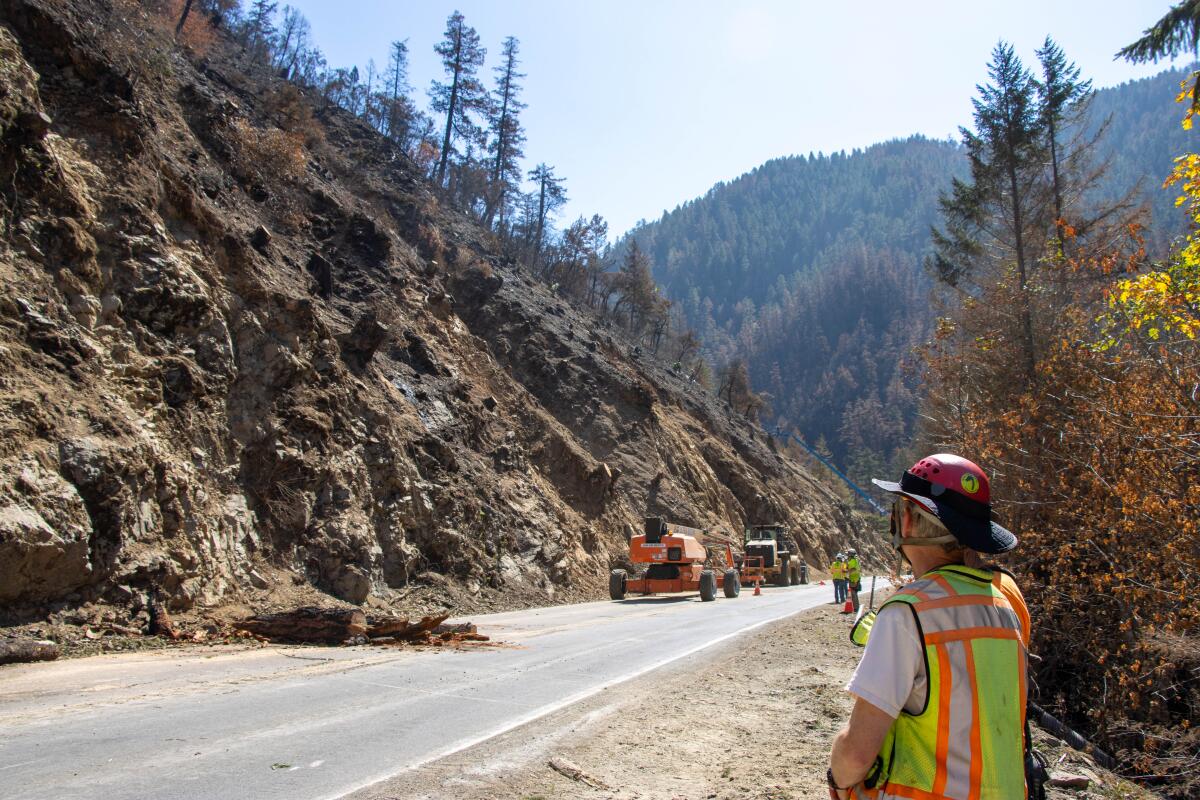
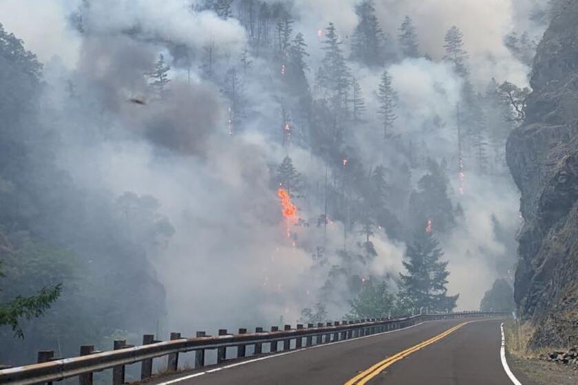
Del Norte and Humboldt counties can expect 1 to 4 inches of rain by Monday, with the greatest concern for rock slides and debris flows along parts of U.S. Route 199, White said. A long stretch of that highway near Gasquet has been repeatedly closed because of the still-burning Smith River Complex fires, which raged along the major thoroughfare for weeks. Transportation officials continue to work to restore the road, and are preparing for further issues from the rains.
Wildfires knocked out power to an entire California county. The unprecedented fight to bring it back
With power lines threatened for weeks by fires on the North Coast, officials formed what appears to be California’s largest and longest-running microgrid powered by generators.
Crescent City could receive more than 2 inches of rain by Monday, while Eureka and Capetown, both farther south in Humboldt County, could get a 1½ inches, according to forecasters. Some of the highest elevations in Del Norte County could get up to 4 inches, while some peaks in Humboldt could see up to 3 inches.
Forecasters are warning about the chance of flash flooding in burn scars, especially in southern Oregon, where several fires are still burning, and western Siskiyou County, where the fight against the Happy Camp fire continues. But as of Friday morning, no official flood warnings have been issued.
The atmospheric river system, which is pulling north narrow bands of moisture from the tropical Pacific, is expected to move south by late Sunday, bringing some rainfall across the Bay Area. The North Bay will see the highest amounts, but still, totals there aren’t expected to reach an inch, said Dalton Behringer, a meteorologist with the National Weather Service in Monterey.
“This looks mostly like a beneficial storm for Oregon and far Northern California,” UCLA climate scientist Daniel Swain said in a Thursday virtual discussion. “It may not fully extinguish these fires, a lot of the fires burning up there right now are burning in heavy, heavy timber, but it really will dramatically reduce fire activity.”
Along with the Smith River Complex fires burning mostly in Del Norte County’s Six Rivers National Forest and the Happy Camp fire burning in Klamath National Forest — which are about 80% and 60% contained, respectively — the SRF Lightning Complex continues to burn farther south into parts of Humboldt County, now beyond 30,000 acres and just 7% contained, according to federal officials. These major wildfires have raged for weeks, knocking out power, killing at least one person and damaging multiple structures.
Officials are hopeful the incoming rain will aid in firefighting and help clear the air, as long-range smoke from the blazes has moved as far south as the Bay Area and even into the Central Valley this week.
White said the system is also likely to bring gusty winds up to 50 mph in the highest terrain, which could damage or topple trees.
Southern California is not expected to feel any effects from the atmospheric river, though some parts of the region could see the possibility of light rain Friday from the remnants from Tropical Depression Kenneth — though nothing measurable, according to the National Weather Service’s Friday’s forecast discussion. Most of the Southland can expect a warm and dry weekend.
There is a 95% chance that El Niño will persist into next year, and a 71% chance that it will become a ‘strong’ El Niño, officials say.
More to Read
Sign up for Essential California
The most important California stories and recommendations in your inbox every morning.
You may occasionally receive promotional content from the Los Angeles Times.


