A major wet weather pattern is barreling toward California. But it’s not the dreaded ‘megaflood’
- Share via
The first in a wave of wet storms is expected to hit California this week and extend into the next, bringing significant rainfall that could cause some localized flooding as well as strong winds and heavy snow.
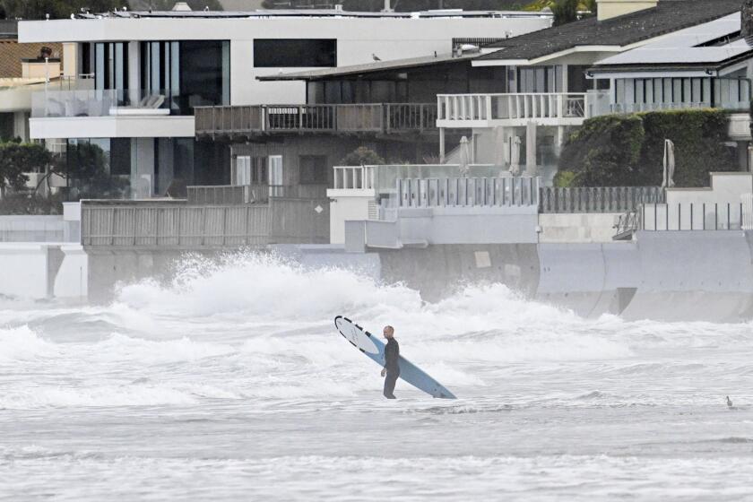
Just a week after areas of downtown San Diego were hit by dangerous flash flooding from a historic deluge of rain — inundating homes and highways — forecasters say the region should be prepared for similar conditions into Thursday.
“There’s definitely a chance for heavy rain as well as thunderstorms, and that means we do have a risk of flooding on Thursday,” said Brandt Maxwell, a National Weather Service meteorologist in San Diego. “It would be difficult to get a repeat performance of what happened last Monday, but we can’t rule it out.”
With the atmospheric river storm still a few days out from Southern California, Maxwell said it’s hard to pinpoint exactly where most of the rain will fall, or how fast. But it’s possible that some coastal regions in Orange and San Diego counties could get close to an inch of rain within an hour — well above amounts that can prompt flash flooding, he said. But such high rates are expected to be short-lived, with rain totals likely remaining under 2 inches Thursday for much of Southern California.
But the storm is forecast to first hit the Pacific Northwest, as early as Tuesday night, before moving south.
The National Weather Service has issued a flood watch beginning late Tuesday for much of Northern California, including most of the Bay Area and parts of the Sacramento Valley and Central Coast, with urban and small-stream flooding possible and a few rivers poised to crest or overflow. A high wind warning is also in effect across the region, with gusts up to 50 mph possible, which could topple trees and knock out power.
And the chances for significant snowfall has continued to grow, with the weather service issuing a winter storm watch across the Sierra Nevada. Two feet of new snow is possible above 5,000 feet and almost 30 inches at 7,000 feet, according to the weather service.
Two ‘thousand-year events’ pummeled San Diego and Ventura. Officials say El Niño, climate change and seasonal patterns make similar storms more likely.
When the system reaches Southern California, which is expected early Thursday, mountains above 6,000 feet could get up to a foot of snow.
Moderate rainfall is forecast across Central California and Los Angeles County, but no significant flooding is expected for the region during this first storm, said Lisa Phillips, a National Weather Service meteorologist in Oxnard.
“We’ll maybe see some flooding on roads, minor creek flooding,” Phillips said, “but [we’re] not expecting a flood watch.”
In San Diego and Orange counties, flood advisories are likely to be issued if the storm proceeds as projected, Maxwell said.
And though forecasters warn that this week’s is likely the first in a possible string of heavy storms, which can exacerbate already saturated grounds, there have been no substantiated projections for any kind of statewide “megaflood” — as has been rumored in some corners of the internet.
“There is not currently any indication whatsoever of an extremely severe, statewide, catastrophic flood event, resulting from a multi-week sequence of storms,” Daniel Swain, a UCLA climate scientist, said in a Friday webinar. Scientists have developed a model dubbed the “ARkStorm Scenario” to explore the potential consequences of a once-in-a thousand-years megastorm event that would cause flooding as devastating as the Great Flood of 1862, which reconfigured much of California’s landscape.
Despite worsening drought conditions, global warming has already doubled the odds that California will experience a catastrophic ‘megaflood.’
Researchers in 2022 found that because of the worsening effects of climate change, such a massive storm is more likely to happen and to be more intense, with a 2% chance of occurring in any given year, as opposed to a 1% likelihood pre-global warming.
“It is a real thing, but it is not something that is headed for California imminently,” Swain said. “The odds of it happening this year remain very low, and the odds of it happening in the next two weeks are close to zero.”
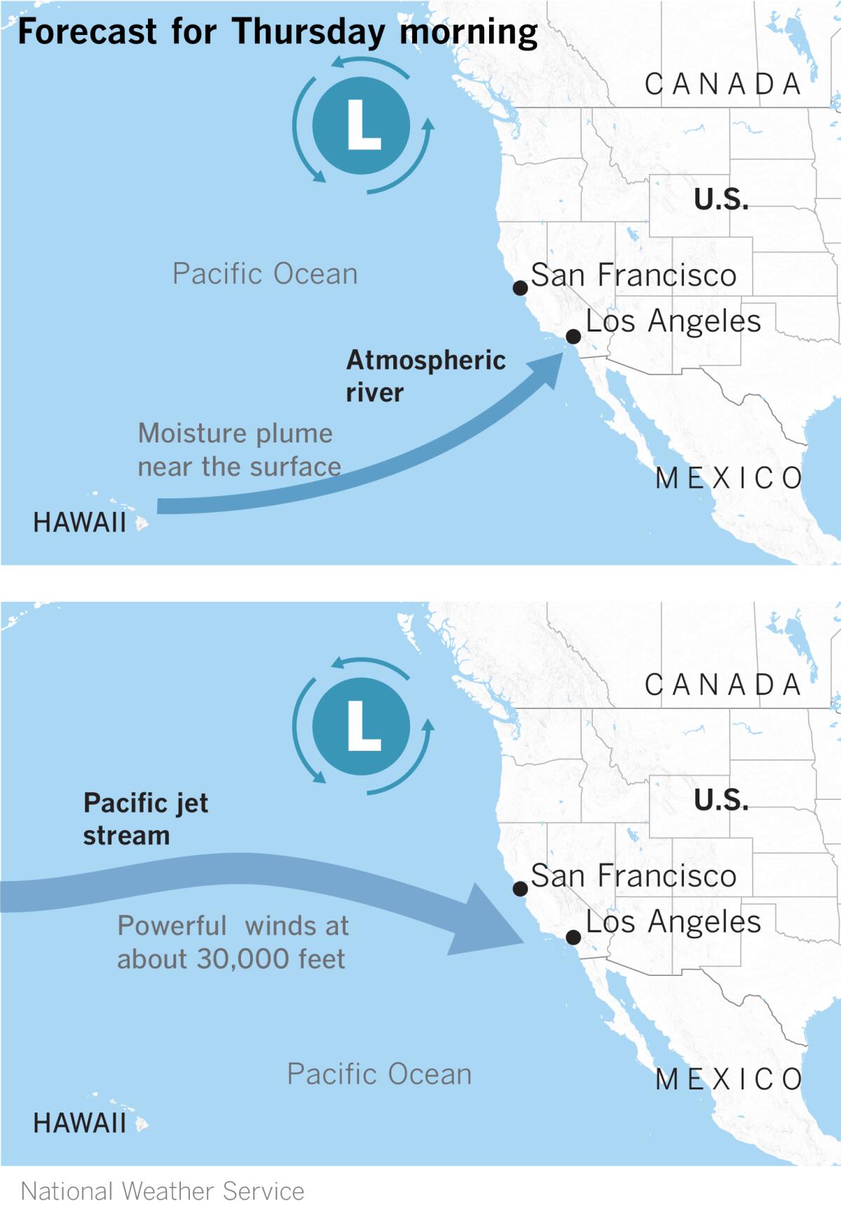
Even still, this week’s storm, possibly the first of many, is what Swain called a “potentially high-impact storm pattern.” The system falls in line with the typical El Niño pattern, fueled by a warm atmospheric river moving along a strong Pacific jet stream, Swain said.
A weaker yet still wet system is forecast to bring colder temperatures to Southern California on Friday, with some showers likely and even lower snow levels, Phillips said. And then another major storm will be moving in by Monday.
“On the heels of the first storm … [the one next week] may even increase the threat for impacts,” said Robbie Munroe, a meteorologist with the National Weather Service in Oxnard. He said the latest models Monday afternoon showed increased chances for significant flooding from that storm.
“Early next week, we could get a pretty substantial storm system. Right now it looks slower-moving, so the rain could last longer,” Maxwell said. “It could be quite a wet February, at least a wet start.”
More to Read
Sign up for Essential California
The most important California stories and recommendations in your inbox every morning.
You may occasionally receive promotional content from the Los Angeles Times.
