Some rain, snow still on tap for SoCal, but worst of deadly winter storm has passed
- Share via
After days of historic rainfall from a deadly atmospheric river storm, forecasters say some dry weather is finally on the horizon for Southern California — but not until after a smaller system brings some additional rain and snow to the region.
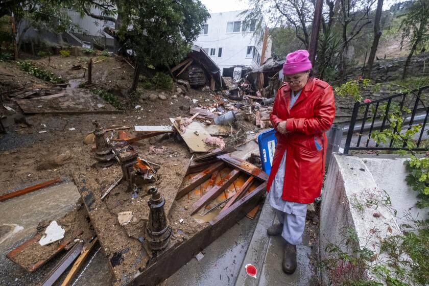
A new low-pressure system is moving into the area Wednesday, bringing a cold front and further precipitation — though nothing as severe as the major system that dumped more than a foot of rain in some parts of Los Angeles County since Sunday, causing mudslides, flooding, widespread power outages and forced evacuations.
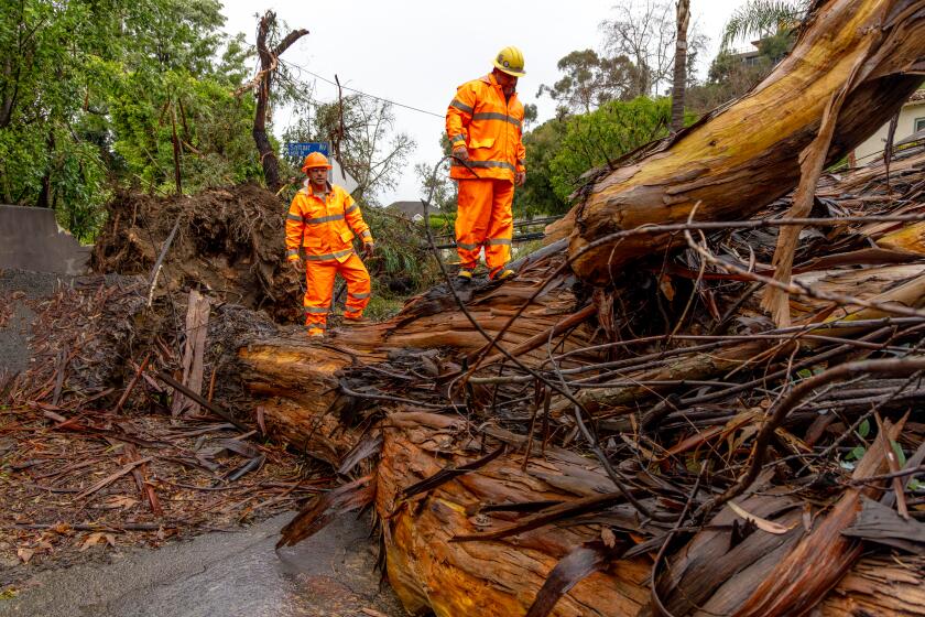
The statewide death toll from the storm has climbed to nine, including four people hit by trees in Northern California and three motorists who died after crashes in Central and Southern California, according to state officials.
The city of Los Angeles is still working its way through the damage caused by the storm, with 562 mudslides and 15 homes red-tagged as of Wednesday evening, according to the mayor’s office. The rains left portions of Mulholland Drive slipping down the mountain in the Hollywood Hills, according to officials.
In the Los Angeles area, the next storm could bring another half-inch of rain Wednesday night to the metro area and up to an inch in the foothills and mountains, said Mike Wofford, a National Weather Service meteorologist in Oxnard.
“A storm like this — if we hadn’t had so much rain before — wouldn’t be a big deal,” Wofford said. But with the ground still saturated and many hillsides still precarious from debris flows and muslides, “there could be some additional issues because of that.”
Most of the area should be able to handle the additional precipitation, he said, but noted that residents in neighborhoods that already saw slides, especially in the Santa Monica mountains, should remain cautious. Rainfall totals topped 13 inches in some locations there and in the San Gabriel mountains, including Bel-Air, Topanga and Cogswell Dam north of Monrovia.
On Wednesday evening, the National Weather Service issued a severe thunderstorm warning and a flash flood warning for a large swath of western Los Angeles County and eastern Ventura County, including Malibu, Beverly Hills, the Hollywood Hills, the San Fernando Valley, Thousand Oaks, Simi Valley and Santa Clarita.
The weather service also noted reports of a possible tornado in Pismo and Grover Beach on the Central Coast and issued a waterspout warning for the Channel Islands.
Evacuation warnings are still in effect near several burn scars in the northern San Gabriel Mountains and in parts of Culver City.
As Californians face non-stop rain from an atmospheric river this week see how rainfall totals in your area compares to other regions and previous years.
Regions farther south and east of Los Angeles County could get some heavier rainfall from this next storm, which is forecast to hit San Diego and the San Bernardino Mountains slightly later Wednesday and linger through Friday.
“We do have some precipitation coming through until Friday, but hopefully by Saturday we dry out a little bit,” said John Suk, a meteorologist for the National Weather Service in San Diego. “I think this weekend’s going to be the first real break that we’re seeing.”
A flood watch remains in effect through Wednesday night across much of southwestern California, including Orange, San Bernardino and San Diego counties, with up to an inch or two of additional rain expected.
“This additional rain falling onto saturated soil will increase the flood potential,” the alert said.
The San Diego River at Fashion Valley mall and the Santa Ana River downstream from the Prado Reservoir in Chino and west Corona had more heightened flood advisories in place Wednesday, warning of minor flooding, especially in low-lying areas.
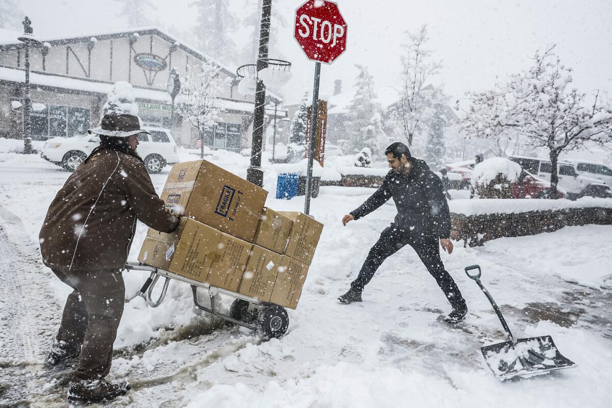
The next, chillier storm is expected to be more snow-focused, with up to 2 feet of snow falling Wednesday through Thursday across the Sierra and in the Southern California mountains.
Chilling rain, swirling gray clouds and blustery winds rolled into Southern California on Sunday as what was anticipated as the strongest storm of the season promised near-record rainfall and flash flooding through Tuesday.
A winter storm warning remains in effect through Thursday morning for the Los Angeles, Riverside, San Bernardino and San Diego mountains, with elevations as low as 4,000 feet expected to get up to 6 inches of snow.
“This is a colder storm,” Wofford said, “so the snow levels are lower.”
As of late Tuesday, Mountain High had already received 30 inches of snow from the last storm; Mt. Baldy had 2 feet, Snow Valley was at 18 inches and Wrightwood at 10 inches, Suk said. Mountain High, one of the highest peaks, had gotten 51 inches as of Wednesday morning, Wofford said, and accumulation had been recorded as low as 4,500 feet.
Wofford said there could be some issues for travelers on the Grapevine on Thursday and Friday.
Times staff writers Noah Goldberg and Rong-Gong Lin II contributed to this report.
More to Read
Sign up for Essential California
The most important California stories and recommendations in your inbox every morning.
You may occasionally receive promotional content from the Los Angeles Times.
