- Share via
For decades, a costly problem has been worsening beneath California’s San Joaquin Valley: the land has been sinking, driven by the chronic overpumping of groundwater.
As agricultural wells have drained water from aquifers, underground clay layers have compacted and the ground surface has been sinking as much as 1 foot per year in some areas.
New research now shows that large portions of the San Joaquin Valley have sunk at a record pace since 2006.
“Never before has it been so rapid for such a long period of time,” said Matthew Lees, the study’s lead author.
New research shows global warming has become the dominant driver of worsening drought in the western United States.
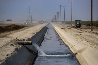
The study by Stanford University researchers is the first to quantify the full extent of land subsidence in the San Joaquin Valley, one of the world’s major farming regions, during the last two decades. The collapsing ground has damaged canals, wells and other infrastructure, requiring repairs that in some areas are now in the hundreds of millions of dollars.
Under California’s groundwater law, local agencies are tasked with combating the problem as they work toward plans to limit pumping and address overdraft by 2040.
Measurements from satellites have tracked changes in the ground surface during much of the last two decades, but there is a gap in the data from 2011 to 2015. The researchers used data from GPS stations to document the declines in the land during those years, which enabled them to detail subsidence for the entire period from 2006 to 2022.
Much of the sinking has occurred in two large swaths of the valley, one around the community of El Nido and the other around the city of Corcoran. The research found that the declines averaged nearly an inch per year if spread across the entire San Joaquin Valley.
“With these findings, we can look at the big picture of mitigating this record-breaking subsidence,” said Rosemary Knight, the study’s senior author and a professor of geophysics at Stanford’s Doerr School of Sustainability.
The study, published in Nature Communications Earth & Environment, also presents ideas about how the sinking could be slowed or stopped through strategic recharging of aquifers.
The findings underline California’s continuing struggle with a phenomenon that has been altering the landscape since the early 1900s, when wells and pumps began to proliferate in the valley.
In a famous 1977 photo, Joseph Poland, a U.S. Geological Survey scientist, stood next to a telephone pole with signs reading 1925, 1955 and 1977, marking how the ground level had fallen nearly 30 feet in the area near Mendota.
In a 1999 report, USGS researchers described the land subsidence in the San Joaquin Valley as “the single largest human alteration of the Earth’s surface topography.”
The rates of decline slowed in the 1970s and ‘80s as newly built aqueducts brought river water to farmlands, and the sinking remained less pronounced into the early 2000s. That changed during the 2007-09 drought, which was followed by extreme droughts from 2012 to 2016 and from 2020 to 2022 — droughts that research shows have been significantly worsened by global warming.
Knight and Lees said the decrease in water deliveries from canals during the droughts, combined with the prioritization of water for environmental purposes and changes in agriculture, have contributed to the sinking over the last two decades.
They compared the total volume of valleywide subsidence since 2006 with measurements from 1944 to 1968 — a portion of the half-century illustrated in Poland’s photo — and found the post-2006 period has brought the same amount of sinking, but over a shorter time.
“History has repeated itself,” Lees said. “We did it again, and we got there faster.”
Lees, a research associate at the University of Manchester in the United Kingdom, worked on the study when he was a geophysics doctoral student at Stanford.
The researchers said in addition to damaging aqueducts and other infrastructure, sinking land threatens to affect the route of the state’s high-speed rail, and also worsens floods hazards as the topography shifts.
The problem is driven by groundwater overdraft, which occurs when the amount of water pumped out exceeds the amount of recharge. When clay layers in aquifers are drained and collapse, the loss of water-storing space is largely irreversible.
According to the researchers, overdraft of the valley’s deep aquifers is causing much of the subsidence. These aquifers lie hundreds of feet underground, below shallow aquifers and clay layers, and they contain clay layers that are especially susceptible to compaction when water is extracted.
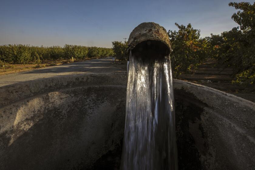
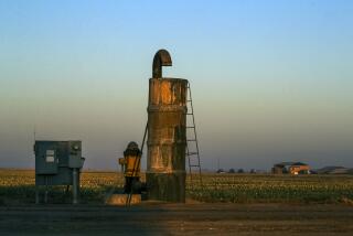
Many wells have been drilled 1,000 feet deep or more to supply farms, and these wells are drawing water from aquifers where much of the subsidence is occurring.

To slow or halt the sinking, the researchers say, it’s important to address the overdraft in the deep aquifers where clay layers are compressing. They say this could be done by reducing pumping from the aquifers or by recharging them using either natural pathways or wells that would allow for injecting water underground.
“We need to stop the overdraft of compacting aquifers,” Knight and Lees wrote, suggesting that efforts be strategically “targeted to the deeper parts of the aquifer system.”
Directing water to the right places to replenish these deeper spaces requires detailed information about the valley’s geologic features, including natural pathways where water can quickly travel through permeable sand, gravel and cobbles to reach aquifers. In parts of the valley, these channels can take in flows near the base of the Sierra Nevada, miles from where the land is subsiding, and funnel water to where it will help slow the sinking.
California recently mapped large portions of the valley’s aquifers to reveal their webs of hydraulic connections. Using a helicopter equipped with a ground-penetrating electromagnetic imaging system, scientists have scanned up to 1,000 feet underground to map optimal areas for recharging aquifers — including channels left by ancient rivers that lie hidden beneath alluvial fans in the valley.
Ten years ago, California adopted a law to curb chronic overpumping of groundwater. Significant challenges remain, even as the state works toward its goals.
“If we’re going to continue pumping from the lower aquifer, we need to recharge in such a way that that recharge water reaches the lower aquifer,” Knight said. “You need to stop the overdraft in the part of the aquifer that’s causing the subsidence, and that’s the deeper part.”
As part of California’s efforts to curb declines in groundwater levels, one partial solution that has been promoted by Gov. Gavin Newsom’s administration and local water agencies is managed aquifer recharge — projects to replenish groundwater that involve a range of methods, such as building infrastructure to capture runoff during wet periods and shunt water to basins where it percolates into the ground.
Other methods include drilling injection wells that deliver water to aquifers or intentionally releasing floodwater on agricultural lands in areas where it can seep rapidly underground.
The scientists analyzed how much water would be needed to recharge portions of aquifers that are driving the subsidence problems, and calculated it would be about 680,000 acre-feet per year on average, an amount comparable to state estimates of how much water is available for groundwater replenishment in an average year.
From a practical standpoint, Lees said, it’s not feasible to dedicate all the water to addressing land subsidence.
“There are a lot of other very important priorities, and there are logistical difficulties in getting that water into the compacting parts of the aquifer system,” he said. “We have to be strategic with what we do with this recharge. Where subsidence is causing the most harm, we’ve got to try and get it to those compacting aquifers.”

Targeting places where subsidence is causing costly problems, Knight said, will mean focusing on areas, for example, where collapsing ground is going to damage an aqueduct or wells that communities rely on for drinking water, or where shifting ground is worsening flood risks.
“The study has made me optimistic,” Knight said. “I think it could be addressed if you strategically target the areas where you want to stop subsidence.”
The findings add to a growing body of research being used by local water officials as they develop state-mandated plans for managing groundwater.
Under California’s Sustainable Groundwater Management Act, adopted a decade ago, land subsidence is one of several undesirable effects that local agencies must take steps to avoid, along with “significant and unreasonable” lowering of groundwater levels and degraded water quality, among others.
Another goal is preventing more household wells from drying up as water levels decline. According to state data, more than 5,000 wells have run dry in the last decade, and scientists warn that thousands more could be at risk unless stronger measures are put in place.
California has placed the Tule groundwater subbasin on probationary status, a step that brings additional state oversight, new fees and reporting requirements.
The latest study helps inform California’s efforts to address subsidence and underscores the importance of considering the different effects pumping has in shallow aquifers and deep aquifers, said Graham Fogg, a hydrogeology emeritus professor at UC Davis who wasn’t involved in the research.
More recharge of deep aquifers is needed and can be done effectively, Fogg said, but will have to be done in concert with reduced pumping.
“Recharge will help solve a lot of it, probably not more than half of the problem,” Fogg said. “The other half is going to have to be pumping reductions, and that’s the painful part.”
Researchers have projected that large portions of the Central Valley’s irrigated cropland will need to be permanently left dry to comply with the restrictions. Experts with the Public Policy Institute of California have estimated that by 2040, the necessary pumping cutbacks could mean fallowing more than 900,000 acres of farmland.
On the positive side, valuable data to guide recharge efforts have emerged in recent years, including detailed information on the natural architecture of the aquifer system, Fogg said.
During the last two decades, the record-breaking pace of subsidence has coincided with the drilling of thousands of new agricultural wells, and as parts of California have had some of the fastest-declining groundwater levels in the world.
The water has been used to irrigate a wide variety of crops, including nuts, fruits, tomatoes, cotton and cattle-feed crops to supply dairies and feedlots. Growers have also planted vast orchards of almonds and pistachios.
Fogg said the latest research is sobering because it shows that California is still grappling with significant undesirable effects of subsidence.
“At this point, there should be no excuse for this kind of subsidence to occur in the next 10 years,” Fogg said.


