The ‘nightmare’ California flood more dangerous than a huge earthquake
California’s drought-to-deluge cycle can mask the dangers Mother Nature can have in store.
During one of the driest March-through-February time periods ever recorded in Southern California, an intense storm dumped so much rain on Montecito in January that mudflows slammed into entire rows of homes. Hundreds of homes were damaged or destroyed, and at least 21 people died.
It was a grim reminder that in a place so dry, sudden flooding can bring disaster.
Eighty years ago this month, epic storms over just six days caused widespread destruction across Southern California.
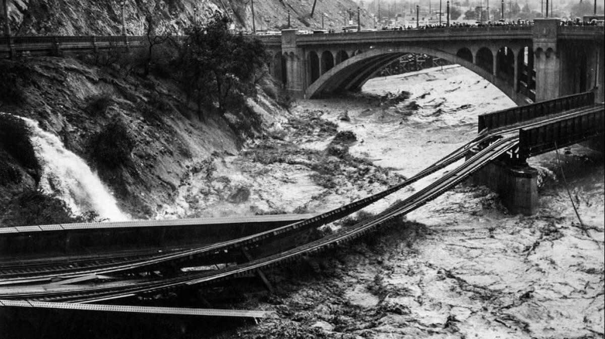
Rain fell as fast as 2 inches for a one-hour period. Wide swaths of the San Fernando Valley were inundated; floodwaters in the Los Angeles River mowed down bridges and pulled apart railroads.
Government officials responded with a major flood control campaign, building dams and deepening rivers and lining them with concrete to flush water out to sea before floodwaters could rise.
But even those protections have limits. And history shows there is precedent for even more devastation.
Several weeks of monumental storms would be all it would take to overwhelm California’s flood control system and cause widespread flooding and destruction.
Nightmare scenario
Overwhelming California’s flood system
Take the heavy rains from the winter of 2016-17 — which poured over a period of 80 days — and compress them down to fall in 23 days: California would experience a flood event so grave it would overwhelm our flood-control systems, force 1.5 million people to evacuate, and cause economic damage that could total $725 billion.
“Really, a major flood like this would dwarf a 7.8 earthquake in Southern California” in terms of the financial toll, said Dale Cox, project manager for the U.S. Geological Survey’s Science Application for Risk Reduction. (A magnitude 7.8 earthquake is expected to cause $213 billion in economic damage.)
“The storm is estimated to produce precipitation that in many places exceeds levels only experienced on average once every 500 to 1,000 years,” the report said.
And as the situation from Hurricane Harvey in Houston shows, once-in-a-1,000-year storms can happen.
“Such an event could occur in any future winter,” the USGS said of a modern-day scenario similar to the historic 1861-62 floods that transformed much of the Central Valley and Los Angeles Basin into an inland sea.
The scenario was dubbed ARkStorm — named for Atmospheric River 1,000 Storm — and published in 2011 after input from more than 100 experts from public and private sectors. The scenario envisions a pounding of California by a series of “atmospheric rivers” — long plumes of water vapor that can pour over the West Coast and hold as much as 15 times the liquid water flowing out of the Mississippi River’s mouth.
Great flood of 1862
Plunging much of California under water
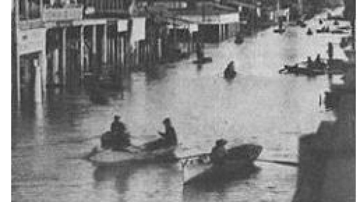
The Great Flood of 1862 occurred in a series of storms that lasted just 45 days, and plunged most of the Central Valley and Los Angeles Basin underwater.
Modern-day flood-control systems built in the 20th century have recently spared California from the kind of catastrophic flooding seen in the early days of statehood.
For instance, officials launched an ambitious project to protect California’s capital, which was built where the American and Sacramento rivers met and struggled for decades with flooding since its founding. One of the solutions was to set aside a massive area of farmland that transforms into an inland lake during the wettest years, designed as a relief valve to spare Sacramento from floodwaters.
But there is always the possibility that just the right set of circumstances meet to cause a rare but devastatingly powerful series of storms to head to California.
“It’s inevitable that all of our flood-control systems, at one point, will be overwhelmed — because we only design for so much,” said Keith Porter, a University of Colorado Boulder research professor and coauthor of the scenario.
Officials in state and local agencies agree that the USGS extreme flood scenario is one that could strike California.
“Yes, the ARkStorm is definitely a realistic scenario,” said Michael Mierzwa, lead flood management planner for the California Department of Water Resources.
Mark Pestrella, chief of the Los Angeles County Flood Control District, agreed. “It’s plausible,” he said. “Many things would have to come together for that to happen.”
On the worst-case scenario
Envisioning a realistic doomsday option
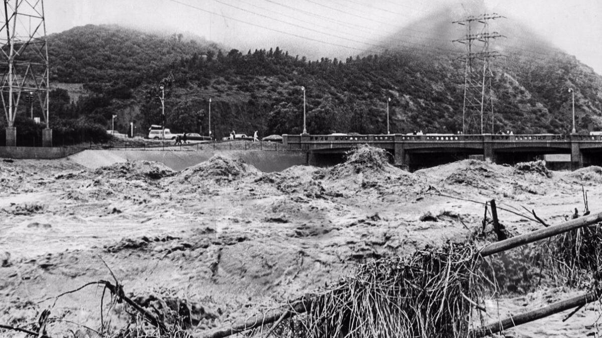
The ARkStorm is modeled on merging two recent extreme California storms that could bring the kind of rainfall that struck in 1861-62. It combines the great Southern California storm of Jan. 19-27, 1969, back-to-back with the Northern California storm of Feb. 8-20, 1986, and what would happen if the first of those storms stalled over a 24-hour period.
“While history will not repeat itself in exactly this way,” a summary of the ARkStorm scenario said, “a story resembling [an uninterrupted sequence] of these two events in terms of duration, windspeeds and precipitation is entirely realistic.”
“Putting those two storms together was enough to exceed the flood capacity of most of the state,” said scientist Lucy Jones, who coauthored the flood scenario report for the U.S. Geological Survey.
The 1861-62 flood was a seminal moment in California history. That flood was said to have forced the state’s eighth governor, Leland Stanford, to row through floodwaters to his inauguration, and then back home to climb in through the second story.
Floodwaters covered a region of the Central Valley 250 to 300 miles long and about 20 to 60 miles wide, according to an account by geologist William Brewer and reviewed by Jones for her book to be published in April, “The Big Ones: How Natural Disasters Have Shaped Us and What We Can Do About Them.”
In her book, Jones called the flood of 1861-62 “the most devastating event in California history” — superseding even the great 1906 San Francisco earthquake.
One-third of California’s taxable land was destroyed, Jones wrote, and the state went bankrupt — the Legislature wasn’t paid for 18 months. Entire industries were destroyed: mining equipment was swept from the mountains and many miners died, a factor in the end of the Gold Rush, Jones wrote; the ranching industry shrank as hundreds of thousands of heads of cattle, sheep and lambs drowned, and California progressed from a ranching economy to one focused on farming.
“Just trying to describe the extent of the damage is overwhelming,” Jones wrote. “Yet, 150 years later, most Californians are unaware that it ever happened.”
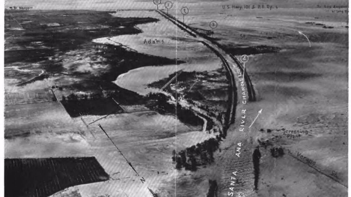
In Anaheim, Santa Ana River swelled to become four miles wide, “creating an inland sea 4 feet deep that lasted for a month,” Jones said. The overflowing river wiped out the town of Agua Mansa near where Fontana is now — destroying what was once the largest settlement between L.A. and New Mexico.
“In Los Angeles, the water was described as extending from mountain to mountain, with no dry land between the Palos Verdes peninsula and the San Gabriel Mountains,” Jones said. A rain gauge near where Marina del Rey is today recorded 66 inches of rain falling in just 45 days, Jones said. That’s more than quadruple the average rainfall downtown L.A. sees in an entire year.
But those storms probably weren’t even the worst California has ever faced. Geologic data points to six mega-storms striking California in the last 1,800 years that were even worse than the 1861-62 storms, based on geologic data collected in the San Francisco Bay and Santa Barbara areas, the report said. And climate change could make such storms more likely in the future — “as the oceans heat up, that means more fuel for an ARkStorm.”
“California flood protection is not designed for an ARkStorm-like event,” the report said. “Levees are not intended to prevent all flooding, such as the 500-year streamflows that are deemed realistic throughout much of the state in ARkStorm."
The ARkStorm could cause a flood 300 miles long and 20 or more miles wide in the Central Valley, forcing 1.5 million people to flee their homes. Sobering maps in the USGS report show much of Sacramento and Stockton underwater, which are both located next to California’s largest rivers, the Sacramento and San Joaquin.
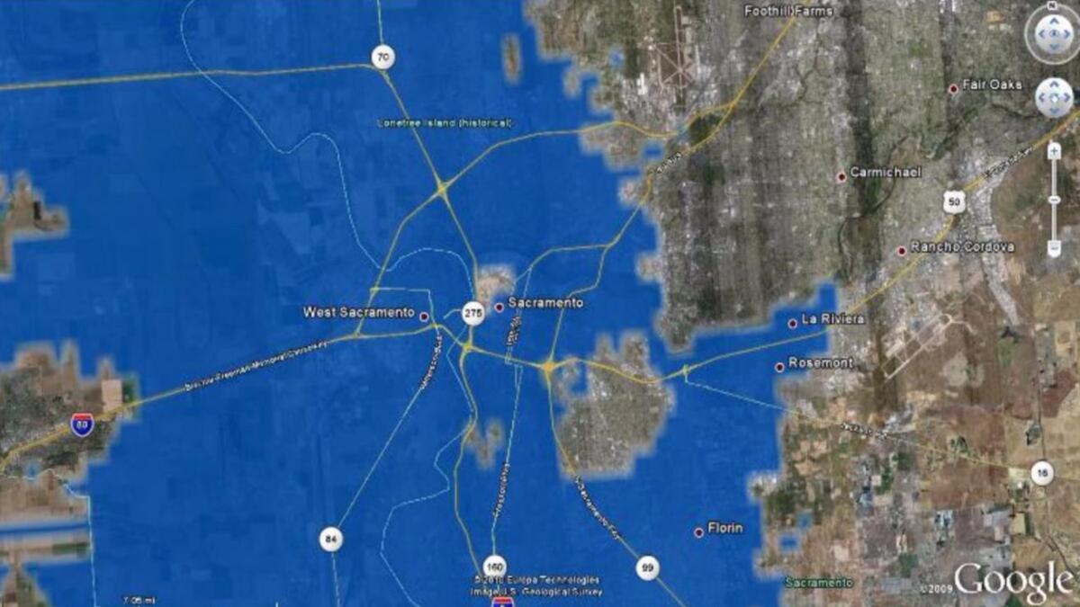
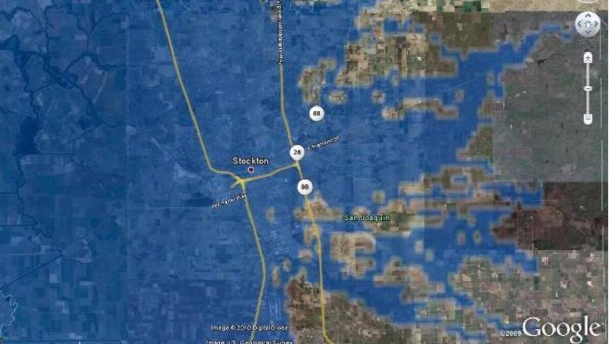
The scenario forecasts 50 breaches of the levees as being realistic. The scenario said officials’ goals for the levees were to keep them intact long enough to assure safe evacuation — not to protect property.
L.A. probably would not suffer as widespread inundation as it did in the 1861-62 flood, Cox said. “But there would be quite a bit of flooding,” he said.
According to the report, the lower reaches of the Los Angeles and San Gabriel rivers could spill their banks, turning sections of Long Beach, Carson, Lakewood, Compton, Downey and West Covina into flood zones. Coastal flooding could inundate areas such as Belmont Shore, Naples and Seal Beach and the ports of Los Angeles and Long Beach.
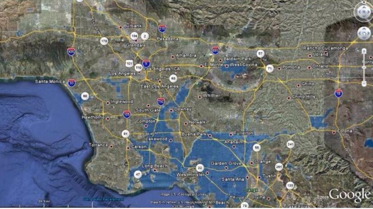
Northern Orange County could turn into a sea, with floodwaters covering Fullerton, Anaheim, Garden Grove, Santa Ana and Westminster all the way to the beach.
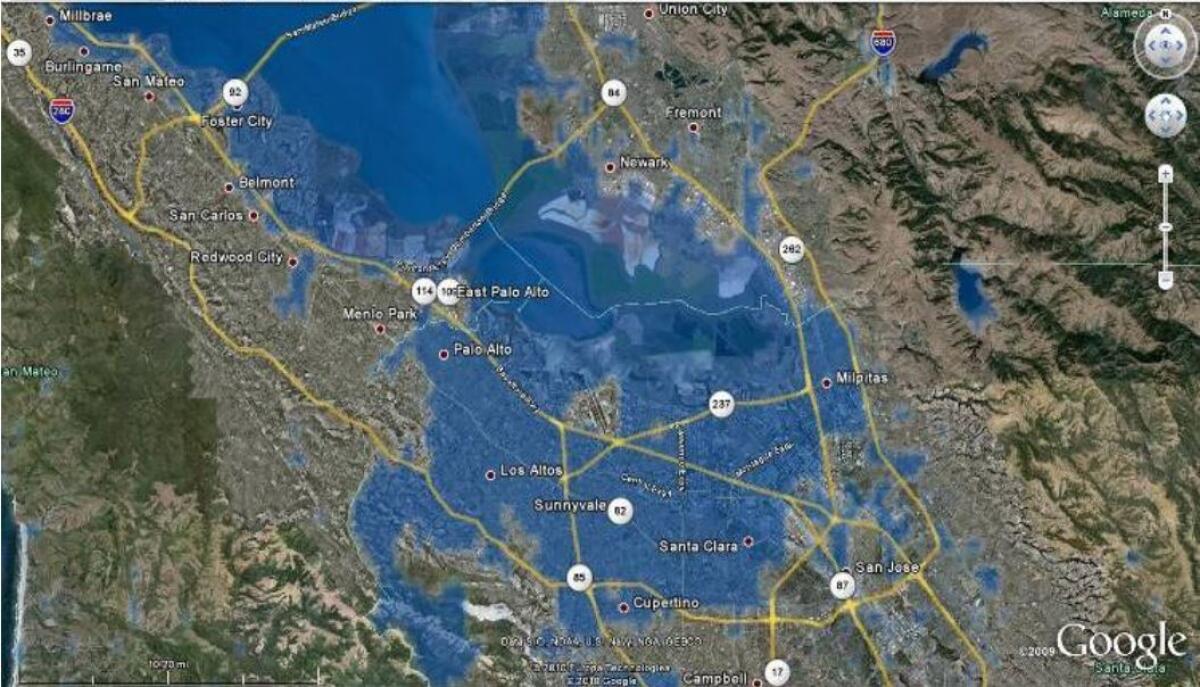
Silicon Valley could be hit hard. Wide swaths of Santa Clara County, such as Santa Clara, Mountain View, Cupertino, San Jose and Palo Alto, could be flooded. So could areas of San Mateo and Alameda counties, including Menlo Park, Foster City, San Mateo, Burlingame, Fremont and Newark.
Floods could also hit San Diego County.
All California counties could see some degree of flooding. Wastewater treatment plants could be damaged by floods, and sediment could get into pumps as they tend to be in low-lying areas. Untreated sewage could flood into and contaminate wells.
Hurricane-force winds of up to 125 mph could strike the mountains. The flooding would disproportionately impact cities, Porter said. “We estimated that 1 in 4 California buildings is touched by flooding,” he said.
A big problem is how much of California is under-insured for economic losses from a rare flood event. Experts estimated that just 6% to 10% of the economic damages would be insured.
Solutions
More things that can be done to handle flood risk
Mierzwa, of the California Department of Water Resources, said more could be done to handle California’s flood risk. State and local agencies spend $30 million a year to maintain 1,600 miles of levees in the Central Valley; they should be spending $130 million annually to meet current federal standards.
“It’s like never paying to maintain your car,” Mierzwa said. “So we’re living with greater risk there.” Also, he said, aging levees and reservoirs need to be replaced.
There are plans to make more room for rivers and create a new flood bypass — a dedicated zone of farmland that would protect Stockton when the San Joaquin River reaches its flood stage. Once built, the state can flood that land in the wettest of years, keeping water away from homes as it winds its way to San Francisco Bay.
In Los Angeles County, flood-control officials say an urgent priority is emptying the flood-control reservoirs of mud and debris that protect the urban communities from floodwaters and fast-moving debris pouring from the San Gabriel Mountains.
The reservoirs are so full of debris that they pose an increased flood risk to the communities below them. The most urgent need is to remove dirt and debris behind Devil’s Gate Dam in Pasadena, which officials have been warning about since at least 2011; under one possible scenario, torrential rains could send mud, rocks and water over the dam and flood the Rose Bowl, the 110 Freeway, Pasadena, South Pasadena and northeast Los Angeles.
Large-scale removal of the debris has not commenced, which could take three to five years to complete the cleanout. Some environmentalists have opposed the county’s plan, saying less sediment should be removed, given the area is now home to trees and wildlife.
Two others that also need urgent debris removal are the flood-control reservoirs behind Big Tujunga Dam, which protects Tujunga, and Pacoima Dam, which protects Olive View-UCLA Medical Center, Sun Valley and Sunland. All three dams protect 2 million to 3 million people from flooding.
Sign up for Essential California
The most important California stories and recommendations in your inbox every morning.
You may occasionally receive promotional content from the Los Angeles Times.


