Opinion: Hurricane Otis is a deadly warning of what warming oceans do to storms
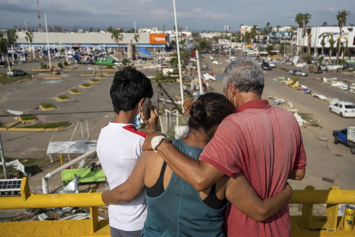
Hurricane Otis — which killed at least 48 people after hitting Mexico’s southern coast in October — adds to a destructive hurricane season that battered the Atlantic and the Eastern Pacific basins. The Atlantic has had a particularly busy year. It’s seen the likes of not only Idalia and Lee but also 17 other named storms thus far, bringing the total well above the average of 14 named storms in the season, which typically lasts from June through November.
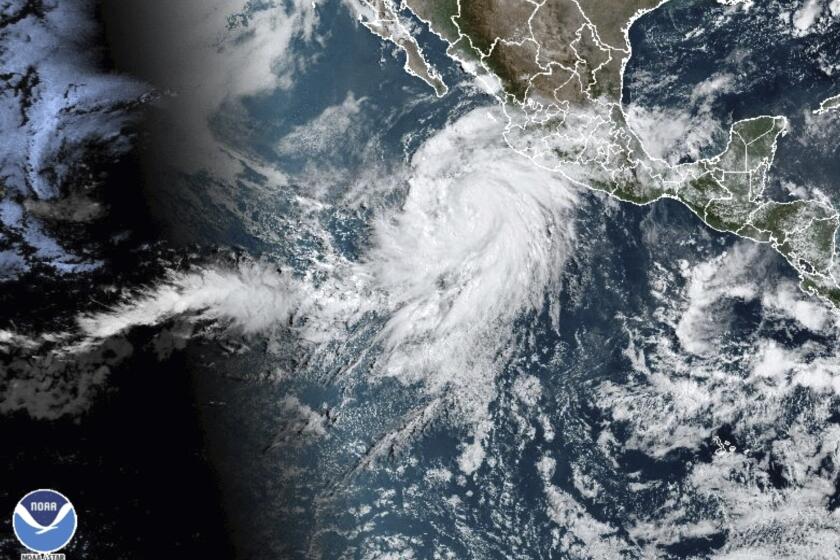
Four of the year’s biggest storms hit a wide variety of locations: Hilary made landfall in the Baja peninsula before traversing California and Nevada; Otis landed in Acapulco; Idalia affected the U.S. Southeast; and Lee reached New England and Canada. Runoff from Hilary temporarily formed a salt lake in Death Valley, and winds from Idalia brought flamingos as far north as Ohio and Pennsylvania. But all these storms also had one glaring similarity — they strengthened unusually quickly as they traveled over exceptionally warm waters.
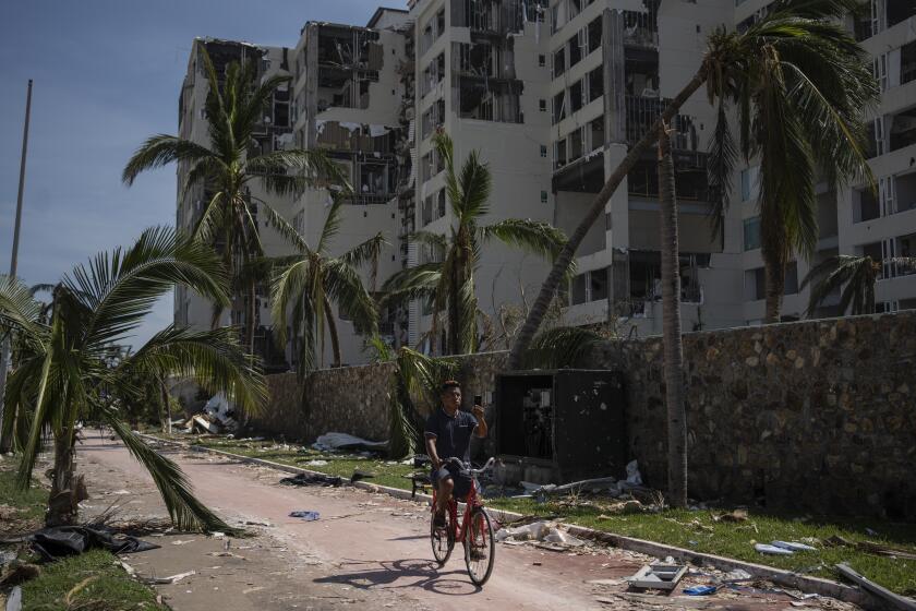
Satellite images show widespread damage to neighborhoods, hotels and marinas after last week’s devastating hurricane hit Acapulco, Mexico.
Hurricanes require certain conditions to form and thrive. One of the most important conditions is warm ocean waters, which are a critical source of fuel for strengthening hurricanes. They allow warm, moist air to rise rapidly through the atmosphere, where that energy translates into violent thunderstorm activity. Hurricanes need water temperatures of at least 78.8 degrees Farenheit; the ocean waters Hilary, Idalia, Lee and Otis traveled over as they strengthened fastest were much warmer — about 86 degrees Fahrenheit.
As humans have warmed the planet by burning fossil fuels, we have made it more likely for those extra-warm ocean waters to occur: About 90% of the excess heating from human activity has gone into our oceans. The rate at which our oceans warm has also accelerated — on average, ocean surface temperatures increased by about 1.6 degrees Fahrenheit in 2011-20 compared with 1850-1900. About two-thirds of that warming happened in just the last four decades.
Warm ocean waters are like caffeine for a storm: When temperatures are extra toasty, it’s like adding an extra shot of caffeine to your morning espresso. So with ocean surface temperatures becoming warmer, it stands to reason that hurricanes strengthen more quickly.
For at least the last 165 years, three conditions have kept California hurricane-free, experts say. So what’s changed to make Hurricane Hilary possible?
In a paper published last month, my research shows that over the last 50 years, this is exactly what we see in the Atlantic. The fastest rates at which Atlantic hurricanes strengthen — such as Hurricane Lee’s peak winds increasing by more than 90 mph in just 24 hours — rose significantly in the modern era of 2001-20 compared with the earlier era of 1971-90. On average, the fastest pace at which Atlantic hurricanes strengthen has increased by more than 25% in the modern era compared with the historical era. It has also become about as likely for a hurricane to intensify by at least 57 mph within just 24 hours as it would have been for a historical hurricane to intensify by this much in 36 hours.
I also found that the probability of modern Atlantic hurricanes intensifying from a minor storm (Category 1 or weaker) into a potentially destructive major hurricane (Category 3 or stronger) in 24 hours has more than doubled compared with the same historical era. The chance of a storm making this kind of jump in a mere 12 hours is more than three times as likely. Statistics show that it would have been impossible for these changes to occur if environmental conditions had not changed from historical times.
Although my research focused on the Atlantic, it’s not unreasonable to expect similar changes elsewhere. In fact, these findings turned out to be tragically prophetic when, six days after their publication, Hurricane Otis shocked almost everyone by intensifying from a tropical storm into a Category 5 hurricane in just over 12 hours before making landfall in Acapulco.
Reducing carbon emissions is not enough. The other challenge is to minimize harm from the fires and floods that can no longer be prevented.
The hurricanes that strengthened so dramatically along the Atlantic and Eastern Pacific coastlines this year, combined with evidence that this kind of strengthening has become more common, should serve as a vital warning.
We are already seeing storms intensify at accelerated rates looking at the data and at events like Lee and Otis, which nearly broke records with the speeds at which they strengthened. As we saw all too well with Otis, hurricanes that intensify this quickly are often difficult to forecast and plan for. Sudden changes may require different protective measures, such as evacuation of certain neighborhoods. That means we already have to start improving preparation and planning in coastal communities that are at risk.
We also know that the rate at which hurricanes strengthen has already increased in just the last 50 years — over a period of substantial increases in ocean temperatures because of human-caused warming. Without major changes to our behavior, including a rapid transition away from fossil fuels, this trend is likely to continue, or even worsen, in the future.
When it comes to a warming planet, we know that we are the cause — which means we can also be the solution. It is up to us to ensure a sustainable future for coastal communities already under threat.
Andra Garner is an assistant professor and climate scientist in the department of environmental science at Rowan University in New Jersey.
More to Read
A cure for the common opinion
Get thought-provoking perspectives with our weekly newsletter.
You may occasionally receive promotional content from the Los Angeles Times.
