What forces are pulling Hurricane Dorian to the north?

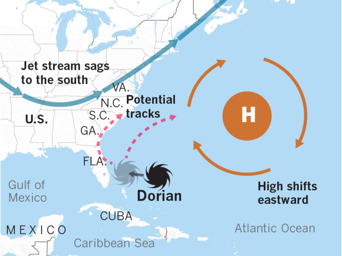
Two major factors are altering Hurricane Dorian’s path: The jet stream and the Bermuda High.
The semipermanent high-pressure system over the western Atlantic, called the Bermuda High, is expected to weaken and shift to the east, said Bill Patzert, retired climatologist for NASA’s Jet Propulsion Laboratory. Clockwise circulation around the high tugs Hurricane Dorian northward.
Meanwhile, forecasts show that the jet stream will sag southward from the Midwest to the Mid-Atlantic region. The jet stream would steer the storm, but could also cause wind shear that would weaken Dorian as it moves north along the Eastern Seaboard.
“These two steering mechanisms are the reason for the newly forecasted path,” Patzert said.
Previous models had Dorian making landfall on the east coast of Florida. The Florida coast is still covered by the National Hurricane Center’s cone of uncertainty, an area that contains the probable path. It also shows the range expected to be affected by the hurricane, although areas outside the cone may be subject to hazardous conditions.
“There are still two days of uncertainty ahead,” Patzert said. “If Dorian hugs the East Coast, there is still big potential for damage from storm surge and flooding due to heavy rain. Dorian is large and heavily laden with moisture.”
Or Dorian could move farther east, reducing the potential for damage in Florida and the Southeast. But one thing looks pretty certain, Patzert said: “The Bahamas are going to get clobbered.”
More to Read
Sign up for Essential California
The most important California stories and recommendations in your inbox every morning.
You may occasionally receive promotional content from the Los Angeles Times.


