Scorching Heat Staying in S.D. : Pressure Cooker Likely to Last Through Holiday
SAN DIEGO — The oppressive heat that generated record-breaking temperatures more than 20 degrees above normal Sunday and Monday is expected to continue today and perhaps through the July 4 weekend.
According to National Weather Service forecaster Richard Stitt, there is no sign that the high-pressure system responsible for the intense heat will break down before the weekend.
“It certainly looks like a spell of hot weather for the next three to five days,” Stitt said. “This is a generally stationary high-pressure system and nothing in the long-range circulation pattern shows it moving anywhere.”
Southern California is in the center of the system, which is compressing the air and generating abnormal temperatures.
“If you were to assign a weight value to this pressure, it is very heavy,” Stitt said. “This is a deep, strong system, and our position within it makes a difference.”
He likened San Diego County’s location in the weather system to being in the eye of a storm.
“There are no significant winds around the center of this high--it is a very stagnant air mass. There’s not much ventilation or movement.”
The system slowly moved into Southern California on Saturday evening and by Sunday temperatures had reached a record 96 at Lindbergh Field.
On Monday the temperature broke the record high of 85 by 8:30 a.m., and climbed to an all-time high for July 1 of 95.
The normal daytime high temperature for this time of year at Lindbergh Field is 73 degrees. The low Sunday night and Monday morning was 73.
High temperatures Monday reached 110 in Poway and Fallbrook, 109 in Santee, 108 in El Cajon and Spring Valley, 107 at San Diego State University and 106 in Lemon Grove, La Mesa and at Montgomery Field.
The high temperatures and low humidity--about 15% to 20% below average--exacerbate the fire hazard in brush-covered canyons, where no rain has fallen since April.
“The last six months passed unusually dry,” said forecaster Wilbur Shigehara. Only 2.9 inches of rain has been recorded at Lindbergh Field since January. Normally 6.21 inches of rain falls during the same period.
Totals for the 1984-85 rainfall season, however, which extends from July 1 to July 1, were normal. Most of the season’s rain fell in October, November and December. December was the 10th wettest on record with 4.55 inches. The seasonal total was 9.65 inches.
Following massive fires over the weekend, area residents Monday in several areas of the county could be seen hosing down parched lawns and dried vegetation. City water consumption reached near-record levels Monday.
City hydrologist Gloria Lesher said increased consumption was anticipated today as the heat continues, so additional water was purchased from the County Water Authority on Monday.
Water consumption Sunday was 275.35 million gallons--about 10 million gallons short of the record set on June 15, 1984. Despite the Normal Heights fire, Lesher said, the total was not impressive because most businesses are closed on Sunday and consumption is ordinarily much lower. City water consumption on June 23, a Sunday, was 241.67 million gallons.
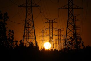
San Diego Gas & Electric reported near-record energy consumption Monday, with peak energy use of 2,292 megawatts. The total fell 50 megawatts short of the all-time record, set Sept. 5.
The warm weather has also affected San Diego’s air quality. According to Air Pollution Control District meteorologist Hal Brown, the high-pressure system acts as a lid holding in pollution. Brown said the system retards development of the sea breeze that normally blows rush-hour car emissions far inland.
Los Angeles smog added to San Diego’s air pollution Monday when the weather pattern steered foul air southward.
Usually, Brown said, the smog is aloft and not visible. Monday’s cloud at sea, about 120 miles long, moved in low and was heated by the sun, generating higher ozone levels.
Measured unhealthful on the Pollution Standard Index, the air in downtown San Diego was rated 138, 163 in Oceanside, 125 in Del Mar, 150 in Escondido and 138 in Kearney Mesa. A number higher than 100 is considered unhealthful. Brown said people who are sensitive to smog should limit their outdoor activities to the morning. The unhealthful air is expected to continue, along with the higher temperatures, through the week.
Highs at the beach are expected to be in the 70s.
Temperatures along the coastal strip are expected to be in the 86- to 92-degree range during the day, with lows in the 65- to 73-degree range.
Inland highs are expected to range from 99 to 109, with lows between 60 and 70.
Highs in the mountains of 86 to 96 will fall to the mid-50s to mid-60s, and desert highs of 110 to 118 are expected to drop to the 70s at night.
More to Read
Sign up for Essential California
The most important California stories and recommendations in your inbox every morning.
You may occasionally receive promotional content from the Los Angeles Times.


