San Diego’s Balmy Winters Sometimes Turn to Bluster
Southern Californians in general, and San Diegans in particular, take their winter weather with a great dose of complacency. After all, with an average rainfall of only 9.32 inches a year, a warm average mean temperature of 64 degrees, and only two recorded snowfalls in modern history--the flakes melting after five minutes--San Diego’s climate is correctly perceived as mild.
Even officials of the National Weather Service don’t worry too much about the area. When they first established a national priority list for installing sophisticated new radar around the country to detect severe weather, San Diego ranked 114th out of 117 stations.
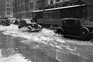
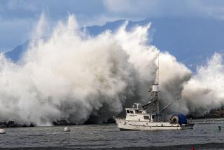
But San Diego’s version of winter weather, usually in the form of rainstorms, does come with occasional dangers that can find residents unprepared. Such problems include high waves, extensive flooding in low-lying beach zones, strong winds and blowing snow in the Cuyamaca mountains, and even an occasional funnel cloud or two which can develop into small tornadoes. About 85% of area rainfall comes between December and March.
Phenomena such as the El Nino, where tropical eastern Pacific waters warm up and sometimes cause worldwide climatic dislocations, also may bring unusual weather aberrations here, including heavier-than-usual rainfall and greater coastal flooding.
The winters of 1979-80 and 1982-83 are remembered by those who suffered property damage from a barrage of storms. But many others, in particular the flood of new residents who have moved here recently, expect only morning low clouds and fog to obscure an otherwise steady succession of pleasant, sunny afternoons.
“The attitudes here mean that we can have more of a problem when severe weather does strike,” Wilbur Shigehara, meteorologist in charge of the local National Weather Service office, told a county-sponsored seminar on winter weather last week.
“Here, if we put out a warning (of flooding or high winds), many people either don’t take notice or they panic.”
Shigehara explained that a weather watch, such as for flash flooding in the desert, or coastal flooding in beach areas, is issued when the potential for severe weather--based on radar, wind patterns and other data--develops.
Watch advisories for severe weather such as high winds or damaging thunderstorms are issued for all areas of the United States by the service’s Severe Weather Center in Kansas City after consultation with the affected area’s local office. Flood watches come from the Los Angeles regional forecasting office in a similar manner.
“I recall a couple of years ago when we got reports of a few mobile homes in Mission Valley being uprooted by funnel clouds, or small tornadoes,” Shigehara said. “I called Kansas City to see about a watch being issued, but since pilot reports showed no thunderstorm activity, the center said just to issue special weather statements about the (tornado) possibility, which we did.”
In terms of dealing with winter weather here, local meteorologists usually limit themselves to special weather statements, warning that predicted rains could bring flooding in Mission Valley, or that high winds along Interstate 8 through the mountains could make driving dangerous.
And they hope residents will take proper precautions, which in low-lying areas can include having a personal evacuation plan to follow.
Occasionally, after a weather watch comes down from Kansas City or Los Angeles, weather conditions worsen after several hours.
Shigehara’s office has the responsibility then for issuing weather warnings, which say that the actual weather patterns forecast are taking place and that danger is imminent or actually occurring. Because the weather can change rapidly in such cases, the San Diego office depends on reports from the California Highway Patrol, county flood engineers and other people in the field.
In addition, the office participates in a multiagency effort that established an automated rainfall measuring network throughout the county last year. Rainfall measurements near reservoirs and river channels can be instantaneously monitored at any time through computer hookups, allowing the weather service to detect immediately and heavy downpour that might bring flash flooding.
As a consequence, warnings can now be issued with much greater accuracy and timeliness to allow residents of areas such as Lakeside or Mission Valley a better chance than in 1979-80 to organize an evacuation.
In the case of beach-area flooding, residents of coastal areas should be attuned to tide tables, Reinhard E. Flick, UC San Diego oceanographer at the Scripps Institution of Oceanography, told county officials.
“Tides are absolutely predictable,” Flick said, defining tides as the up-and-down motion of waves due to gravitational interaction between the earth, moon and sun. “The tides are not the same as the sea level, which is also affected by wind, rain and other factors which are meteorological.”
For residents, the problem comes when a period of high tides coincides with a major rainstorm.
“The tide tables provide us windows of time during which we should take extra precautions,” Flick said. In the 1982-83 period, Flick said that storms increased the high tide levels by one additional foot.
The highest tides for the past decade are predicted at the beginning and end of next month, Flick said. On Dec. 31, the morning high tide is predicted to be 7.8 feet. If a major storm hits at that time, extensive coastal flooding could result.
“At those times (of maximum tides and a storm), people should learn to pay close attention to weather service information,” Flick said.
An El Nino phenomenon could bring unusually harsh rain and high sea levels if a series of related conditions fall into place, UCSD climate researcher Daniel R. Cayan told the seminar.
“In a way, El Nino has become a buzzword of sorts in the weather field since the (1982-83) major occurrence,” said Cayan, who works with the Scripps climate research group.
Cayan cautioned that El Nino is only one of many influences that can change area weather from normal patterns. While the phenomenon makes for heightened storm activity over the central and northern Pacific Ocean, the storms may or may not end up off the Southern California coast, he said.
“The storm track, where the storms will be blown by westerly winds, depends on where the low pressure center of these storm systems sits itself in the Pacific.”
Cayan said that a 1977 El Nino condition coincided with drought conditions throughout much of California because the low pressure center was centered far enough off the Pacific Coast to keep storms from reaching the state. But in the 1982-83 period, the low was near the coast and a wet El Nino pattern brought a series of storms onshore with serious results.
“So there’s quite a contrast, not only in the (rain) but in the rise in sea levels, which can also be a (consequence) of El Nino,” Cayan said.
In essence, Cayan said that El Nino patterns are much easier to analyze after they occur than they are to predict before taking place. In the last nine El Nino conditions going back to World War II, five resulted in drier than normal winters and six in wetter than normal conditions.
“All of this does not make for an easy winter forecast,” Cayan said.
Another member of the Scripps climate group, Jerome Namias, will issue his annual nationwide winter quarter forecast Dec. 1 in which he will attempt to incorporate a potential developing El Nino pattern into his predictions.
Flick suggested that San Diegans take to heart a poem by Robert Frost, titled “Once By The Pacific” in realizing that wintertime weather can bring problems. Part of the poem reads:
The shattered water made a misty din.
Great waves looked over others coming in.
And thought of doing something to the shore
That water never did to land before.
The clouds were low and hairy in the sky.
Like locks blown forward in the gleam of eyes.
Perhaps the weather service should word its warnings similarly, Flick added, and more people would pay attention.
More to Read
Sign up for Essential California
The most important California stories and recommendations in your inbox every morning.
You may occasionally receive promotional content from the Los Angeles Times.


