Cold Springs Trail Boasts Coastal and Canyon Vistas
Our favorite route to the main ridge was by a way called the Cold Springs Trail. We used to enjoy taking visitors up it, mainly because you come on the top suddenly, without warning. Then we collected remarks. Everybody, even the most stolid, said something.
--Steward Edward White
The Mountains, 1906
After the Santa Ynez Forest Reserve was established in 1899, rangers recognized the desirability of a trail crossing the Reserve from coast to desert. A trail up the West Fork of Cold Springs Canyon had historically been the way into the Santa Barbara back country, but the rangers realized that this tricky trail, which climbed around a waterfall and crossed shale slopes, would be difficult to maintain. In 1905, the Forest Service built a trail up the East Fork of Cold Springs Canyon.
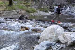
And a lovely trail it is. It begins by the alder-shaded, year-round creek, then rises out of the canyon for fine coastal views.
Directions to trailhead: From Highway 101 in Montecito, a few miles south of Santa Barbara, exit on Hot Springs Road and proceed toward the foothills for two and one-half miles to Mountain Drive. Turn left. A mile’s travel on Mountain Drive brings you to the Cold Springs trailhead, which begins at a point where a creek flows over a cement drainage apron.
The hike: The trail immediately crosses the creek to the east side of the canyon. It rises briefly through oak woodland, then returns to the creek. On your left, a quarter mile from the trailhead, is the easily overlooked, unsigned West Fork Trail. This century-old trail ascends one and one-half miles through California bay laurel to Gibraltar Road. Remember this fine trail and save it for another day.
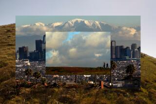
Continuing past the West Fork trail junction, the East Fork Trail rises up the canyon wall and rejoins the creek a half mile later. Look for a fine swimming hole below you to the right. The trail then switchbacks moderately out of the canyon to Montecito Overlook. Enjoy the view of the Santa Barbara coastline and the Channel Islands.
Past the overlook, you’ll cross a fire road leading down to Hot Springs Canyon, begin an uphill climb and soon encounter the Hot Springs connector trail. The one-mile-long connector trail leads down into Hot Springs Canyon. Along the trail thrives bamboo, huge agave, banana and palm trees--remnants of landscaped gardens that surrounded Hot Springs Resort during its glory days. Explore the ruins of Hot Springs Hotel, constructed in the early 1880s. Europeans and Americans from colder climes flocked here to “take the cure. A 1920 fire destroyed the hotel; it was rebuilt and burned again in 1964.”
From the junction with the Hot Springs connector trail, Cold Springs Trail switchbacks up canyon and offers fine coastal views. A one-mile climb brings you to two eucalyptus trees (about the only shade en route!) and another three-fourths mile of travel takes you to the unsigned junction with a side trail leading to Montecito Peak. A steep one-fourth mile climb up this trail leads to the top of Montecito Park (3,214 feet). Enjoy the view and sign the summit register.
Cold Springs Trail continues a last mile to Camino Cielo. From the Sky Road, many trails lead into the far reaches of the Santa Barbara back country. Enjoy the grand views and return the same way.
Cold Springs Trail
Mountain Drive to Montecito Overlook: three miles round trip; 900-foot elevation gain.
Mountain Drive to Montecito Peak: 7 1/2 miles round trip; 2,500-foot elevation gain.
Mountain Drive to Camino Cielo: nine miles round trip; 2,700-foot elevation gain.
More to Read
Sign up for The Wild
We’ll help you find the best places to hike, bike and run, as well as the perfect silent spots for meditation and yoga.
You may occasionally receive promotional content from the Los Angeles Times.


