Cold Air Seen Bringing Relief to East Coast
Thunderstorms that barreled across the central part of the country Tuesday with tornadoes and powerful wind gusts headed East on a cold front expected to break a heat wave along the Atlantic Coast, weather officials said.
Scattered storms across the upper and middle Mississippi Valley, Great Lakes and southern and central Plains were produced by a slow-moving cold front that curved from northwest Ontario to central New Mexico.
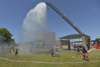
Readings in the 90s, from 15 to 20 degrees above normal, have punished residents along the Atlantic Coast since Friday, although no deaths have been attributed to the heat.
Newark, N.J., had a high of 82 on Tuesday, a day after a record-tying 94, but the humidity remained uncomfortably high. New York City had a near-normal high of 78 degrees after four days in the 90s.
Trees, Power Lines Downed
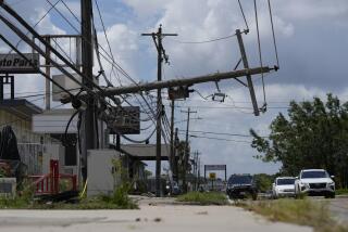
Thunderstorms in the Midwest downed trees and power lines at Dixon, Ill., and whipped up wind gusts of 70 m.p.h. at Macomb, Ill. High winds caused delays of up to 90 minutes at Chicago’s O’Hare International Airport and Midway Airport.
Up to two feet of water flooded Lake Shore Drive in Chicago and jammed traffic, officials said.
Hail and 50-m.p.h. winds hit lower Michigan, while hail pelted Demotte, Ind., and 60-m.p.h. winds tore limbs off trees at Moberly, Mo.
In east-central Kansas, the storms spawned tornadoes near Alta Vista and Harveyville, and tornadoes were spotted in central Illinois and in Texas at Killeen. No injuries were reported.
Storms also moved through China Grove, Tex., and knocked down three radio station antennas, police said. No one was injured when the towers--one 500 feet high--were ripped down, knocking two stations off the air.
More to Read
Sign up for Essential California
The most important California stories and recommendations in your inbox every morning.
You may occasionally receive promotional content from the Los Angeles Times.


