Storm Passes, Worst Is Over . . . Maybe : County Gets by With No Major Problems
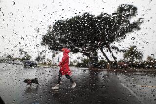
A turbulent storm front that lashed out at Southern California, stranding 5,000 visitors in Death Valley and triggering flash-flood warnings and waterspouts elsewhere, rolled across Orange County Thursday, causing only some minor power outages but otherwise resulting in no major damage or traffic problems.
Forecasters said the storm brought a torrential downpour to John Wayne Airport Thursday morning. The rains stopped by noon and the rest of the day was mostly clear--until 8 p.m., when more thunderstorms drenched the county.
The forecasters predicted clear skies for the weekend.
A Sunny Weekend?
“The worst is over,” said Mike Smith, a meteorologist with WeatherData, which provides forecasts for The Times. “Things were much worse just north and just south of Orange County. By Friday, the sun should be shining, and I think you’re in for a very nice, sunny weekend.”
In parts of Southern California Thursday morning, the conditions produced spectacular thunder and lightning displays one minute, then equally spectacular rainbows as the clouds parted during breaks in the rain.
Hard hit was the vast, usually arid Death Valley National Monument area, where heavy rains closed three state highways--California 190, 178 and 127--because of flooding, authorities said.
About 5,000 visitors were stranded in the Furnace Creek area as the afternoon thunderstorms rolled in from the west, National Monument information officer Ross Hopkins said. All were considered in no danger, he said.
Among those stranded were 80 horsemen on a ride to the monument from Ridgecrest in Kern County, 18 high school students who could not get home to Furnace Creek from their school in Shoshone, 65 miles away. The students were spending the night with faculty members, school officials said.
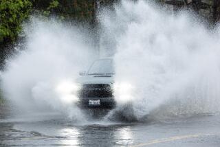
Although the rain-slickened streets and highways caused some fender-benders across Orange County, there were no reports of weather-related traffic fatalities. Unlike in San Diego, where heavy rains and flooding closed several streets, there were no reports here of serious flooding or street closings.
A spokeswoman for the California Highway Patrol said there seemed to be no major rain-related problems on Orange County freeways during commute hours.
“I guess we’re all learning how to drive in the rain,” she said.
New Storms Arrived
There were some reports of minor outages caused by fallen power lines, but by late afternoon all electricity had been restored, a spokesman for the Southern California Edison Co. said.
The low-pressure system moved into the Southland early Wednesday and by Thursday was hovering over the entire metropolitan Los Angeles area.
“It was a stronger-than-average system for this time of year, and that means showers and thundershowers,” WeatherData’s Smith said. “It was just sitting there swirling in the atmosphere above Orange County, causing all kinds of things to happen.”
The heaviest rain came in the early morning but ended in most parts of the county before noon, until the new storms arrived Thursday night.
At 10 a.m., the National Weather Service reported heavy rains around John Wayne Airport and parts of Costa Mesa, Irvine and Santa Ana.
Around this time, Smith said, the rainfall rate at the airport was greater than 1 inch per hour.
“That’s really coming down, pouring, even in places that get a lot of rain,” he said.
Some of the biggest downpours were reported at El Toro Marine Corps Air Station, where .87 of an inch had fallen in the 48 hours leading up to 4 p.m. Thursday. In the same period, Newport Beach had .71 of an inch of rain and San Juan Capistrano .52 of an inch.
In Santa Ana, just less than half an inch was reported in the 24 hours ending at 4 p.m. Thursday, but .72 of an inch drenched the El Toro area in the same period.
All those figures increased slightly Thursday night with the new rain.
“It appears the most rain hit from a line from about El Toro and Newport Beach north,” Smith said.
Farther north and south of Orange County, things were much worse.
The storm was particularly troublesome in the foothill communities of the San Gabriel Valley, where the National Weather Service issued a special advisory Thursday afternoon warning of heavy thunderstorms and gusty winds up to 35 m.p.h. But no immediate problems were reported.
The weather service also issued a special marine warning in the afternoon for boaters to beware of heavy rains and winds gusting up to 40 knots from Oxnard to Long Beach and 60 miles out to sea.
Several waterspouts--funnel clouds that touch water--were spotted during the day from Malibu to San Clemente, but no damage was reported. Observers at Los Angeles International Airport said one touched the ocean’s surface about five miles from the airport at 9:30 a.m. but dissipated about 10 minutes later.
Southern California mountain regions all reported snow, with up to six inches reported at levels above 7,000 feet. However, ski resort operators all agreed they would need up to 18 inches more before the slopes will be ready to open.
To the east in Las Vegas, where the brunt of Thursday’s storm had yet to reach, several thunderstorms raked the area, dumping hail the size of golf balls in some areas and bringing the total rainfall for the week to more than two inches. Streets were briefly flooded, with up to three feet of water in some intersections in the western part of the city, but no major damage was reported.
At San Diego’s Lindbergh Field, 1.08 inches of rain was reported in the 48 hours up to 4 p.m., making it the second-wettest Nov. 5 on record, according to the National Weather Service.
In addition, a roof collapsed at a county-operated medical building, and lightning and gusty winds downed power lines across the county. Some San Diego streets were also closed because of flooding.
By noon, forecasters said an estimated 20 lightning strikes had touched down in various parts of San Diego County. One of the strikes apparently hit an electrical transformer about 10 a.m. Thursday on 54th Street, causing 100 people to lose power for about 45 minutes.
Fred Vaughn, a spokesman for San Diego Gas & Electric Co., said power outages were also reported in the Old Town and Sports Arena areas of San Diego, Carlsbad and Escondido.
According to WeatherData’s Smith, it was “probably just luck, coincidence” that Orange County was spared the brunt of the storm.
“The mountains get a little bit higher as you get into Los Angeles, and when you have a storm system like this, that can mean they’ll get the worst of it,” the forecaster said.
Smith said that with the clearing skies predicted for Friday, temperatures might get a little bit cooler, possibly dipping into the 50s in some areas.
At John Wayne Airport Thursday, a high of 66 and a low of 57 was reported. The normal high for this time of year is 74 with a low of 49.
Smith said the warm, clear skies should stick around until early next week.
“After Tuesday, I’m not so sure,” he said, hinting there was a chance of more precipitation from another storm building in the North Pacific. “But it also may miss L.A. altogether.”
Times staff writers George Ramos in Los Angeles and Kathie Bozanich in San Diego contributed to this report.
More to Read
Sign up for Essential California
The most important California stories and recommendations in your inbox every morning.
You may occasionally receive promotional content from the Los Angeles Times.


