Fury of First Winter Storm Not Over Yet
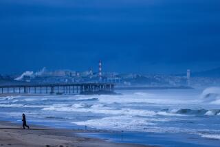
The first major storm of the winter season continued to harass Southern California with heavy rain and wind-driven snow Friday, blocking two major routes to the north and snarling commuter traffic throughout the Los Angeles Basin.
Forecasters said the cold, dank weather should ease a little today, then intensify again Sunday as the center of the storm moves over the Los Angeles area.
As much as 5 inches of rain had fallen above some foothill communities in the Southland by Friday evening, flooding numerous surface streets and launching minor mudslides, especially below hillsides denuded in the wind-whipped fires that destroyed or damaged dozens of homes last week.
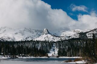
A winter storm warning continued in effect in the San Gabriel and San Bernardino mountains, with snow falling steadily in most resort areas above 4,000 feet.
Interstate 5, closed by snow and ice at 8 p.m. Thursday, did not reopen until about noon Friday. The top of Tejon Pass near Gorman was littered with trucks that jackknifed on the slick pavement, and at least 50 tractor-trailer rigs were stalled on the Grapevine Grade leading up from the San Joaquin Valley.
“It’s not too much fun out there,” California Highway Patrol Officer Chris Black said Friday morning. “Most of these trucks don’t carry chains, so we’ve got to push them over the top.”
U.S. 101 Reopened
U.S. 101 in the San Luis Obispo area reopened at dawn Friday after wet snow closed the road at the 1,500-foot Cuesta Summit shortly before midnight. Stranded motorists clogged motels in San Luis Obispo, Atascadero and Paso Robles.
There were at least 10 storm-related accidents on Interstate 15 in the Cajon Pass area late Thursday and early Friday--at least two of which claimed lives--but the roadway remained open.
Chains were required in many mountain resort areas as winds up to 60 m.p.h. and temperatures in the 20s drove the chill factor down to 30 below zero in some areas.
Several downtown Los Angeles freeways were clogged during the Friday morning rush hour.
But the evening rush hour “went very smoothly,” CHP Officer Bob Weaver said.
“I guess everybody got so tortured in the previous 24 hours that they took everything smoothly and just went home and stayed there,” he said. “We didn’t have any significant problems.”
The storm, which ranged the length of California, struck the northern half of the state with hurricane-force winds Thursday, destroying property, knocking out power to more than 300,000 homes, closing highways, tearing boats and small planes from their moorings and downing thousands of trees.
The frigid winds dropped the chill factor to 15 degrees below zero Thursday night at the scene of a timber fire near Sonora, forcing fire crews to abandon their battle and seek shelter before returning to the fire lines at dawn.
Because of an unusual weather pattern, the heaviest winds were confined to the northern half of the state, while most of the rain and snow fell in the south.
As a result, the storm did little to ease the continuing threat of a statewide drought, according to Bill Helms, a spokesman for the state’s flood and drought center in Sacramento.
“Rain in Southern California at this time of year goes right out into the Pacific,” Helms said. “There are no major water storage facilities in the south except for the dams that store water shipped in from Northern California.”
Two dry winters in a row have caused water levels in major reservoirs to drop in Northern California, and there has been no appreciable rain there since the third week in November.
While skies in the north cleared Friday, forecasters said Southern California is expected to remain cold, cloudy and wet for a while longer.
Dave Beursterien, a meteorologist with WeatherData Inc., said the storm was centered about 80 miles northwest of Point Conception on Friday evening, spinning off bands of moisture that rotated counterclockwise around the main body of the low-pressure weather system before heading inland.
He said these bands should bring alternate periods of sunshine and cloudiness along with sporadic rain and snow showers as they move eastward across the valleys and mountains of Southern California today.
“Los Angeles should get about .10 of an inch of rain on Saturday, with a little more in the foothills, and up to about 2 to 4 inches of new snow in the mountains,” Beursterien said. “On Sunday, the showers will increase as the center of the storm passes over (the Los Angeles area). There will be another quarter to half an inch of rain then . . . and up to another 3 to 5 inches of snow in the mountains.”
Beursterien said skies will clear late Sunday or early Monday as the entire storm system moves out to the east.
High temperatures in the coastal valleys will not push much above the mid-50s and low 60s today and Sunday, forecasters said, and thermometer readings at most mountain resorts will remain below freezing through the weekend.
Rainfall from the storm totaled 1.76 inches at the Los Angeles Civic Center by Friday evening, raising the season’s total to 2.11 inches, the National Weather Service said. The normal seasonal total for the date is 3.35 inches. A total of 5.07 inches had fallen by this date last year.
Of that 1.76, .89 of an inch fell at the Civic Center between Thursday midnight and 4:30 p.m. Friday. Other Friday measurements included .51 at Los Angeles International Airport, .70 at Culver City, .70 at Lancaster, .87 at Long Beach, 1.85 at Monrovia, 1.20 at Montebello, 5.43 at Mt. Wilson, 2.02 at Pasadena, .86 at Riverside and 1.35 at San Juan Capistrano.
The high temperature in downtown Los Angeles on Friday was 58 degrees, after an overnight low of 51 degrees.
More to Read
Sign up for Essential California
The most important California stories and recommendations in your inbox every morning.
You may occasionally receive promotional content from the Los Angeles Times.


