They Say It Never Rains in Southern California, but . . . : Public works: Los Angeles County flood control officials are poised with an army of workers and a division of equipment, but in the event of a tempest, that may not be enough.
The average rainfall in Southern California for the month of October is less than a quarter of an inch. But for Los Angeles County flood control officials it’s the start of the rainy season.
“From here on out, we’ve got to be ready to move,” said Larry Ammon, who heads the flood control maintenance system for the Department of Public Works.
Starting this week, Ammon has to be prepared to field an army of more than 400 workers, with almost 400 pieces of earth-moving equipment and back-up resources, and to lease “every rental truck between here and Montana,” as one flood control supervisor put it.
In the event of a flood, Ammon’s army is poised with bulldozers, front loaders and dump trucks, ready to scoop up the gravel and muck that comes sliding down the mountains and haul it back into the canyons, making room for more.
Ammon, 52, a good-natured, gray-haired man, is concerned about the periodic violent rainstorms that can afflict Los Angeles in the fall and winter.
Any time between now and April, flood control officials say, a tempest could blow in from the Pacific, get tangled in the peaks of the San Gabriel Mountains and inundate the canyons. That’s when the county flood-control system proves its worth, Ammon said.
In dry years, most people forget about the vast system--with its dams and debris basins stretching across the southern face of the San Gabriel Mountains and its channels wending through the Los Angeles Basin to the sea.
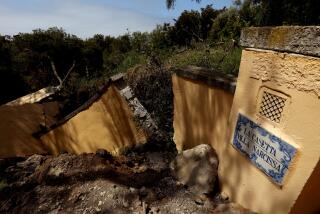
But in hillside communities where brush fires have put homes in jeopardy of flooding and mudslides--such as Turnbull Canyon in Hacienda Heights, where fire scorched the surrounding hills in July--there is a heightened appreciation of county flood control efforts.
“The higher up the hill you are, the more aware you are,” said Barbara Fish, chairman of the Hacienda Heights Improvement Assn. in the unincorporated community.
Conservationists and environmentalists are not as appreciative of the flood control system. Almost since the Flood Control District was formed in 1915, environmentalists have waged war with it, charging that the system meddles with a natural balance. According to critics, the district contributes to “sand starvation” of Southern California beaches by blocking the flow of sediment to the seashore, wipes out trout beds and detracts from natural scenery by spraying Gunite on canyon walls and paving stream beds.
“Look at what they’ve done to the Los Angeles River,” said Sierra Madre insurance broker Miner Harkness, a hard-liner on the conservation issue. “It was once a beautiful natural river; now it looks like a cesspool.”
Most scientists who have studied the effects of flood control in Los Angeles County contend that in an area that has been undergoing violent geological change for millions of years, the county is, in effect, seeking to block a natural force--erosion.
“They can’t win in the long run,” said Norman Brooks, director of Caltech’s Environmental Quality Laboratory. “You can’t stop the mountains from eroding.”
They can’t stop some major floods either, not with the system in place now, according to the U.S. Army Corps of Engineers. Because of the massive amount of development in the Los Angeles Basin in the last 50 years, Corps spokeswoman Mary O’Keeffe said, large inundations of rainwater can no longer seep into the ground.
In “100-year events,” that is, floods so big they are likely to come only once a century, the system of drainage channels will not be able to handle the runoff, she said.
The overflow could cause extensive flooding in adjacent neighborhoods. “As far as the Corps is concerned, the Los Angeles River has the greatest potential for flood damage of any system west of the Mississippi,” she said.
Right now, a main concern of flood control officials is the fire-stripped area of the Puente Hills.
The scene of the Hacienda Heights July brush fire that blackened 1,500 acres of hillside land is another disaster waiting to happen, said area engineer Rudy Dzubnar.
“It all depends on the amount of rain we get, the intensity and the longevity,” he said.
If a series of big, long-lasting rainstorms hits, the hills, denuded of foliage, could send fast-moving mud and rocks down on the houses below, he said.
Mudslides--or “debris flows,” as geologists call them--have been known to move faster than a man can run, filling houses and swimming pools with gunky silt, carrying away cars or pianos and moving refrigerator-sized boulders out of the mountains and onto city streets. A single storm can wash the equivalent of 1 1/2 inches off an entire fire-stripped hillside and send it streaming into the canyons below, Brooks said.
The crew has built a 200-foot-wide emergency debris catcher at the mouth of a dry stream bed--a line of steel I-beams sunk deep into a bed of concrete, with horizontal wooden slats. “Now, if debris comes out of the canyon, it stops here instead of ending up back there where the houses are,” Dzubnar said.
Bulldozers also have gouged out a road on the side of the hill so that between storms earth-moving equipment can get in fast to clear the debris.
Half a mile away, workers have built a cage-like steel trash rack at the entrance of a four-foot drainpipe so that water will keep flowing downstream even when debris backs up.
What flood control officials worry about most are sudden surges. If those drainage channels get blocked, Dzubnar said, a potent mixture of water and debris builds up at the choke point. “It can’t hold forever,” he said. “That’s when you can have a surge flow.”
The system works most of the time and sliding debris is captured in debris basins--the larger ones the size of the Rose Bowl--before it reaches homes. But every 10 years or so, a succession of storms move in one by one to pour tons of water on the mountains, loosening the dirt and gravel.
“When that happens, you’re nothing,” said flood control construction superintendent Irwin Janssen, who, after 27 years with the district, has a collection of astounding battle stories.
He has seen mud rush through the back door of a house and carry the furniture out the front door, and he has watched as a rush of debris swept away a 30-ton truck loader, operator and all. In a 1980 rainstorm, he said, mud and boulders filled an emergency debris catcher above Altadena in a quarter of an hour. “We were just putting the last board into place, and the basin filled up,” Janssen said.
In the week after that storm, flood control workers toted away 150,000 cubic yards of debris, or 20,000 dump truck loads.
To deflect the fury, the flood control district has built what is, in effect, a countywide winnowing machine. A series of 15 major dams (along with five dams maintained by the Corps of Engineers) blocks the initial torrents.
Bowl-shaped debris basins, 354 of them at critical points near populated areas, catch sliding masses of mud and boulders, straining out the water through big drainpipes.
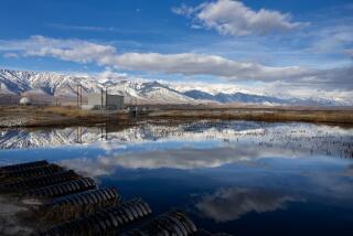
Then a 2,500-mile network of open channels and underground storm drains either directs the sandy flow into “spreading grounds”--terraced fields that during the rainy season look like rice paddies--or carries the water to the sea. In the spreading grounds, the water seeps into the earth, replenishing subterranean basins.
The worst debris flows are typically preceded by fires, which denude the slopes of binding vegetation and drive oils from the burnt chaparral brush deep into the soil. Thus, the surface is slippery and impervious to water, which slides across it with all the speed gravity can give it.
“Water gathers in the canyons and comes down some very steep gradients,” Silver said. Even with a normal covering of chaparral brush, he added, “there’s little time for the ground to absorb the moisture.”
But the county system’s inability to handle the floods, some critics say, is not its only flaw. Equally problematical is its the failure to come up with a satisfactory solution to the problems of debris disposal, they contend.
Right now, there are 25 million cubic yards of the stuff backed up behind three dams in San Gabriel Canyon, north of Azusa. The debris is heaped in rocky, treacherously uneven terrain, where earth-moving equipment has a hard time operating.
Even if bulldozers could get to the debris, there is no more room for it in the mountains, officials said.
In the flood control district’s 74 years of operation, contractors have transported vast quantities of sand and gravel from debris basins--an average annual amount of 450,000 cubic yards. The stuff has been hauled to disposal beds in the mountains at a cost of between $8 and $10 per cubic yard.
But the canyons are running out of room, county officials said. Starting this year, the county will haul the debris to an abandoned gravel pit in Irwindale. The 81-acre pit is expected to accommodate 50 years’ worth of debris, said a Department of Public Works spokeswoman.
Last year, flood control officials suggested a cheaper way of disposing of debris. They proposed opening Morris Dam and sluicing a modest 1 million cubic yards of the debris downstream to the Santa Fe Control Basin in Irwindale. But environmentalists quickly sued to stop the experiment, charging that the procedure would wipe out bass and Western pond turtles in the riparian habitats below the dam.
However, the problems would be equally serious if the debris is left where it is, coastal preservation activists said. By blocking the flow, the county is contributing to the erosion of Southern California beaches. The California Coastal Commission calculates that the San Gabriel and Los Angeles rivers now carry only about one-third as much sediment as they did before being dammed--with some long-range consequences.
While beaches from Santa Monica to Redondo Beach have been stabilized by jetties and piers, those to the south and north, not replenished by the natural flow of sand from the mountains, are slowly being eaten away by winter storms. At the same time, coastal cliffs, vulnerable to the waves because of the narrowness of beaches, are collapsing.
“We’re going to have to start looking at beach sand as an endangered natural resource, just like redwood trees and wild rivers,” Inman said.
Geologists contend that, in the long run, the flood control system offers only fragile, temporary protection to hillside communities, while adding to the grave condition of the coastline. According to Caltech’s Silver, there is a tradition in Southern California of ignoring geological dangers. It is difficult to persuade developers and property owners of their shortsightedness, he said, although uncontrollable floods are as inevitable as earthquakes.
“We worry about the recurrence of major earthquakes every 150 years or so, but we don’t seem to worry about the recurrence of great storm systems,” Silver said.
More to Read
Sign up for Essential California
The most important California stories and recommendations in your inbox every morning.
You may occasionally receive promotional content from the Los Angeles Times.


