Drought Eased but Far From Over, Officials Say : Storms: Recent precipitation has only helped to improve last year’s ‘disastrously low’ water storage.
SACRAMENTO — After the weekend’s heavy rain and snow around California, officials said Monday that the water picture entering the state’s sixth year of drought is improved, if still a looming problem for farmers and cities this summer.
“It’s definitely helpful,” Maurice Roos, chief hydrologist for the state Department of Water Resources, said of the stormy weather that moved over California from the Pacific last weekend.
The storms leave the state “better off than we were last year” when the year-end snowpack was “disastrously low,” Roos said.
But even with another Pacific storm predicted to arrive in Southern California late New Year’s Day or Thursday, water officials sought to remind people that the new weather system would not drop enough precipitation on the Northern California mountains to end the drought.
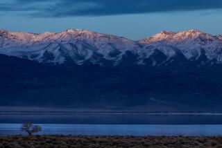
So far the snow has fallen heaviest at the southern end of the Sierra Nevada, which is good for skiers at Lake Tahoe and Mammoth Mountain, but not of much benefit to the state’s water reserves.
The north end of the mountain range and the Trinity and Cascade mountains are the critical sources of runoff into the state and federal reservoirs that supply two-thirds of the water to California cities and farms. The northern Sierra snowpack Monday was at 47% of normal for this time of year.
Still, the weekend storms offered ski resort operators the promise of a bountiful week to end the traditionally lucrative holiday season. Parts of the southern Sierra received up to four feet of fresh snow. In the Lake Tahoe Basin, the snowpack Monday stood at about half of normal for the end of the year, better than the 30% of normal snowpack that was on the slopes when 1990 ended.
Four feet of snow fell over the weekend in the Mammoth Mountain basin in the eastern Sierra watershed that supplies the Los Angeles Aqueduct. The Mammoth snowpack Monday was at 60% of normal, far better than the 23% of normal at this time last year.
“Basically we need about 10 storms between now and April to make it to normal,” said Bill Hasencampof the Los Angeles Department of Water and Power.
The Los Angeles Aqueduct is expected to supply about half of Los Angeles’ needs this year, Hasencamp said, and city officials anticipate keeping water restrictions in effect this year.
Forecasters predicted that Southern California skies will remain clear for the Rose Parade on Wednesday morning. But rain could start falling by late Wednesday afternoon or night as the next storm front blows in, though it was too early to tell how much rain might come with the new storm.
“Chances are that it will stay nice for Wednesday morning,” said Stephanie Hunter of WeatherData, a firm that supplies weather information to The Times.
In downtown Los Angeles, almost 3 inches of rain fell between Dec. 27 and Monday morning, increasing the Civic Center total to 3.82 inches for the season. Rainfall dampened a wide area of the state, with the San Francisco area receiving two inches of rain and San Diego 0.59 of an inch.
With the added water flowing into the Sacramento-San Joaquin River Delta, technicians were preparing Monday to crank up the huge State Water Project pumps later in the week.
By Wednesday, the pumps will be operating at capacity, at least for a time, sucking water from the delta at a rate of 6,400 cubic feet--more than 47,000 gallons--per second, and pushing it south into San Luis Reservoir, said water project official Larry Gage.
San Luis Reservoir near Los Banos, where water is stored before it is transported to Southern California, already holds 400,000 acre-feet more than it did at this time last year.
Drought-related water restrictions are expected to stay in force in most of the state, but in parts of coastal California that rely primarily on local supplies, the weekend storms raised hopes that severe water rationing can be ended.
In the hills east of Santa Barbara, for example, seven inches of rain fell, pushing the season’s total to 8.29 inches, only slightly below normal for that area. Santa Barbara’s Gibraltar Reservoir--which had dried up in November, 1990, because of the drought--could begin spilling over into the Santa Ynez River in the storm forecast for later this week.
But Santa Barbara water agency spokeswoman Lisa Weeks said the main county reservoir, Lake Cachuma, remains at 28% of capacity, adding, “it’s too soon to say that the drought is over.”
As California heads into January, usually the wettest month of the year, the state Department of Water Resources on Monday stood by its predictions that water supplies will remain at the “critical” stage in 1992.
In the fall, the department anticipated that runoff from the Sacramento River system--the key indicator of drought in California--would be substantially better next year than it was this year. But despite the weekend storms, precipitation in December was half of the month’s historic average. As a result, the state may revise its Sacramento River system prediction downward next week, Roos said.
“I hate to be too pessimistic,” Roos said. “But it takes a long time to offset a deficit like this. One storm doesn’t do it.”
Federal water officials pay particular attention to the mountains above Shasta Lake, the massive federal reservoir north of Redding. The weekend storm deposited only two to three inches of precipitation in those mountains.
At this time of year, the normal storage in Shasta Lake is 2.5 million acre-feet. This time last year, the lake held had 1.6 million acre-feet of water. Currently the lake holds only 1.3 million acre-feet.
“We are way, way behind,” said Lynnette Wirth, spokeswoman for the Bureau of Reclamation, adding that the federal system--which includes Folsom, New Melones, Shasta and Clair Engle reservoirs--would need storms of “biblical” proportions in order to be fully replenished in 1992.
More to Read
Sign up for Essential California
The most important California stories and recommendations in your inbox every morning.
You may occasionally receive promotional content from the Los Angeles Times.


