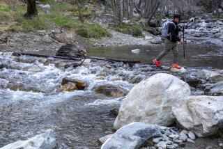
Black Rock Canyon, the ‘Complete’ Desert Trail
A hike through Black Rock Canyon has just about everything a desert hike should have: plenty of cactus, pinyon pine-dotted peaks, a sandy wash, dramatic rock formations, a hidden spring, grand vistas . . . and much more.
Tucked away in the northwest corner of Joshua Tree National Monument, at 4,000 feet elevation near the town of Twentynine Palms, the Black Rock Canyon area also contains forests of the shaggy Joshuas.
A bit off the tourist track, the canyon rarely makes the national monument’s “must-see” list. Ironically, though, Black Rock is one of the easiest places to reach.
The area has a trail for hikers of all abilities. Families with kids enjoy poking around the campground, taking a ranger-led walk or sauntering along nearby nature trails. More experienced hikers follow trails and cross-country routes to the tops of nearby peaks. Well-prepared “desert rats” can wander for days without seeing a soul in the rugged and remote Little San Bernardino Mountains.
To learn more about desert flora, take the 1 1/4-mile Hi-View Nature Trail. Numbered posts en route are keyed to an interpretive pamphlet available at Black Rock Ranger Station. To reach the trail head, double back to the campground entrance and follow the signs 3/4 mile to the Yucca Valley Park and Recreation District’s South Park.
Black Rock Canyon Trail follows a classic desert wash, then ascends to the crest of the Little San Bernardino Mountains at Warren Peak. Desert and mountain views from the peak are stunning.
*
Directions to trail head: From California 62 (Twentynine Palms Highway) in Yucca Valley, turn right on Joshua Lane and drive five miles through a residential area to Black Rock Ranger Station. Park at the station. The station has some interpretive displays and sells books and maps. Walk uphill through the campground to campsite No. 30 and the trail head.
*
The hike: From the upper end of the campground, the trail leads to a water tank, goes left a very short distance on a park service road, then angles right. After a few hundred yards, the trail splits. The main trail descends directly into Black Rock Canyon wash. A quarter-mile from the trail head, the path drops into the dry, sandy creek bed of Black Rock Canyon. You’ll bear right and head up the wide canyon mouth, passing Joshua trees, desert willow, cholla and rabbit brush.
A mile of wash-walking leads to the remains of so-called “tanks,” or rock basins built by early ranchers to hold water for their cattle. Another quarter-mile up the wash is Black Rock Spring, sometimes dry, sometimes a trickle. Beyond the spring, the canyon narrows.
Near the head of the canyon, the trail splits. Turning left (east) cross-country will lead along a rough ridge to Peak 5195.
If you follow the right fork of the rough trail, you’ll climb to a dramatic ridge crest of the Little San Bernardino Mountains, then angle right along the crest. A steep, 1/4-mile ascent past contorted, wind-blown juniper and pinyon pine brings you to the top of Warren Peak.
Oh, what a grand clear-day view! North is the Mojave Desert. To the west is snowy Mt. San Gorgonio, Southern California’s highest peak (11,485 feet), as well as the San Bernardino Mountains and the deep trough of San Gorgonio Pass. To the southwest lies mighty Mt. San Jacinto, and to the south are Palm Springs and the Coachella Valley. The peaks of the Little San Bernardinos extend southeast, marching toward the Salton Sea.
Black Rock Canyon Trail WHERE: Joshua Tree National Monument. DISTANCE: From Black Rock Campground to Warren Peak, 6 miles round trip, with 1,000-foot elevation gain. TERRAIN: High desert canyon, juniper and pinyon pine-dotted crest of Little San Bernardino Mountains. HIGHLIGHTS: Joshua trees, desert flora-filled wash, panoramic views. DEGREE OF DIFFICULTY: Moderate to strenuous. PRECAUTIONS: Don’t hike during storms (lightning, flash floods in desert washes). FOR MORE INFORMATION: Contact Joshua Tree National Monument, 74485 National Monument Drive, Twentynine Palms, Calif. 92277, (619) 367-7511.
More to Read
Sign up for The Wild
We’ll help you find the best places to hike, bike and run, as well as the perfect silent spots for meditation and yoga.
You may occasionally receive promotional content from the Los Angeles Times.


