N. California Storms Pose Flood Threat
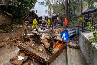
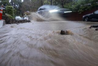
SAN FRANCISCO — Continuing rain and strong winds Monday brought a threat of flooding and mudslides to parts of Northern California, and forecasters warned that more of the same is on the way.
The National Weather Service said a series of weather systems will be “marching across the Pacific this week,” bringing rain and snow Tuesday night and Wednesday. Skies are not expected to clear until Friday.
“This is a very strong jet stream bringing one storm after another, so you can’t tell where one ends and the other begins,” said Weather Service meteorologist Dan Klinger.
Monday’s rain snarled traffic all day, causing scores of fender-benders in the San Francisco Bay Area, including five that closed the Caldecott Tunnel for about an hour during the morning rush. Traffic backed up to Walnut Creek, moving at a walker’s pace through the tunnel linking Alameda and Contra Costa counties.
A mudslide and flooding also closed coastal California 1 in portions of Sonoma and San Mateo counties, the California Highway Patrol said. The mudslide was near Meyers Grade Road north of Jenner. Flooding also closed the highway in Bloomfield in Sonoma County and in two spots in San Mateo County, including California 1’s intersection with California 84, officials said.
The storm that slapped Northern California on Monday sent a puny cousin south to drop some late-afternoon showers over the Los Angeles Basin but was not expected to do much damage in Southern California, said John Sherwin, a meteorologist with WeatherData Inc.
“The real deep energy and moisture of the storm is staying in Northern California and the Pacific Northwest,” Sherwin said. With the center of the storm north of Monterey, just the weak tail of a cold front was left to lash out at Southern California. Even that, Sherwin said, was expected to taper off by this morning, leaving the region with just a few clouds and perhaps some scattered drizzle in the foothills.
Sherwin forecast dry weather for the next few days in Southern California, with temperatures rising to the mid- to upper 60s by Wednesday. In Northern California and the Pacific Northwest, however, umbrellas and overcoats will remain in use.
In Oregon, a second blast of moisture moved toward Portland on Monday as the city tried to shake off a heavy dose of snow and freezing rain Sunday that closed airport runways for two hours and turned streets and freeways into ice rinks.
A 40-mile stretch of Interstate 84 remained closed Monday between Troutdale and Hood River at the west end of the Columbia Gorge.
“It’s so bad it’s even dangerous for our crews to be out there,” said John Thomas, an Oregon Department of Transportation spokesman.
The freeway was closed about 10:30 a.m. Sunday when snow and winds gusting to 50 mph created white-out conditions. Crews worked through the night trying to clear snowdrifts up to 6 feet deep.
Portland Mayor Vera Katz urged workers to use public transit or stay home Monday. Commuters packed Tri-Met buses as motorists generally stayed off the streets.
In Northern California, snow piled up at the rate of an inch an hour in the Sierra, whipped by winds exceeding 100 mph, making trips over the mountain passes treacherous to impossible.
Traffic was halted or chains were required on Interstate 80 over Donner Summit, while U.S. 50 was shut down on the California side. Chains or snow tires were required on all other mountain highways.
An inch of snow an hour was accumulating in Truckee and elsewhere around Lake Tahoe, according to the National Weather Service.
Elsewhere, the wet weather left residents of the Santa Cruz Mountains bracing for possible mudslides because the ground was already saturated. A truck-sized portion of road caved in on Smith Grade.
A flash flood watch was issued for the higher elevations of Sonoma, Marin and San Mateo counties, while a more serious flood warning was on for St. Helena on the Napa River.
The National Weather Service said the river was expected to crest near 14 feet late Monday at St. Helena, where flood stage is 13 feet. The river was forecast to reach 22 feet Monday night in Napa, 3 feet below flood stage.
St. Helena Police Chief Bert Johansson said he wasn’t worried.
“If it does crest, it will wet some vineyards and streets, but no homes,” he said. “About 16 feet would be a different matter.”
Officials in Napa said they would distribute sand for sandbags if the flood watch for the river at their city was upgraded.
“We’re not concerned yet,” city spokesman Graham Wadsworth said.
The Russian River was expected to crest well below the warning stage, said the Sonoma County Water Agency.
The Santa Rosa area recorded 2.5 inches of rainfall Sunday, followed by more than an inch Monday morning. The river hit 10.2 feet Monday morning at Healdsburg, where the warning stage is 15 feet.
There was some minor flooding in San Jose, but the sun had shown itself by Monday afternoon, bringing balmy weather to at least some portions of the San Francisco Bay Area.
Times staff writer Stephanie Simon contributed to this story.
More to Read
Sign up for Essential California
The most important California stories and recommendations in your inbox every morning.
You may occasionally receive promotional content from the Los Angeles Times.


