Wintry Storm Puts Chill on Spring Fever
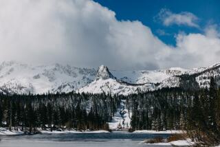
Spring continued to remain elusive Wednesday as a wintry storm dumped heavy snow in the mountains and whitened lawns in normally balmy places like Pasadena and La Canada Flintridge.
The National Weather Service reported more than a foot of snow atop Mt. Wilson as the storm finally began to move out Wednesday afternoon, giving way to on-again, off-again sunshine in Los Angeles.
“It’s pretty impressive to have that much snow in April,” said National Weather Service meteorologist Bruce Rockwell. “It’s been more like January, and even in January, we don’t often get that much.”
Hail pelted Laguna Beach, San Juan Capistrano, Chatsworth, Malibu, Del Mar and San Diego. On Interstate 5, just south of the Del Mar Racetrack, bewildered motorists inched along as the balls of ice bounced off their vehicles and piled up beside the roadway.
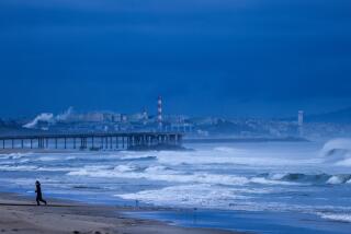
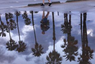
In other places there was rain--heavy at times and sometimes accompanied by thunder and lightning. There was enough of it Wednesday morning to trigger another rash of traffic accidents, snarling commuter traffic for the second day in a row.
A Postal Service worker, L.V. Hall, 68, of Rosamond, was killed when his truck skidded on slippery pavement and crashed on the Antelope Valley Freeway in Lancaster.
Forecasters said that after partly sunny weather this morning, there’s a chance of more showers tonight and Friday morning, along with a gradual warming trend.
They said the weather Saturday and Sunday should be pleasant. Although it might rain a little Sunday night, that storm system looks a lot warmer--”more like storms are supposed to be in April,” as one meteorologist put it.
It was cold enough in Los Angeles on Wednesday to set a record. After an overnight low at the Civic Center of 46 degrees, the thermometer crept up to a high of only 55--the coolest maximum temperature ever recorded for the date in downtown Los Angeles. The previous record of 57 was set in 1975.
The snow that fell late Tuesday and early Wednesday was quite localized. While the peaks overlooking Los Angeles were white as low as the 3,500-foot level, major mountain routes--such as Interstate 5 through the Tejon Pass near Gorman and Interstate 15 through the Cajon Pass above San Bernardino--remained open throughout the storm.
“It snows, and then the sun comes out. It snows and then the sun comes out,” said Cindy Williams, office manager at the California Highway Patrol office at Fort Tejon. “Nothing sticks.”
On the other hand, CHP Officer Roger LaVoire said he was looking out the window of his Lake Arrowhead office “at close to a foot and a half on the ground.”
LaVoire said that although there was only a little new snow on the ground at Big Bear Lake, plows had to clear more than a foot of it from roads leading to the mountain resort. Chains were required above 3,000 feet on dozens of roads in the San Gabriel, San Bernardino and San Jacinto mountains, including highways leading to the lake and to Riverside County resort communities like Idyllwild and Pine Cove.
Either snow or hail--depending on who was reporting it--frosted newly blooming roses in the San Rafael district of Pasadena and the higher slopes in La Canada Flintridge and Altadena. Whatever it was, it didn’t last long.
In the Riverside County community of Norco, the sleet was mixed with heavy, windblown rain. In between the dark, gloomy clouds, rainbows decorated brief patches of sunlight.
In most low-lying areas, the rain fell during the night, halted briefly and then resumed in earnest during the Wednesday morning rush hour.
The CHP said there were 127 accident calls between 5 and 9 a.m. on the highways and freeways it patrols in Los Angeles County. That’s about twice the normal number.
Guy Pearson, a meteorologist with WeatherData Inc., which provides forecasts for The Times, said the two-day storm stemmed from a shift in the high-altitude jet stream winds that funnel cold storm systems from the Gulf of Alaska into North America.
He said the dynamics that cause these winds to shift are not fully understood, but at present, the stream is split, with the northern part sagging farther south than usual, routing some of the systems directly into Southern California.
He said this pattern is expected to remain in place for a while, which means that Southern California could experience more wintry weather later this month.
The National Weather Service said that 0.39 of an inch of rain fell at the Los Angeles Civic Center in the 24-hour period ending at 4:30 p.m. Wednesday.
Other 24-hour storm totals as of 4:30 p.m. Wednesday included 0.96 of an inch in Temecula, 0.65 in Anaheim, 0.55 in Ontario, 0.33 in San Diego, 0.14 in Newport Beach and 0.08 in Palm Springs.
The rainfall in downtown Los Angeles raised the total for the season--which runs from July 1 through June 30--to 6.69 inches. Despite all the chilly, wet weather lately, that’s still less than half the normal season’s total for the date, which is 13.84 inches.
Meteorologists say the relative dearth of rain this season is the result of La Nina, the oceanographic and meteorological counterpoint in Southern California to last year’s drenching El Nino.
*
Times staff writers Kurt Streeter in the San Fernando Valley and Rene Lynch in Orange County contributed to this story.
More to Read
Sign up for Essential California
The most important California stories and recommendations in your inbox every morning.
You may occasionally receive promotional content from the Los Angeles Times.


