L.A. Gets Relief From Dry Spell
After more than two months without any rain, Los Angeles finally got some. Not a lot. At least, not right away.
A low-pressure system over northern Mexico spun off a few scattered sprinkles across Southern California on Friday evening. Eric Edge, a meteorologist with Weather Central, said there is a chance of light showers again Monday, with the possibility of more substantial rain toward the end of next week.
The last time measurable rain fell on Los Angeles was Oct. 29, when 0.53 of an inch was collected in the city’s official rain gauge at USC, raising the total for the season--which runs from July 1 through June 30--to 1.20 inches. That’s less than one-fourth of the normal season’s total by Jan. 5 of 5.24 inches, but it’s considerably more than the 0.84 of an inch that we had at this point last year.
Last year was the first since 1962 in which no measurable rain fell in November and December. November is often a fairly dry month in Southern California, but December is usually one of the wettest. In fact, the rainiest month since record keeping began in 1877 was December 1889, when 15.80 inches of precipitation fell on the city.
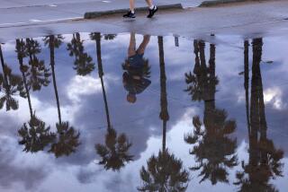
Sprinkles began dampening streets in the Los Angeles Basin shortly before nightfall Friday as moisture pushed north from Baja California. Heavier rain was reported in San Bernardino and Riverside counties. Forecasters said there could be a few more sprinkles in Los Angeles County this morning, with partial clearing this afternoon and Sunday.
Edge said a large low-pressure storm system from the northern Pacific should reach Southern California by Monday morning. Although the air over the Southland is so dry that most of the rain will evaporate before it hits the ground, he said, there still is a chance of measurable precipitation in Los Angeles on Monday afternoon.
Dry weather is forecast for Tuesday and Wednesday, but Edge said a more powerful Pacific storm system is expected to reach the coast by the end of next week.
Although that system has the potential to dump substantial rain on Southern California, he said it is still too early to predict the track that the storm will follow and how much rain it will bring.
Despite the arid start, forecasters say that Los Angeles could still have a fairly normal rainfall season. Last year, which began even drier, dryer, ended up with a total of more than 9 inches of rain.
(BEGIN TEXT OF INFOBOX / INFOGRAPHIC)
Change Is in the Air
A persistent high-pressure area over Utah has been responsible for the weather conditions from late November through early January: mostly sunny, morning fog, dry, above normal temperatures.
*
Winds from the high-pressure area blow toward Southern California through the mountains and valleys. This air warms and becomes drier as it descends toward the coastal regions.
*
By early next week, the ridge of high pressure will move east, causing a trough in the jet stream over the western U.S. and producing onshore winds. As a result, conditions will be cooler with more clouds and a chance of precipitation.
Source: Weather Central, Inc.
More to Read
Sign up for Essential California
The most important California stories and recommendations in your inbox every morning.
You may occasionally receive promotional content from the Los Angeles Times.


