6 ‘Irreplaceable’ Areas Get Monument Status
WASHINGTON — President Clinton will announce the establishment of six new national monuments today, giving special protections to the sites to prevent commercial development.
The Interior Department will impose restrictions on activities such as mining and logging and on the use of off-road vehicles, an administration source said Tuesday.
By designating the monuments, the president gives them protections that will extend beyond his administration, which ends Saturday.
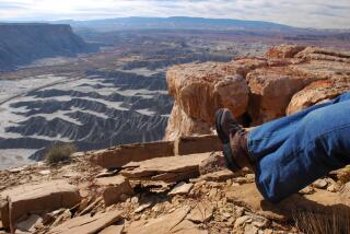
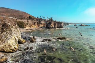
One of the sites is the Carrizo Plain, located in Central California just off the southwestern edge of the San Joaquin Valley, between San Luis Obispo and Bakersfield. The area includes 204,107 acres of federal land and is bisected by the San Andreas fault. It includes “critical habitats for the long-term survival” of many plant and animal species, according to a White House document describing the new protected areas.
By designating the sites as monuments, the president “will help safeguard the valuable ecology and history of these irreplaceable landscapes for future generations,” according to the White House.
The list of newly protected areas is the latest in a series of actions sought by environmentalists, and adopted by the Clinton administration in recent weeks as the president strives to leave a legacy.
The other newly designated sites are:
* Upper Missouri River Breaks, a region of 377,346 acres of land in central Montana. It ranges along 149 miles of the Upper Missouri River, the adjacent Breaks country and sections of Arrow Creek, Antelope Creek and the Judith River. This is “the only major portion of the Missouri River to be protected and preserved in its natural, free-flowing state,” the White House said. “It is also the premier segment of the Lewis & Clark National Historic Trail.”
* Pompeys Pillar landmark, 51 acres of federal land along the Yellowstone River in central Montana, 28 miles east of Billings. It is the only major sandstone formation in the area.
* Sonoran Desert monument, 486,149 acres of land in central Arizona. It includes mountain ranges, valleys and “large saguaro cactus forest communities that provide excellent habitats for a wide range of wildlife species,” according to the White House.
* Minidoka Internment National Monument, a 73-acre site in Jerome County in south-central Idaho. The monument includes portions of the Minidoka Relocation Center, where Japanese Americans were interned during World War II.
* Kasha-Katuwe Tent Rocks, a 4,148-acre site in north-central New Mexico near Santa Fe. Its elevations range from 5,560 to 6,760 feet above sea level. “Rich in pumice, ash and tuff deposits, the light-colored cone-shaped tent rock formations are the products of explosive volcanic eruptions that occurred between 6 and 7 million years ago,” the White House said in its fact sheet.
The Lewis and Clark expedition traveled along the Missouri River Breaks site, and Capt. William Clark, the expedition leader, carved his name in the sandstone rock at Pompeys Pillar.
More to Read
Sign up for Essential California
The most important California stories and recommendations in your inbox every morning.
You may occasionally receive promotional content from the Los Angeles Times.


