Summer Is Coolest Since ’87
It’s been the coolest summer in 14 years.
The National Weather Service said Friday that average temperatures during July and August were about 4 degrees below normal in downtown Los Angeles and about 1 1/2 degrees below normal in the San Fernando Valley.
“That’s not real dramatic, but it’s been enough so people notice,” said Tim McClung, a Weather Service meteorologist.
And it has helped to keep air conditioners turned off to avoid any more power blackouts in energy-conscious California.
There are several reasons why it’s been the coolest summer since 1987, but none of them has anything to do with such widely discussed meteorological phenomena as global warming or the expected return of El Nino this winter, McClung said.
“It’s just how the weather patterns set up,” he said.
McClung said the average temperature in downtown Los Angeles in July was 71 degrees, 3.9 degrees below the normal average of 74.9. The average in August was 72 degrees, 4 degrees below the average of 76.
The Valley average in July was 73.1 degrees, 2.8 degrees below the normal of 75.9. The average in August was 76.1, half a degree below the normal of 76.6.
These averages are computed by adding the maximum and minimum readings for each day, dividing by 2 and averaging the totals.
In one of those strange twists of meteorological irony, one of the main reasons it’s been cooler than usual is that it’s been hotter than usual in the desert. The inland heat sets up an interaction with the cool Pacific waters along the coast.
McClung said ocean temperatures off Southern California have been a couple of degrees cooler than usual this summer, and that has kept coastal air temperatures cool too.
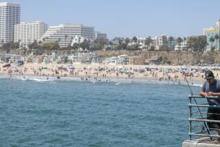
On Friday, the air and water temperatures at the beach in Santa Monica were in the upper 60s. On the other hand, temperatures have been soaring in the deserts. In Palm Springs, the thermometer peaked at 103 degrees Friday.
Cool air is denser than hot air, so air tends to flow from cooler areas to warmer areas. With a temperature differential often reaching 40 degrees or more, the onshore flow of cool, damp air from the Pacific has been especially persistent this summer.
On a lot of days, this dank air has been piling up against the coastal slopes of Southern California as fog and clouds. Morning sunshine starts burning away the overcast, but the closer to the coast, the later it has been before the skies begin to turn sunny and temperatures begin to rise.
This happens every year during June, hence the term “June gloom.” But this year, with the ocean water staying cool and the deserts heating up, we’ve had “July gloom” and “August gloom” too.
Compounding the effects of the onshore flow is a Southern California phenomenon known as the “Catalina eddy,” McClung said.
Winds tend to move down the West Coast in a generally southeast direction, paralleling the flow of the ocean’s Japanese current. Off Southern California, in the general area of Santa Catalina Island, those winds start encountering the persistent eastbound breezes that circle the globe north of the equator.
Lack of Monsoonal Air Has Cooling Effect
McClung said those breezes deflect the air flow in an arc that is intensified and tightened by the rotation of the Earth, strengthening the onshore movement of moist marine air into the Los Angeles Basin.
Another thing keeping us cooler than normal has been the lack of monsoonal weather systems that often pump warm, moist air from the tropics into Southern California at this time of year.
The days usually aren’t that much hotter than normal during these monsoonal flows, but things don’t cool off much at night, keeping the average temperatures high. The high humidity makes it feel even warmer.
Little change in the weather is expected this Labor Day weekend, which means skies will be mostly sunny by noon along the coast and downtown, and sunny almost all day in the inland valleys.
Temperatures are expected to remain slightly below normal, with top readings ranging from the upper 60s at the beach to about 90 in the warmest valleys.
The dwindling remains of former hurricane Flossie probably will peter out before reaching this far north, and there’s nothing else dramatic on the horizon.
“Look for a gradual cooling trend next week,” the Weather Service said.
More to Read
Sign up for Essential California
The most important California stories and recommendations in your inbox every morning.
You may occasionally receive promotional content from the Los Angeles Times.


