Cold Rain Expected to Sweep Southland
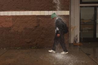
A chilly storm is expected to sweep rapidly through Southern California this afternoon, dropping moderate rain on the coastal valleys and some snow in the mountains before moving out, leaving behind some of the coldest temperatures of the winter.
The National Weather Service predicted about a fourth to half an inch of rain in the valleys and about twice that much in the foothills, enough to pose a slight chance of minor flooding and mudslides below slopes stripped bare in the fall wildfires. Meteorologists said there could be a few thundershowers near the mountains.
The snow level is predicted to start out at about 6,000 feet this morning, dropping to as low as 4,000 feet by Sunday morning. As much as a foot of snow could fall at the higher elevations, but forecasters said that little more than a dusting should occur at 4,000 feet.
Little, if any, disruption of traffic is expected in the Tejon and Cajon passes, which top out at close to 4,000 feet, but motorists were warned of slippery pavement and scattered pockets of dense fog.
Temperatures will drop into the 30s tonight in the coldest parts of the San Gabriel and San Fernando valleys after daytime highs in the 50s and 60s, the weather service said. The lowest readings in the mountains should be in the teens and 20s.
As skies clear, winds gusting to 40 mph could drive the wind-chill at higher mountain elevations below zero Sunday night.
Partly cloudy to mostly sunny weather with seasonably cool temperatures was forecast throughout the Southland for Monday through Friday.
In downtown Los Angeles, total rainfall for the season, which runs from July 1 through June 30, stood at 4.85 inches Friday, slightly below the normal total for the date of 4.91 inches.
Forecasts call for near normal rainfall through March.
More to Read
Sign up for Essential California
The most important California stories and recommendations in your inbox every morning.
You may occasionally receive promotional content from the Los Angeles Times.


