Hilary timeline: When will the storm hit? How bad will it get where I live?
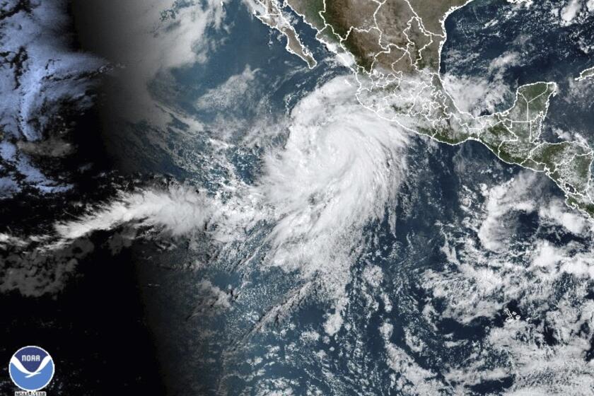
Tropical Storm Hilary is bringing the threat of heavy rains, flash flooding, high winds and intense surf to Southern California this weekend.
Forecasters said the storm will move through fast, with the biggest impact for Southern California on Sunday afternoon.
“The three biggest threats that we’re worried about, concerned about, that will probably cause the biggest impacts with Hurricane Hilary for Southern California is the wind, the flooding rains and the thunderstorms,” Ryan Kittell, a meteorologist with the National Weather Service in Oxnard, said Saturday.
Hilary is expected to remain at hurricane strength at the Baja California coastline, with authorities there bracing for damage.
Here’s what to expect:
Hurricane Hilary is moving toward Southern California. Here’s how to prepare and stay safe before and during the storm, heavy rain and potential flooding.
Overview
A flood watch is set to take effect along the California coast from San Diego to Ventura counties on Sunday evening and last through Monday night. Inland counties such as Riverside, San Bernardino and Imperial also will have a flood watch in effect through Monday. Rainfall amounts will vary significantly, with desert cities such as Palm Springs and Yuma, Ariz., expected to receive up to 5 inches in a matter of days.
Hurricane Hilary is headed toward San Diego and L.A., with about a 50-50 chance tropical storm-force winds hit SoCal. What to know and how to stay safe.
Here is a timeline of the storm:
Sunday
- Hilary hits with full force, with rain and heavy winds forecast for much of the day.
- Steady rain is now falling across the region, but officials are most concerned with inland valleys, desert and mountain areas.
- In Southern California, showers are likely and thunderstorms are possible.
- The storm could produce heavy rainfall in some areas, with the heaviest rain starting Sunday afternoon and increasing substantially from 6 p.m. to midnight in Los Angeles and Ventura counties. High temperatures will top out near 79 degrees.
- The Antelope Valley and mountain areas in L.A. County could see 3 to 7 inches of rain — with a rate of 1 to 2 inches of rain per hour on Sunday evening.
- By Sunday evening, the Antelope Valley — including Lancaster and Palmdale — will be the area of highest concern, with flooded roadways, and debris and mud flows possible.
- Any homeless encampments near rivers are in danger as creeks and rivers swell.
- Winds are expected to develop late Saturday, increase through the morning and peak Sunday afternoon. Valleys, including the Santa Clarita and Antelope Valleys, and the San Gabriel Mountains will see some of the strongest winds.
Monday
- Showers are likely and a thunderstorm is possible before noon, diminishing after noon. Skies will be cloudy, with a high near 73.
- Flash flooding, high surf and damaging winds are possible.
By 5 a.m. Hilary should pass out of California.
Coastal areas
- High surf (5-9 feet)
- Strong winds
- Dangerous rip currents
- Coastal flooding/beach erosion
- Dangerous conditions for south- and southeast-facing harbors
- Catalina Island could be affected
Deserts and mountains
- Intense rainfall in mountains, up to 10 inches in isolated areas
- Coachella Valley could see up to 5 inches of rain
- Flash flooding possible in some areas
- Five to seven inches of rain possible in Wrightwood, Big Bear and parts of Imperial County
Source: National Weather Service
More to Read
Sign up for Essential California
The most important California stories and recommendations in your inbox every morning.
You may occasionally receive promotional content from the Los Angeles Times.


