Slow-moving storm to bring heavy rain and flooding to Southern California before Christmas

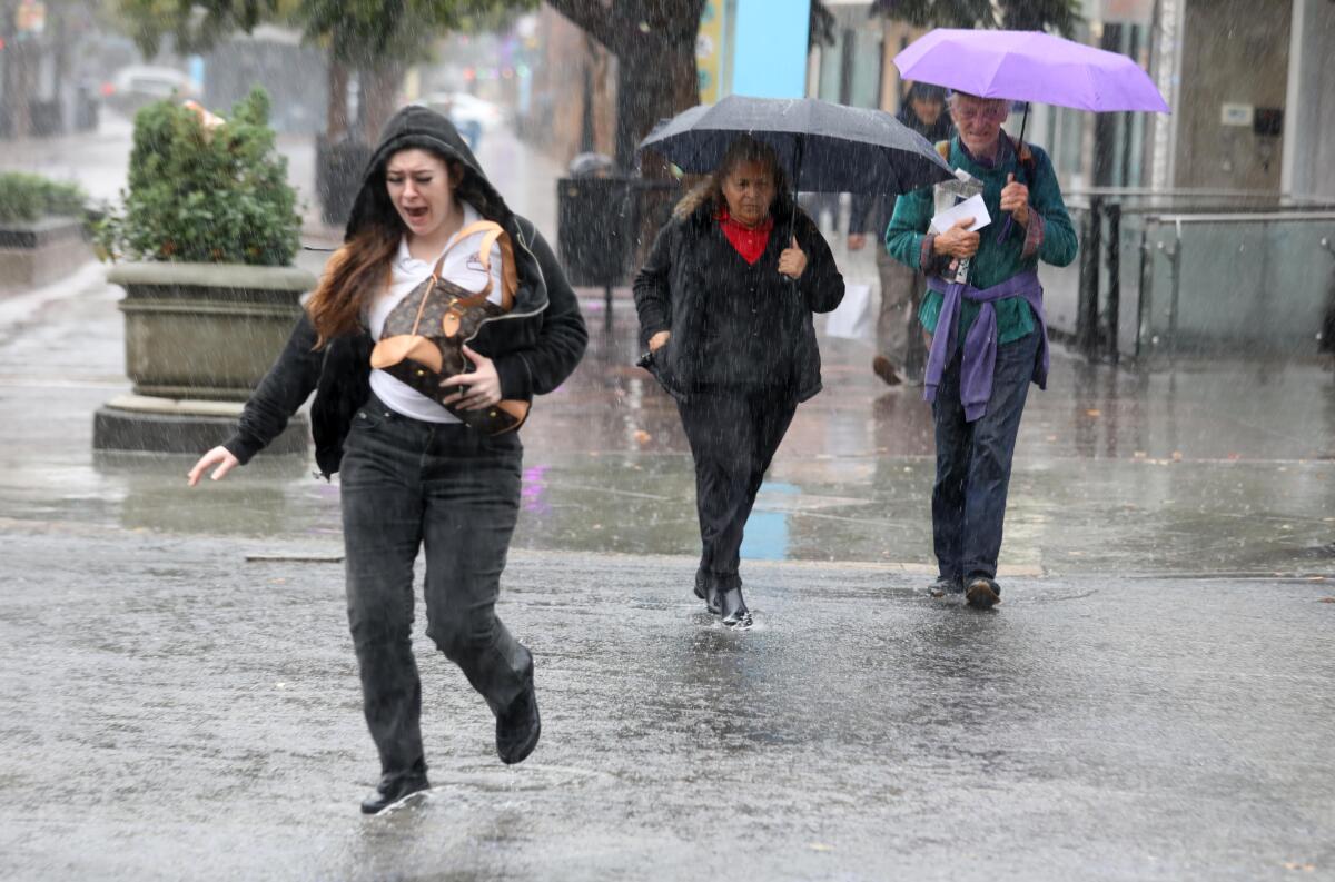
There is no snow in the forecast for Southern California this holiday season, but residents can expect heavy rain, thunderstorms, and flooding on roadways and creeks as a slow-moving winter storm system lingers over the region through Friday.
Forecasts predict that Christmas Eve and Christmas Day will be warmer and dry.
A tightly wound and well-defined low-pressure storm system about 300 miles off the San Francisco Bay Area is slowly making its way south, according to the National Weather Service.
Typically, winter storm systems are propelled by the Pacific jet stream, said meteorologist Ryan Kittell, of the National Weather Service in Oxnard. But this holiday low-pressure system is cut off from the stream and merely wobbling its way toward Southern California in a cyclonic flow.
The National Weather Service issued a special marine weather warning for the Central Coast on Wednesday morning due to the potential for water spouts and strong winds. There is a slight chance that the current conditions will cause a tornado or water spout between Point Conception in Santa Barbara County and Los Angeles County, according to the forecast.
There is a flood watch in effect for the next two days for most of Southern California. Residents in San Luis Obispo, Ventura, Santa Barbara and Los Angeles counties should be on the lookout for debris flows, flash flooding, general flooding and overflowing rivers, the National Weather Service said.
Are you in a flood zone? Here’s how to find out and some other safety tips.
Areas along the Santa Ynez and Santa Monica coastal ranges near isolated thunderstorms could see rainfall rates of an inch an hour Wednesday and Thursday. Other areas could expect to see 0.30 to 0.60 of an inch of rain per hour.
“It’s not a typical or classic winter storm that would drop rain for a few hours and then move along,” Kittell said.
The storm band stretching toward Southern California has drenched the San Francisco Bay Area for three days, leaving behind flooded roads, a few inches of rain and major delays for travelers.
The National Weather Service issued flood advisories for Alameda, San Francisco, San Mateo, Marin, Sonoma, Santa Clara and Santa Cruz counties, along with a portion of Contra Costa County.
Caltrans closed a portion of Interstate 80 near El Cerrito in Contra Costa County on Tuesday night due to flooding. Route 9 west of Saratoga in Santa Clara County was closed Wednesday morning due to a debris slide.
San Francisco International Airport delayed multiple flights on Tuesday and Wednesday due to rain and poor weather, the San Francisco Standard reported. More than 170 flights were delayed on Tuesday, and those interruptions carried over into Wednesday. Oakland International Airport and San Jose’s Mineta International Airport also saw delays.
The Oakland airport recorded 1.82 inches of rain, San Jose Mineta received 1.48 inches, and Monterey Regional Airport saw 1.67 inches over the same period.
The San Francisco-Embarcadero weather station recorded 2.9 inches of rain over the last 72 hours, according to the National Weather Service in the Bay Area.
“We’ll continue to see this band of moisture pass over the region throughout the day,” said meteorologist Alexis Clouser, with the National Weather Service in Monterey. “Overall, the area got a good amount of rain, and since it’s been so dry, it’s a good start to the water year.”
As the storm system makes its way south, it will meander down the coast and bring scattered showers farther inland. Thursday will see the start of a drying trend that will carry over into the weekend.
The brunt of the storm is forecast to hit San Luis Obispo, Santa Barbara and Ventura counties, according to the National Weather Service. Los Angeles County will also see heavy rain, but forecasters are uncertain if the area will get the same drenching as is expected for the counties farther north and west.
The storm is expected to bring flooding for most of the region through Thursday, according to the National Weather Service, which cautioned drivers to avoid roads that appear to be under water.
“Rain may be locally heavy at times, & numerous floods are likely,” the National Weather Service said in their social media channels. “Flash & urban flooding are expected, & debris/mud flows will be possible. Turn around, don’t drown!”
Southern California residents can expect showers throughout Friday, which will give way to gusty winds on Saturday and slightly warmer temperatures by Sunday, according to the forecast.
The slow-moving storm is also a bit warmer than average, Kittell said, dashing any hopes for snow below the 7,500-foot mark.
“It’s going to be cold, but not terribly cold,” Kittell said.
More to Read
Sign up for Essential California
The most important California stories and recommendations in your inbox every morning.
You may occasionally receive promotional content from the Los Angeles Times.


