How would a ‘smart wall’ work at the U.S.-Mexico border?

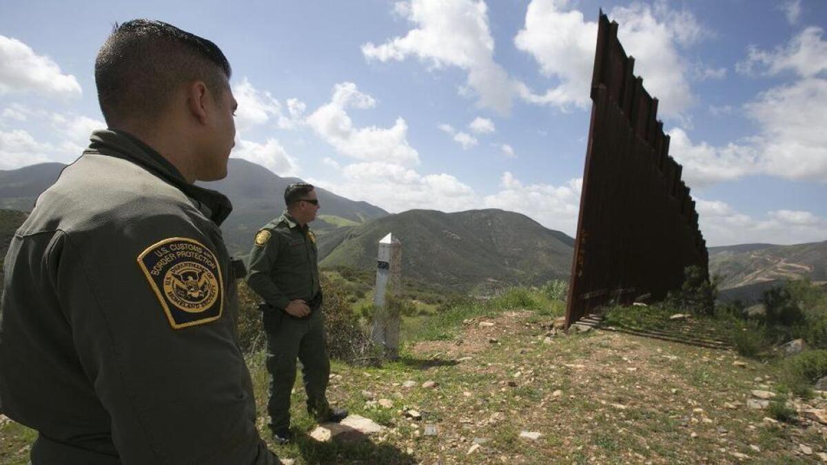
Reporting from San Diego — Deep in the Otay Mountain Wilderness, there is no wall.
The only boundary between the U.S. and Mexico is a section of barbed wire fence in a pastoral valley. And miles and miles of treacherous terrain.
It’s a territory crisscrossed by steep trails that disappear into tunnels of thick brush, a place looped by violently rutted roads that Border Patrol agents negotiate daily.
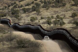
Land such as this is not a likely candidate for President Trump’s “big, beautiful wall.”
But it is fertile for an invisible kind of fence, one built of artificial intelligence, radar, drones, sensors, motion-activated cameras and even lidar, the same technology used in self-driving vehicles.
“Virtual walls” or “smart walls” along the southwest border are increasingly being billed as an alternative to the proposed concrete and steel barriers that have so sharply divided public opinion.
An electronic fence is not about preventing intrusion as much as it is about detecting intrusions and then intercepting them.
Although even the strongest proponents for such a technological solution admit physical barriers are likely best in urban areas such as San Diego and El Paso, they see a virtual wall as a cheaper and more effective way to police much of the rest of the 2,000-mile southwest border.
U.S. Customs and Border Protection has asked that $223 million of its fiscal 2019 budget focus on technology improvements, funding that could have bipartisan support.
But the increased focus on smart walls is deepening concern about a growing Big Brother-is-watching network, and civil liberties organizations have asked lawmakers to proceed with caution.
“Warrantless use of these technologies comes at an unacceptably high cost,” Neema Singh Guliani and Michelle Fraling, officials with the American Civil Liberties Union, said last month. “They allow the government to track, surveil and monitor individuals indiscriminately and with precise detail. Individuals in the border zone should not be subject to near-constant surveillance that intrudes on the most intimate aspects of their lives.”
Lessons learned
An electronic fence is not a new idea. It is one that the federal government has actually failed to implement wide-scale at least three times in the last few decades.
From 1997 to 2005, the government spent about $429 million on two border technology programs deemed unsuccessful, according to congressional reports.
The third and most recent iteration was the Secure Border Initiative Network, known as SBInet, a massive project started in 2006. Boeing was contracted to build a network of surveillance towers and ground sensors that would detect intrusions and relay the information to command posts, where agents would decide how to react.
It was rolled out first along the Arizona border, but expansion was halted in 2010 due to serious concerns about its feasibility.
The Government Accountability Office faulted SBInet for being poorly managed, overrun with costs and missed deadlines. The technology was also troubled, pulled off the shelves rather than custom-designed for the border environment and the job at hand.
The program was killed in 2011, at a price tag of more than $1 billion.
Instead of one technology system borderwide, we now follow a system customized to the particular conditions on the border.
— Alan Bersin, former U.S. Customs and Border Protection commissioner
“I terminated it when I was commissioner. It was a failure,” Alan Bersin recalled in an interview last week with the Union-Tribune. Bersin, a former U.S. attorney in San Diego, served as a so-called “border czar” under two presidents and was appointed U.S. Customs and Border Protection commissioner from 2010 to 2011.
Part of the problem, Bersin said, was pursuing a one-size-fits-all approach to the border.
“Instead of one technology system borderwide, we now follow a system customized to the particular conditions on the border,” Bersin said. “The setting up of an electronic fence in the Sonoran Arizona desert is far different than doing so around San Diego’s urban area.”
Aging technology
Even before SBInet was terminated, doubts about the program led authorities to redirect millions of dollars in funding to deploy other technology across the border. That included mobile and fixed surveillance towers, cameras, drones and thermal imaging devices.
Many of those systems are in use today, although they are aging — both physically and in concept as technology leaps forward.
To cope, Border Patrol sectors have largely focused on incremental improvements in a piecemeal strategy.
Evidence of that effort can be seen in the Border Patrol’s Brown Field Station east of San Diego, a 568-square-mile region stretching from Otay Mountain to Tecate, with 11 miles of international border.
Agents there typically spend a large amount of their time on the job investigating alerts from seismic sensors tripped by potential intruders. Problem is, the sensors are also tripped by rabbits, deer, the rain, other agents.
A sensor in a remote canyon could mean a two-hour hike, only to discover fresh mountain lion tracks nearby.
The recent addition of several motion-activated Buckeye cameras has helped tremendously, agents said. The camera takes a grainy snapshot immediately after being triggered, sending the information back to the Tactical Operations Center at the station for quick analysis.
The command post, better known as TOC (pronounced “talk”), monitors other surveillance, too. Radar returns predict the presence of suspicious activity and send images that can distinguish vehicles and people. An agent sitting at the computer can then direct a field agent to intercept.
The TOC also takes a high-tech approach to one of the Border Patrol’s most low-tech tactics — tracking “sign.”
Sign refers to the traces left behind by a person on the move, whether it be footprints, litter, broken branches or overturned rocks. Reading sign is how agents have done the job for decades, something unchanged by even the best technology, they say.
For instance, an agent who discovers fresh footprints from a group of people headed up a specific trail will report it to the TOC. The spot will be marked with GPS coordinates and updated as more sign is discovered. The information can be passed on to the next shift for continued tracking.
“The TOC can track a sign for two, three days,” said Border Patrol spokesman Fabian Carbajal, who has spent 13 years of his career patrolling Brown Field Station.
The future
The capabilities are a start, but innovators at many smaller firms have their sights set on technology that seemed futuristic not too long ago.
Quanergy, a Silicon Valley company that developed lidar for driverless vehicles, has been testing new laser technology in the Texas border town of Del Rio with the cooperation of a local sheriff, the New York Times reported. Laser sensors give a 3D view of an area, building on the existing technology already being used.
Anduril Industries, based in Orange County, is working to apply the power of artificial intelligence to national security settings. Its founder is Palmer Luckey, the entrepreneur behind the virtual-reality company Oculus.
“One of the big advantages to the use of AI-enabled technology is that you can deploy it without having to increase manpower,” said Matt Steckman, Anduril’s head of corporate and government affairs. “You get computers to do a lot of the work and let the humans be the decision-makers.”
Anduril’s system, called Lattice, uses hundreds or even thousands of sensors, then lets artificial intelligence scan the environment five times per second and interpret the results. Only meaningful results will be transmitted to an agent in the field, on a smartphone or tablet, in the form of a cropped image of the form. The agent can then decide how to respond.
Tech companies are also working to make devices more mobile, and therefore more nimble.
David Aguilar, former acting commissioner of U.S. Customs and Border Protection, said technology would unquestionably be a large part of securing the border — used in combination with physical barriers where appropriate as well as manpower.
He gave the example of SAR radar, being looked at to constantly map and remap a portion of land in remote areas to detect terrain change, such as a new trail or road implicating fresh trafficking routes.
“That’s good intelligence,” said Aguilar, who also served as Border Patrol chief, in a recent interview. “You can go in there, drop ground sensors in the area, fly a drone on a persistent basis or post tethered aerostats to watch that area.”
But he warned against viewing any one solution, including technology, as a silver bullet.
“There is no such thing. You’re never going to have a border that is going to be impenetrable. That’s just not going to happen. Does that mean we stop working toward it? No.”
David writes for the San Diego Union-Tribune
kristina.davis@sduniontribune.com
More to Read
Sign up for Essential California
The most important California stories and recommendations in your inbox every morning.
You may occasionally receive promotional content from the Los Angeles Times.


