‘Everything is blinding white’: Sierra storms pay off for resorts and add hope for drought

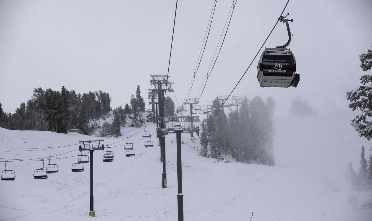
A fall Sierra Nevada storm dropped nearly a foot of snow at Mammoth Mountain and less in town in Mammoth Lakes earlier this month. A second storm dumped up to 36 inches of snow Sunday and Monday.
Alex Hoon was driving north from Mammoth Lakes on Tuesday, looking in awe at the decidedly winter landscape.
“Everything is blinding white … fresh white snow,” said Hoon, a meteorologist for the National Weather Service in Reno. “It was beautiful.”
A series of storms has left a large swath of the Sierra Nevada with a blanket of snow — something of a surreal sight after four years of drought. Social media filled with photos of snowplows, skiing and landmark peaks in Yosemite dusted with snow.
About 36 inches of snow was dumped on Mammoth’s summit in just two days, while folks at slightly lower elevations saw up to 20 inches of snow. Farther north, Lake Tahoe got as much as 12 inches of snow.
Forecasters said the heavy snow was from one of the biggest storms the region has seen in several years.
But welcome as it is, the early November dump of white means little in terms of building a hefty winter snowpack that could help ease the drought.
“The snow that typically will fall in November isn’t always the snow that lasts the entire winter,” said National Weather Service meteorologist Brooke Bingaman. “What we’re really going to rely on is the snowpack that falls in the second half of the winter, particularly January and February.”
The key date for California’s snowpack is five months away: April 1, when the mountain snowpack is customarily at its peak and state hydrologists know roughly how much water it will produce to help fill reservoirs in the spring and early summer. This year, the statewide snowpack on that date was an abysmal 5% of average, the lowest in more than 60 years of record-keeping.
The snowpack, technically the water content of snow, acts as nature’s reservoir, typically providing about a third of California’s water supply.
“We’d love to see a whole series of these, measured out tablespoon by tablespoon all winter long,” said Kelly Redmond, regional climatologist at the Western Regional Climate Center in Reno.
Extraordinary as it may seem after four years of drought, the snowfall accumulation of the recent Sierra Nevada storms is about average for this time of year, Bingaman said.
“Once we get into November, that’s when we get a more regular occurrence
of storms.... So far this month, it’s pretty much clockwork.”
Forecasters continue to predict a strong El Niño this winter, but the storms could be warmer, producing more rain than snow. Moreover, Redmond said, “it’s worth remembering, of the last four drought winters, two of them started out very promising: on the wet side and then just pooped out.”
“It’s a good teaser,” he said of the storm that draped the valleys near Reno with 18 inches of snow. “Even just an average winter would be great.”
Nonetheless, the snow is a boon for sports shops and ski resorts across the Sierra Nevada, but it’s too early to tell whether it’s a harbinger of a snowy winter closer to the historical average that could help California’s vital snowpack.
“It’s really too early to answer that.... We’re probably a little bit below normal,” said Karl Swanberg, a National Weather Service forecaster in Sacramento. “With the lowest snowpack on record last year, anything’s an improvement.”
Indeed, a combination of years of drought and media hype over an upcoming El Niño may magnify the attention to any precipitation as something other than normal, Swanberg said.
At Mammoth Lakes, ski and snowboarding slopes opened earlier than scheduled after a storm last week, said Rick Flamson, owner of Rick’s Sports Center, a mainstay for 25 years.
“If you believe the weather people — and I’m a little bit of a weather buff myself — it seems to me that, yes, we’re all very optimistic it’s going to be a better winter,” Flamson said. “Last year at this time, the ski area was just opening. I’m looking straight out this front door at the snow out there,” and he can imagine hotels will be booked this weekend.
But the storms also brought complications. Some areas were overwhelmed, and roads were closed temporarily, Hoon said.
Utility customers on the Nevada side of Lake Tahoe have been coping with a power outage after branches weighed down with snow snapped and took out electrical lines, Hoon said.
Nevada Energy said it was a severe storm that caused widespread power outages.
The storm also brought heavy rain to coastal areas of Northern California. In Monterey, San Benito, Santa Cruz and Santa Clara counties, more than an inch of rain fell in some areas. The Bay Area saw less rainfall but more than 500 lightning strikes.
For all the talk of El Niño, experts said the storm had the telltale signs of the routine seasonal systems that flow south from the northern Pacific.
Regardless, “we need moisture, no matter how it comes,” Swanberg said.
joseph.serna@latimes.com
Twitter: @JosephSerna
bettina.boxall@latimes.com
Twitter: @boxall
Times staff writers Matt Hamilton and Veronica Rocha contributed to this report.
ALSO:
Santa Ana winds, rising temperatures bring heightened wildfire risk
Puma found dead in Point Mugu State Park killed by rat poisons
Mammoth sees 20 inches of snow as storm wallops Sierra


