Did ‘First Americans’ come by way of Channel Islands? San Diego State to comb seafloor for clues

- Share via
Researchers plan to search the seafloor off Southern California for clues that could help answer two of the oldest and most contentious questions in science: When did the first modern humans arrive in the Americas? And did they initially spread south from Siberia by following ancient Pacific shorelines that are now covered by water?
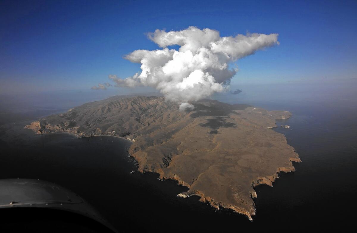
San Diego State and its partners will use sensors to look for areas in the northern Channel Islands that might have been human settlements thousands of years ago when the sea level was lower and the land was exposed.
Scientists said these “submerged cultural landscapes” might contain remnants of the tools that the “First Americans” used for fishing, hunting and boating, as well as sites where they cooked shellfish.
The $900,000 study, funded by a federal agency, is scheduled to unfold during the next four years. It represents the largest underwater archaeological expedition of its kind off Southern California.
See the most-read stories in Science this hour >>
It also underscores a grand mystery: Scientists are able to spot planets dozens of light years from Earth, but figuring out key details in human history remains elusive.
“We’re taking up fundamental questions about who we are and where we came from,” said Todd Braje, a San Diego State archaeologist who is helping to lead the project with Jillian Maloney, one of the school’s geoscientists.
“This is about human history and the human odyssey,” Braje added.
Scientists are confident that they have reconstructed part of the story.
It’s widely believed that Asia and North America were linked by a “land bridge” across the Bering Strait during the last Ice Age, when the sea level was hundreds of feet lower. The bridge, which is now covered by water, connected Siberia to Alaska and northwestern Canada.
Researchers theorize that humans crossed the bridge from Siberia to hunt for mastodons, mammoth and other large game. These First Americans used sharp projectiles to kill their prey.
But what route — or routes — did they follow into the Americas? Exactly when did they migrate to the New World? And did these settlers move in one migration, or in many?
Those questions remain unanswered, and exploring them has proved to be a humbling, acrimonious experience.
In the 1920s and ‘30s, stone spear points were discovered near Clovis, N.M., drawing intense interest from archaeologists. Scientists decided that these “Clovis points” were part of hunting spears used by the first settlers.
The thinking was that the settlers had traveled from Siberia into Canada, then moved southeast through an opening in the ice sheets, reaching the interior of North America. It is the foundation of the Clovis First theory, which asserts that the settlers arrived about 13,000 years ago. The theory became dogma as artifacts from Clovis culture were found in other parts of the Americas.
“Adherence to that view has become almost a litmus test for acceptance into” archaeology, Scientist magazine said in a retrospective.
But the theory slowly began to unravel in the 1970s when American researcher Tom Dillehay identified artifacts from a human settlement in Chile. Dillehay determined that the artifacts were at least 14,000 years old, predating Clovis culture.
Many scientists disagreed with his claim. But it turned out to be true, and researchers have since found other sites where the archaeological record suggests that settlers arrived before the Clovis people.
The findings include a site in southern Oregon that some scholars see as possible evidence that the First Americans originally traveled south along the Pacific coast, by foot and by boat.
San Diego State will explore the so-called Pacific coast migration model with funding from the U.S. Bureau of Ocean Energy Management, which protects marine assets on the West Coast.
“We don’t want to put anything in areas that are biologically or historically important,” said Dave Ball, an archaeologist with the bureau. “And we expect that there’s going to be interest in developing offshore renewable energy” off the West Coast.
The northern Channel Islands — San Miguel, Santa Rosa, Santa Cruz and Anacapa — were connected thousands of years ago, when the sea level was about 360 feet lower than it is today. Now, the islands are separate, and many ancient shorelines are submerged.
Even with advances in imaging and detection technology, Braje said finding traces of human settlements “will be harder than looking for a needle in a haystack.”
Shipborne researchers will use three types of sensors, including sidescan sonar, to take images of the seafloor and the rock layers below. These kinds of sensors are also used to search for earthquake faults and oil field deposits.
See more of our top stories on Facebook >>
San Diego State and its partners will initially focus on the seafloor between the Santa Rosa and Santa Cruz islands.
“If there are any landforms that have not been buried by sediment, we would be able to observe them with these data,” Maloney said. “The combination of ... these types of data help us to understand how the coastal environmental has changed through time, from the glacial period low sea level all the way up to modern sea level.”
The scientists will be able to take small core samples of the seafloor if they spot areas that may have been human settlements.
Braje, 39, is excited but circumspect, saying: “It’s possible that by the time I retire, we’ll still only have a general idea of how the first humans settled the Americas.”
gary.robbins@sduniontribune.com
Twitter: @grobbins
Robbins writes for the San Diego Union-Tribune.
ALSO
Losing a partner can literally break your heart
Hot Jupiter! Astronomers discover giant planet with three shining suns
This ‘Kite Runner’ arthopod kept its young tethered to its body with strings


