Flooding Mississippi submerges Memphis waterfront
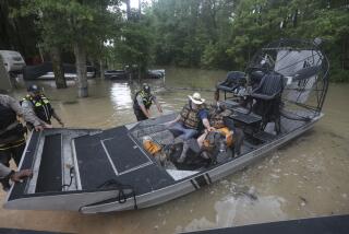
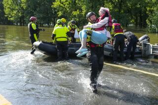
Reporting from Memphis — The Mississippi River began cresting and hit nearly 48 feet early Tuesday, falling short of a record but wreaking havoc across Arkansas, Tennessee and Mississippi as tributaries and creeks swollen from the flooded waterway spilled over their banks into residential, business and farming areas.
At 7 a.m. Central time Tuesday the water level reached 47.87 feet as the coffee-colored river cut through Memphis, swallowing much of the riverfront recreation area. The tourist riverboat Capt. John T. Lozier, usually about 30 feet from the riverside street, bobbed just a few feet from where onlookers gathered to take pictures and gape at the yawning river. The cobblestone walkway that runs parallel to the street was under water, as were no-parking signs, trash cans, the plank leading to the riverboat, and large swaths of Mud Island, just off the coast of downtown. Only a small mound of grass, with state, federal and local flags flying from their poles, was visible from the downtown area Tuesday as the bike paths, walkways and long grassy stretches of the recreational area remained submerged.
“I’ve seen it up a few times, but I’ve lived here 57 years and I’ve never seen it this high,” said Randall Cain, who came early Tuesday to take pictures of the flooding. Looking at the tourist boat a few feet from the river’s edge, Cain said, “It’s usually way out in the water.”
Photos: Mississippi River flooding
It was unclear if the water would rise further. At a morning news briefing, Bob Nations, director of the Shelby County Office of Preparedness in Memphis, said officials were “fairly confident” that the river had reached its peak in the city but he said the cresting was “an ‘ing’ thing” and that the water could go higher. “Right now we’re below record, thank goodness,” he said, alluding to the 1937 floods that occurred when the Mississippi crested at 48.7 feet. “But I say that with a lot of caution.”
Nations said it could be several days before water levels go down. “People have to understand that we consider this still a bit unpredictable but definitely a dangerous environment. It’s not the time for citizens to necessarily start cleaning up. It’s just a time for great patience.”
Dangers included power lines submerged in floodwaters, a situation that caused officials to cut power to about 1,500 people in Memphis to prevent electrocution. “What it all boils down to … is that’s a very dangerous situation,” said Callen Hays, a crisis management coordinator at Memphis’ Light, Gas and Water Division. Hays compared the potential catastrophe to being in a bathtub and having someone “throw a toaster into it.”
Cain also warned that the floods probably had sent wildlife, ranging from deer to some dangerous snakes, inland, making it more important for the hundreds of evacuees from low-lying areas to be cautious when they return home. It was unclear when that might be, though. In Dyer County, one of the hardest-hit areas, James Medling, director of emergency management, said the river would need to drop eight or nine feet before things returned to normal. “It’s going to be a while yet,” he said.
There was no danger to Memphis’ major tourist draws, such as Graceland, which lies far beyond the water’s reach, and much of the city appeared normal. Levees built to prevent massive flooding were holding, according to the Army Corps of Engineers on Tuesday. Shelby County and four others were declared disaster areas by President Obama late Monday. The designation means that they’ll be eligible for federal disaster aid, which local officials say is much-needed.
Cleanup was expected to be massive, and there were fears that farmland and cities further south could yet be devastated. Inmates in Louisiana’s largest prison were taken to higher ground, and farmers were building homemade levees to protect their crops. Engineers diverted water into Lake Pontchartrain to ease the pressure on levees around New Orleans, where levee failures after Hurricane Katrina virtually drowned the city.
The flooding is the result of heavy rains recently and unusually heavy snow over the winter further north that began melting and adding to the already swollen Mississippi.
Photos: Mississippi River flooding
Times wire services were used in compiling this report.
More to Read
Sign up for Essential California
The most important California stories and recommendations in your inbox every morning.
You may occasionally receive promotional content from the Los Angeles Times.


