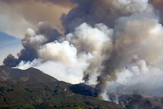
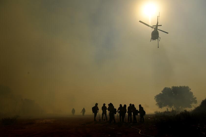
Northern California braces for fire weather as Southland expects rain — those events are related
Dangerous fire weather is returning to broad swaths of Northern California at the same time as Southern California is expecting its first winter storm of the season to produce widespread rain.
And the two events are related.
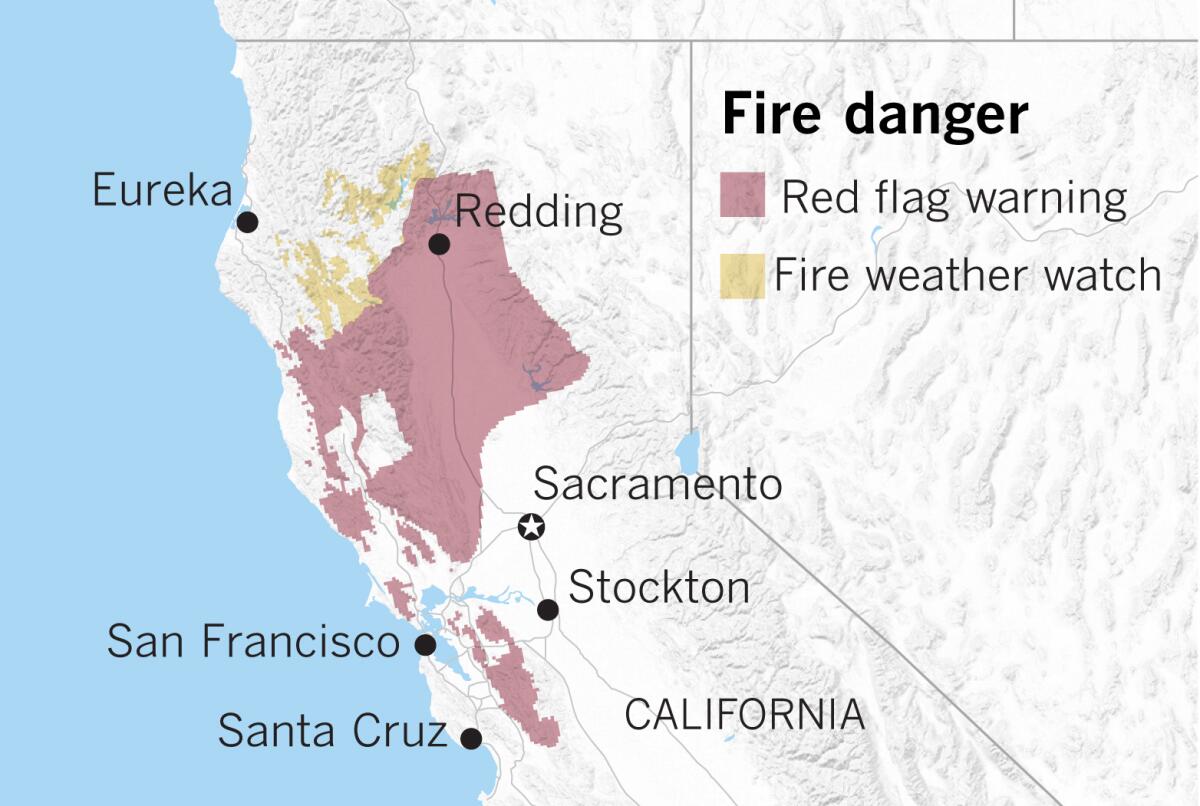
Red flag warnings sounding the alarm for fire weather for parts of the Bay Area and northern Sacramento Valley will go into effect from 4 a.m. Wednesday through 7 a.m. Thursday for strong, dry winds coming from the north and northeast. Velocities of 20 to 30 mph are expected, with gusts as high as 45 mph and perhaps in excess of 60 mph near such locations as Mt. St. Helena and Mt. Diablo.
This bout of fire weather “will not be anywhere as strong as the Red Flag Warning event in late October,” National Weather Service meteorologists said. But the concern was high enough that Pacific Gas & Electric Co. notified hundreds of thousands customers that it may shut off power in parts of 22 counties in the Sierra foothills, North Bay, East Bay and Santa Cruz Mountains starting Wednesday morning, aiming to prevent dry, windy conditions from damaging utility equipment and igniting a fire.
Meanwhile, in Southern California, showers will begin to develop Tuesday and become more widespread on Wednesday. Pasadena and Long Beach could see ¼ inch to ½ inch of rain; Orange and San Diego counties are likely to get most of the rain from the system, as much as 1 inch.
The drama begins Tuesday when high pressure over California will weaken as a low-pressure system moves down along the coast into California from the north. At the same time, a low-pressure system off the Baja California coast will move off to the northeast. As it moves, it is likely to pull moisture from the remnants of Tropical Storm Raymond into the southwest U.S. That moisture is initially expected to mainly affect northern Baja, California’s eastern deserts and Arizona.
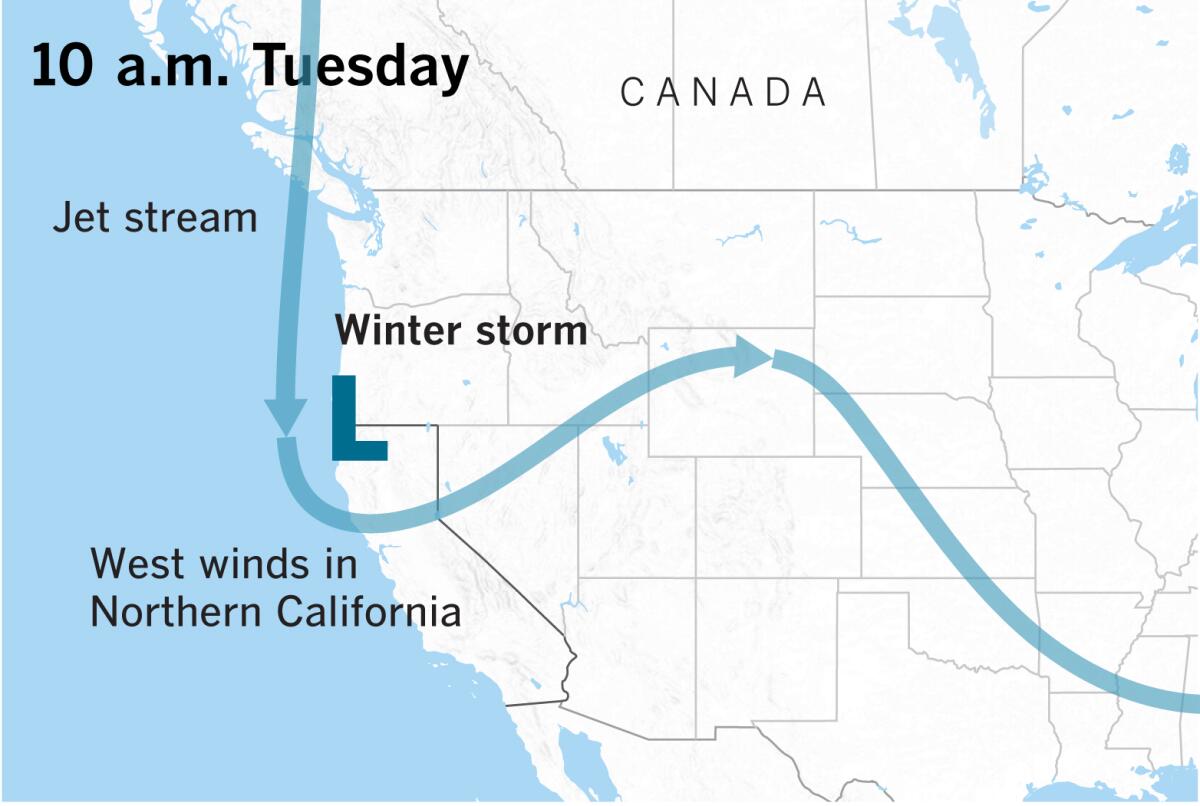
The cold air from the low moving down the coast from the north will mix with tropical moisture on Wednesday, and the storm center will settle over Riverside County. Thunderstorms could develop because cold air aloft will increase the instability.
As this happens, strong winds from the north and northeast will kick up in Northern California as a result of the position of the low and the jet stream’s powerful support aloft.
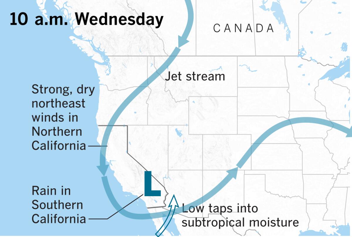
Northern California will miss out on this rainstorm. Dry conditions will continue there through the rest of the week, and winds will diminish during the day on Thursday.
In Southern California, the majority of the precipitation from the storm will fall on Wednesday into early Thursday morning, with showers lingering on Thursday.
Snow levels will start falling at an elevation 10,000 feet above sea level on Tuesday evening, but then are expected to lower to 6,000 feet by Wednesday evening. Elevations above 7,000 feet could get 6 to 10 inches, and elevations from 6,000 to 6,500 feet could get 1 to 2 inches.
Flash flood watches will be in effect in the mountains of Orange, Riverside, San Bernardino and San Diego counties.
Rainfall of this kind can wet down tinder-dry vegetation, making wildfires a little less likely in coming weeks.
Dry weather and gradually rising temperatures will return to Southern California late in the week.
More to Read
Sign up for Essential California
The most important California stories and recommendations in your inbox every morning.
You may occasionally receive promotional content from the Los Angeles Times.
