There’s rain in the weekend forecast but not enough to help the snowpack

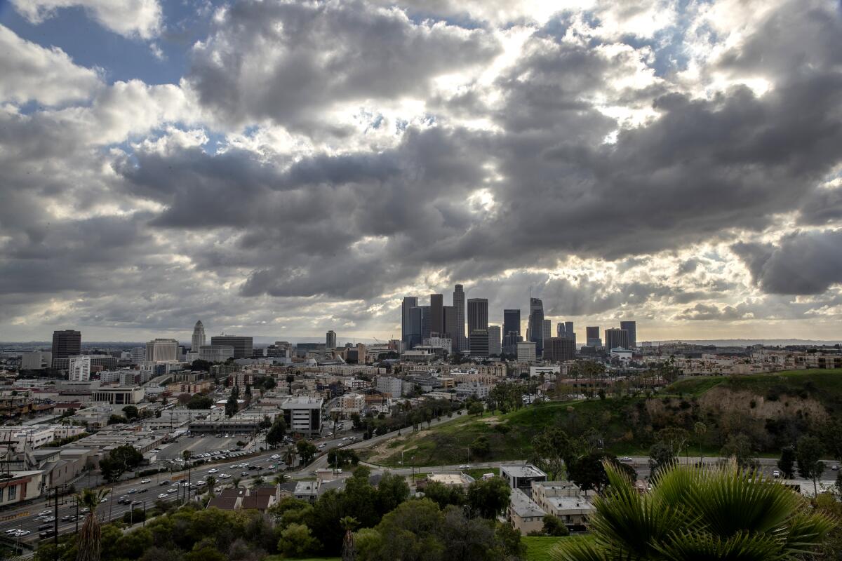
A smattering of rain is forecast for portions of California this week, including precipitation from a small storm expected to arrive late Friday. Still, the state’s parched winter appears to be continuing, with unusually dry conditions expanding across a wider swath of the landscape.
A report released by the U.S. Drought Monitor on Thursday shows that nearly 60% of the state — including much of Northern California and portions of the Central Coast and Los Angeles County — is considered abnormally dry, up from 46% last week. The amount of the state considered to be in a moderate drought remains at 9.5%.
Although precipitation in November and December provided a solid start to winter across the state, a persistent high-pressure ridge hovering over the eastern Pacific Ocean has kept wet weather at bay for much of January and early February, said Joe Sirard, a meteorologist with the National Weather Service in Oxnard.
The ridge has recently shifted to the west, which has allowed a small storm to creep off the California coast. That system, which is expected to hit portions of Central and Southern California by late Friday, could provide some of the first measurable rain in Los Angeles County this month.
The storm is predicted to drop one-tenth to a quarter of an inch of rain on the coasts and valleys and up to half an inch in the mountains. But it won’t be enough to make up for the winter rain deficit, Sirard said.
Typically, downtown Los Angeles receives 6.92 inches of rain in January and February. This year, downtown L.A. got 0.32 inches of rain in January. So far in February — typically the wettest month of the year — the area has received just a trace amount of precipitation.
The total seasonal rainfall so far in downtown L.A. is also more than an inch below normal, coming in at just 7.28 inches, data show.
“We’re running way, way, way below normal for the winter,” Sirard said. “We’re going to need a wet March to get us back to even close to normal. With the way this winter’s going, I’m not too optimistic about that.”
The latest storm, which will miss large swaths of Northern California entirely, also isn’t expected to generate much snow for the Sierra Nevada, aside from the possibility of a light dusting in the southern section.
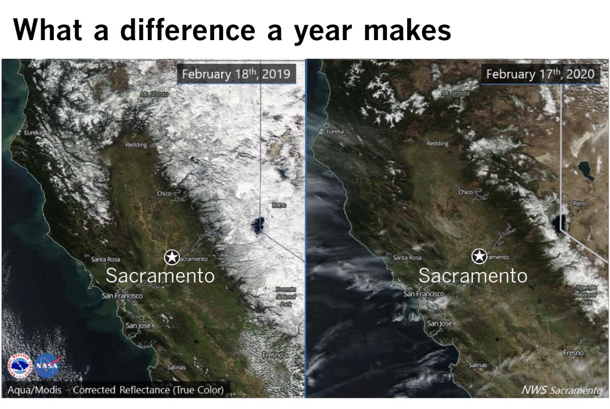
The lack of rain has taken its toll on the Sierra snowpack, a key source of the state’s water supply. As of Wednesday, the statewide snowpack measured 53% of average for the time of year. At roughly the same time last year, the snowpack measured 153% of average.
Two satellite photos released by the National Weather Service in Sacramento this week show the stark difference in the snowy layer from last winter to the current one.

In the image above, the Sierra Nevada is shown, at left, blanketed with snow on Feb. 18, 2019. At right, the same portion of California is shown, with scant snow cover, on Feb. 17 of this year.
The snow season typically begins in December and ends on the first day of April, when the snowpack is normally at its highest. How much snow falls during this period is critical to California’s annual water outlook and is watched closely by state water managers.
Last year at this time, the northern Sierra had a snowpack that was 129% of normal for the date. This year, the snowpack in the northern Sierra stands at 58% of normal.
Last winter’s snowpack was bolstered significantly by a series of atmospheric rivers that pounded the state with precipitation. This year, the high-pressure ridge has blocked any significant storm activity from hitting California.
The snowpack provides about 30% of the annual freshwater supply for the state. Its spring and summer runoff feeds rivers and reservoirs, and part of it is distributed to water agencies for farm irrigation, landscaping and urban drinking supplies.
The good news, officials say, is that the state’s reservoirs, including Folsom Lake and Shasta Lake, are near or above their averages for this time of year, thanks in part to solid rainfall last winter.
Precipitation figures suggest that California has been locked in a two-decade drought, according to climate scientist Bill Patzert. Measurements of rainfall in downtown L.A. showed 14 years from 1999 through 2019 that were below the 143-year average, although there were a few wet years interspersed during that period.
“I think of droughts in the long term, not year to year. Droughts tend to be long, they tend to be large and they wax and wane,” Patzert told the Los Angeles Times last week. “The other thing is, they fool you. You think you’re out, and they pull you back in.”
More to Read
Sign up for Essential California
The most important California stories and recommendations in your inbox every morning.
You may occasionally receive promotional content from the Los Angeles Times.


