Before disastrous flood, officials knew Pajaro River levee could fail but took no action
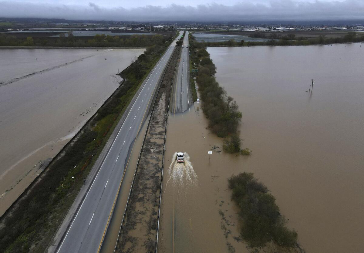
WATSONVILLE, Calif. — Officials had known for decades that the Pajaro River levee that failed this weekend — flooding an entire migrant town and trapping scores of residents — was vulnerable but never prioritized repairs in part because they believed it did not make financial sense to protect the low-income area, interviews and records show.
“It was pretty much recognized by the early ‘60s that the levees were probably not adequate for the water that that system gets,” Stu Townsley, the U.S. Army Corps of Engineers’ deputy district engineer for project management for the San Francisco region, told The Times on Sunday.
And despite having studied it on and off for years, in terms of “benefit-cost ratios,” it never penciled out, he said.
“It’s a low-income area. It’s largely farmworkers that live in the town of Pajaro,” Townsley said. “Therefore, you get basically Bay Area construction costs but the value of property isn’t all that high.”
The levee was built in 1949 and, according to a 2021 Army Corps webpage summary of the system, “no longer provides the designed level of protection.”
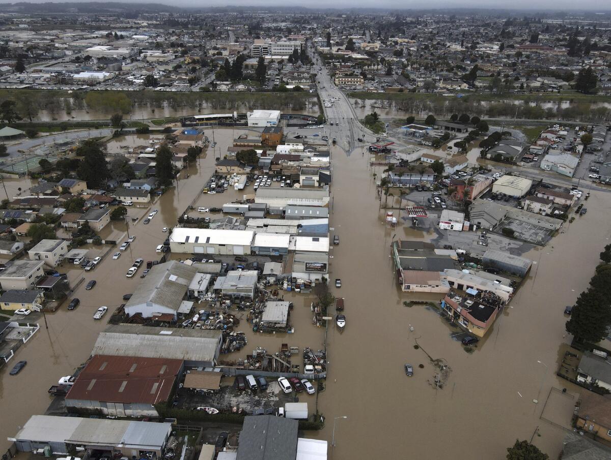
Flooding has occurred five times since it was completed, including a breaching event in 1995 in which two people drowned and economic damage was estimated to range between $50 million and $95 million. Flooding occurred again in 1997, and in 1998 President Clinton issued a disaster declaration. More recently, there was a near-flooding event in 2017 and again this past January, when Pajaro residents were evacuated for one week.
But three years ago, “as part of the overall environmental justice resetting of the federal government Corps of Engineers, OMB, Congress, all recognized that if you exclusively looked at benefit-cost ratios you wouldn’t fund projects in areas that were typically lower-income,” Townsley said.
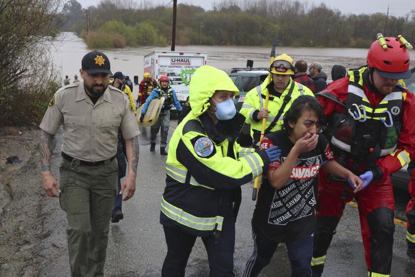
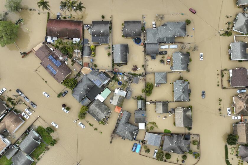
A levee failure on the Pajaro River in Monterey County triggered massive flooding and prompted hundreds of evacuations and dozens of water rescues.
So the Corps initiated a study that resulted in a report demonstrating “there would be some value for life safety, even though the project benefit-cost ratio was pretty close to unity for the costs to equal the benefits,” he said.
And they’re currently designing a system they’re hoping to move into construction in the next two years, he said, funded by the Infrastructure Jobs Act and state money — secured by a 2021 bill that directed the Department of Water Resources to pay 100% of the state’s cost for reconstruction of the Pajaro/Watsonville levee system.
“It’s tragic that we got this just before we’re starting construction,” Townsley said, referring to the breach and flooding.
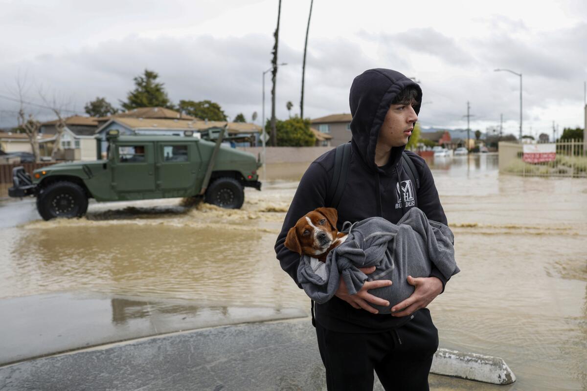
The region is bracing for another round of rain beginning Monday, bringing more flood concerns as officials continue to assess damage from the weekend storm. More than 5,000 people in Monterey County remained under an evacuation order or warning on Sunday, with more than 200 people sheltering at the Santa Cruz County Fairgrounds and a Salinas church.
“Low-income neighborhoods and communities have always historically been ignored by state and federal governments,” said Monterey County Supervisor Luis Alejo.
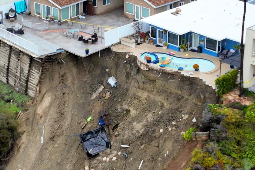
California continues to deal with damage from March storms: surging rivers, mudslides, breached levees and displacement in flooded towns.
“The story of Pajaro is exactly that. There was a lack of commitment by our federal and state governments,” he said. “The residents have never felt they had that kind of support, knowing that the danger, the risk, has always been there.”
Farshid Vahedifard, a professor of civil and environmental engineering at Mississippi State University, said communities living near levees are often underserved or economically disadvantaged.
City, local and state governments “have a historic, you know, a long track record of discrimination when it comes to levees. They are a good example of infrastructure equity issues that we have been dealing with for decades,” he said.
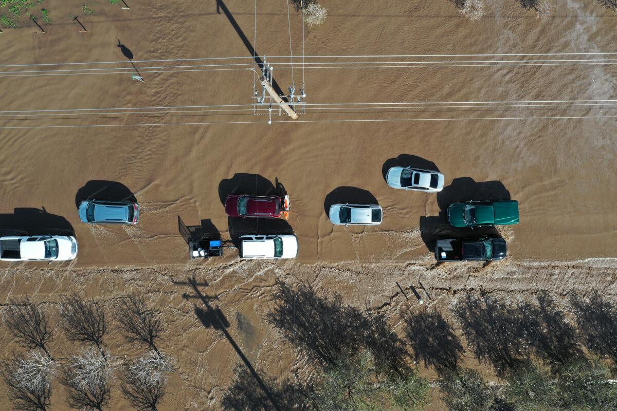
Flash flood warnings remain in effect for parts of Santa Cruz, Monterey, Tulare and Sonoma counties, according to the National Weather Service.
In a recent paper, Vahedifard noted that inland floods had caused 624 fatalities in the U.S. and $164 billion in damages “that disproportionately affect disadvantaged communities.”
Pajaro is in unincorporated Monterey County. Although it’s across the river from Watsonville and in a diferent county, the two communities share a ZIP Code. Pajaro does not have its own post office.
According to Alfredo Torres, a Watsonville resident who grew up in Pajaro, the smaller Monterey County town is considered the backwater of the area.
“It doesn’t have the urban amenities of Watsonville,” he said, and because it’s in an unincorporated area, public services — such as law enforcement — are pretty minimal.
Watsonville’s population is close to 53,000; Pajaro’s is roughly 3,000.
On Saturday, most of the Pajaro evacuees at the Santa Cruz County Fairgrounds were primarily Spanish-speaking. Andres Garcia, a Pajaro resident, said many are migrant farmworkers who work in the nearby strawberry farms.
Alejo said both communities are economically disadvantaged, which is why historically so little effort was made to reinforce the levee. Per-capita income in the two communities is less than half the state and national average.
He said that also made it difficult for the cities to pay for the levee repairs.
Although the Army Corps had close to $150 million in federal funding, state and local communities were required to foot 50% of the cost, of which up to 70% was the state’s responsibility. The rest fell on local communities.
“That was difficult, because that’s tens of millions of dollars that local, low-income families could never afford,” Alejo said.
In 2021, Sen. John Laird (D-Santa Cruz) authored a bill requiring the state to completely fund the project. This past fall, Laird and others held a ceremony celebrating the funding of the levee project.
“I said some version of ‘I hope to God it doesn’t rain before this gets done,’” he said.
Laird has worked for years to get funding to repair the system. He said he was a county staffer in 1995 when the river flooded and spent several nights at the fairgrounds “where many of the same families that are being evacuated this time.”
According to county officials, the state is trying to plug the breach — which has grown to 120 feet — with granite boulders.
A successful plug, however, comes with risks, Townsley said.
“This next wave [of weather] coming in is going to put additional pressure on the system and so you’re in this weird spot where the breach actually reduces pressure on the Watsonville side,” he said. “Once again, the lowest-income community is now bearing the brunt ...”
It’s not just an issue for Santa Cruz and Monterey counties. Scientific research shows global warming is intensifying the water cycle and is projected to unleash more extreme storms, worsening flood dangers.
California emergency officials said Sunday they were already coordinating plans to position flood-fighting personnel, including swift water rescue teams, ahead of the next storm.
“We’re mapping where the next storm is going to hit and putting resources” — firefighters, National Guard crews, high-water vehicles — “in areas where the storm is going to be most severe or where there are already rivers that are swollen, so that if something does happen, you can quickly get in and rescue people,” said Brian Ferguson, spokesperson for the Governor’s Office of Emergency Services.
A recent state flood protection plan for the Central Valley says catastrophic flooding would threaten millions of Californians, putting many areas underwater and causing death and destruction on an unprecedented scale. The damage could total as much as $1 trillion.
The plan calls for $25 billion to $30 billion in investments over the next 30 years in the Central Valley, with recommendations that range from strengthening levees to restoring natural floodplains along rivers.
The plan says state agencies are “working toward unifying an approach to understanding and addressing equity and social justice through flood management programs,” and “recognize that a Central Valley-focused investigation into how inequity and injustices influence flood management is still needed.”
“The last time there was a flood through here was in ‘95, and there was talk then of doing things” to address the levee, said Glenn Church, a member of the Monterey County Board of Supervisors. He sighed. “Government moves sometimes kind of slow.
“It would have been great if all this could have been done sooner,” Church said. “But I’m just glad to see that there’s finally some permanent solutions being put in place for dealing with this, so we don’t have to deal with this every 10 or 20 years.”
Times staff writers Emily Alpert Reyes, Ian James and Hannah Fry contributed to this report.
More to Read
Sign up for Essential California
The most important California stories and recommendations in your inbox every morning.
You may occasionally receive promotional content from the Los Angeles Times.
