Southern California has baked for much of July, but the heat could finally ease soon

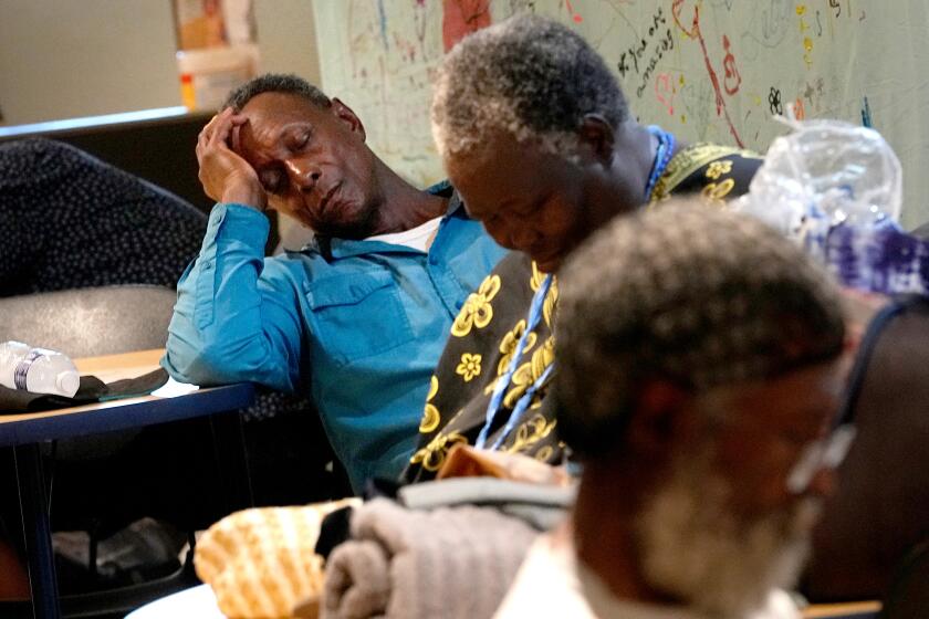
Much of Southern California has spent almost all of July under heat advisories, breaking multiple high-temperature records, but as the month enters its final days, some relief could be in store.
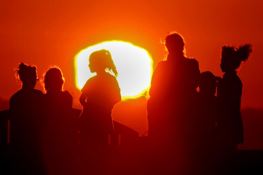
For more than two weeks straight, a heat dome has broiled the region with triple-digit temperatures as an unrelenting ridge of high pressure lingers over the Southwest, a stifling reminder that extreme heat events are only expected to increase in frequency and duration against the backdrop of human-caused climate change.
But after this weekend, forecasters say, the warm weather should feel a bit more bearable.
“Today’s going to be the last of really high heat for the L.A. Basin,” Joe Sirard, a National Weather Service meteorologist in Oxnard, said Friday. “Finally we’re going to get a break, thankfully.”
The extreme heat wave is a worrisome indication of a climate gone haywire as the arrival of El Niño meets with human-caused climate change.
As the weekend progresses, forecasts show a slight dip in temperatures from dangerous highs for the region’s valleys, mountains and deserts — though officials are warning it will still be hot — with more significant cooling to begin Monday.
“It’s still going to be a hot weekend for the valleys and mountains,” Sirard said, with highs Saturday and Sunday expected to reach 105 in the Antelope Valley and into the mid-90s to low 100s in other L.A. County valleys and mountains. Much of the region’s coastline will remain cooler, with a marine layer continuing to ward off the stifling heat.
A heat advisory remains in effect through Friday night for much of inland southwestern California, warning of highs up to 108 in the valleys.
By Tuesday, though, forecasts show the hottest areas falling into the high 80s and lower 90s — unlikely to be described as cool, but still a welcome change.
Huge swaths of the U.S., including California, are expected to see warmer-than-average temperatures in August, government forecasters say.
“We’re actually going to get into a period midweek where we’re going to have below-normal temperatures for this time of year,” Sirard said. “It will feel cooler because we’ve been so hot for so many days.”
The long bout of heat has been driven by the stationary ridge of high pressure, which pushes down and warms the air. It’s also a worrisome sign that Earth’s climate has been radically altered by human behavior colliding with the onset of El Niño, some experts say. This month is shaping up to be the planet’s hottest on record.
“We would not see the kinds of temperatures globally that we’re seeing without climate change — it’s virtually impossible to explain these changes in the absence of climate change,” said Katharine Jacobs, director of the Center for Climate Adaptation Science and Solutions at the University of Arizona.
El Niño, which officially arrived in June, is a recurring climate pattern in the tropical Pacific that is typically associated with higher global temperatures, and it has contributed to the exceptional heat in the Southwest, Jacobs said.
Las Vegas and Phoenix have always endured broiling summers, but the scale and duration of this heat wave has brought new levels of misery.
In downtown L.A., temperatures have remained above normal since at least July 12, Sirard said. Woodland Hills recorded its 15th consecutive day with temperatures above 100 degrees Friday, breaking the 14-day record span set in 2012. On Thursday, Lancaster broke a daily temperature record, reaching 108 degrees.
Across the Central Valley, highs have been at or above 100 degrees for most of the month. As of Friday, Fresno had reached that mark for 16 straight days, a trend likely to extend through the weekend — though not anywhere close to record-setting, said National Weather Service meteorologist David Spector in Hanford, Calif. That region is also expecting a cooling trend in the coming days, with below-normal temperatures expected by midweek.
Even Las Vegas and Phoenix — which have baked at more extreme temperatures longer than California — now have some relief on the horizon. Temperatures in those cities are expected to fall next week, with a chance of thunderstorms and rainfall helping cool the area.
“We’re seeing the upper-level ridge of high pressure that has been persistent over our area moving off to the east,” Sirard said. In Southern California, a new upper-level trough is expected to move into the area by the end of the weekend, which will help cool things off, along with an increased onshore flow from the ocean.
California’s first heat wave of the year could last into next week. Here are some tips on how to stay safe and cool during hot weather.
Monday could also bring a chance for some showers and thunderstorms in the area, especially in the eastern San Gabriel Valley and mountains.
The cooling should last through the end of next week, Sirard said, but it’s unclear whether it will stick around much longer. Climate predictions for August have forecast above-average temperatures for much of California.
Even with noticeable drops in temperatures, Sirard warned that people still need to use caution in the heat, especially if working or recreating outside this weekend. He recommended avoiding the sun during the heat of the day, staying in an air-conditioned location when possible and waiting until cooler temperatures for hiking.
“It’s still very hot. People still need to be using common sense in the heat: drink plenty of fluids, stay hydrated, wear lightweight, light-colored clothing,” Sirard said. “The heat is very dangerous, and it can kill you if you’re not careful.”
Times staff writer Hayley Smith contributed to this report.
More to Read
Sign up for Essential California
The most important California stories and recommendations in your inbox every morning.
You may occasionally receive promotional content from the Los Angeles Times.


