California remains in puzzling earthquake ‘drought’ despite recent shaking
- Share via
- There have been no destructive earthquakes underneath California’s most populous cities in the last 30 years.
- Experts say the earthquake drought cannot last forever and that now is a good time to prepare.
Despite an unusual number of modest earthquakes this year in Southern California, the state overall remains in the midst of a “drought” of major earthquakes.
There have been no significant damaging earthquakes underneath California’s most populous cities in the last 30 years.
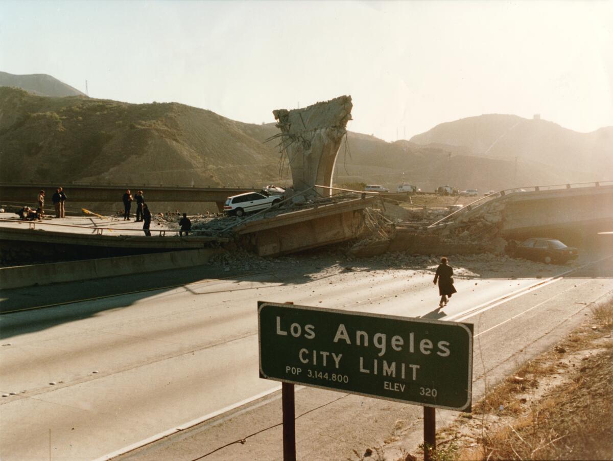
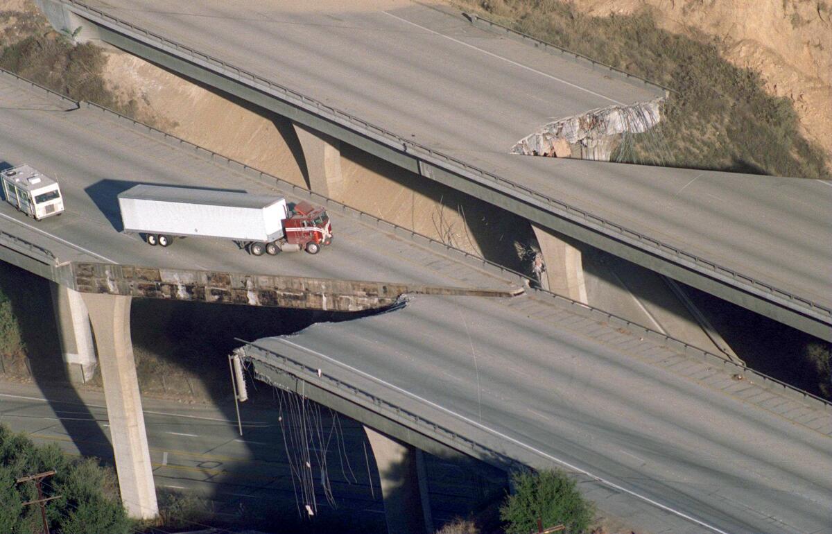
That’s a stark contrast to the prior three decades, when earthquakes in suburban or mountainous areas caused catastrophic damage in the urban infrastructure, causing freeway and building collapses and resulting in the deaths of scores of people.
“If you take the last 30 years as your definition of how often you should expect to be feeling earthquakes, you are underestimating the long-term rate,” said seismologist Lucy Jones, a Caltech research associate. “Since Northridge, in the L.A. area, we’ve been seeing fewer earthquakes, and having fewer damaging ones, than the long-term rate would imply.”
30 years, but how much longer?
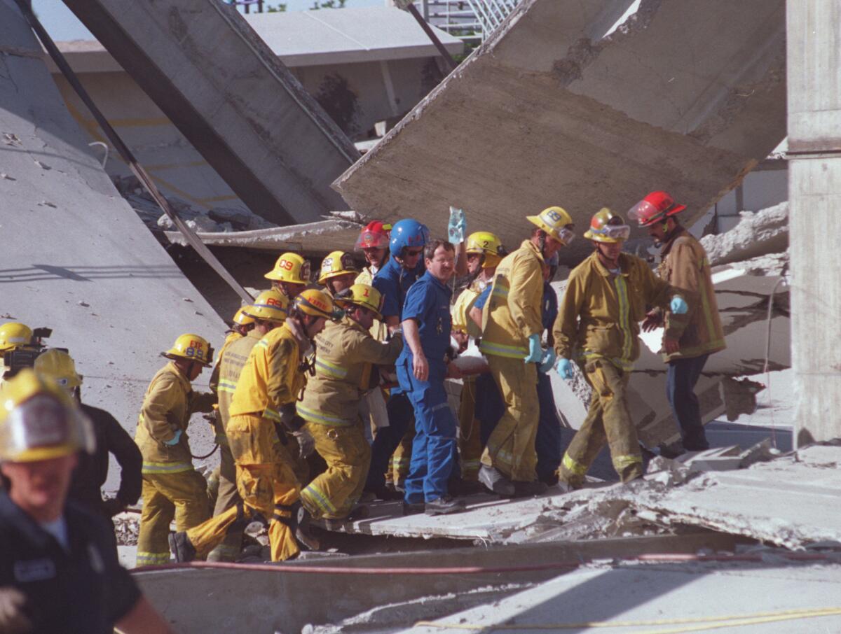
Between 1964 and 1994, Los Angeles faced two big earthquakes, which both hit the suburban San Fernando Valley hard: the magnitude 6.6 Sylmar earthquake of 1971, which resulted in 64 deaths; and the magnitude 6.7 Northridge earthquake of 1994, in which about 60 people died. The Northridge quake caused up to $20 billion in damage and an additional $40 billion or more in economic losses — the costliest seismic disaster in U.S. history, the California Geological Survey said.
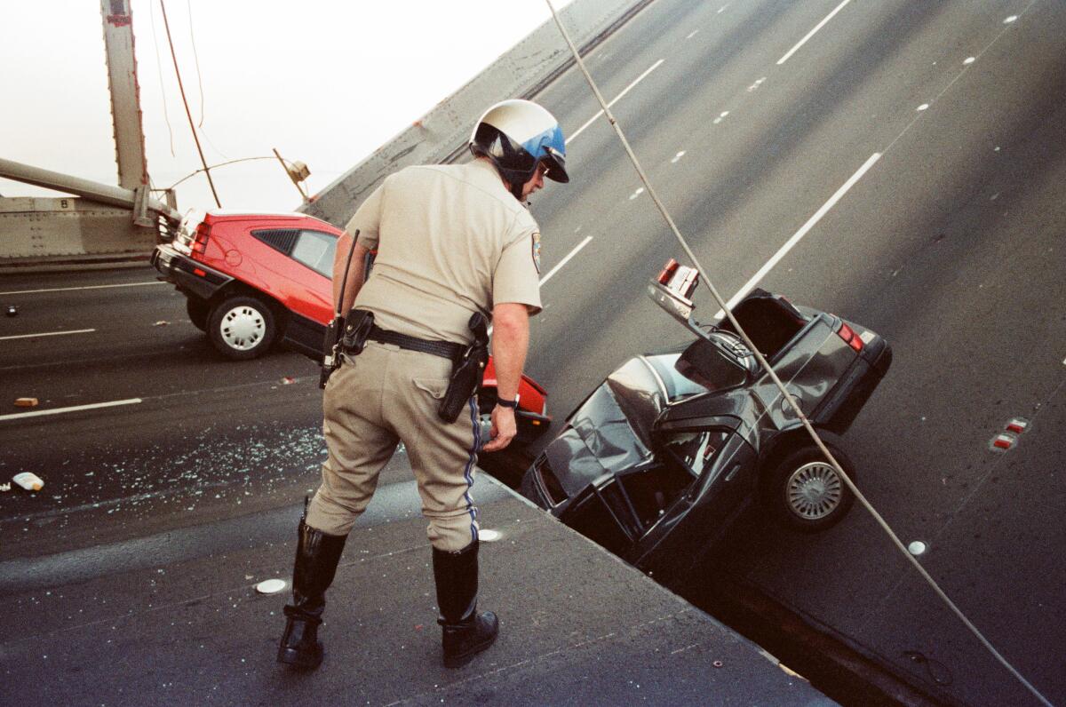
In Northern California, the magnitude 6.9 Loma Prieta earthquake of 1989 was centered in the Santa Cruz Mountains, yet still caused collapses in San Francisco and Oakland, about 60 miles from the epicenter. Sixty-three deaths were reported.
Scientists warn that even those earthquakes are relatively moderate compared with what can happen. No one alive today has experienced the kind of seismic power early Californians faced more than a century ago. In 1906, an earthquake with an estimated magnitude of 7.9 ruptured 300 miles of the San Andreas fault, from Humboldt County to San Benito County, and destroyed much of San Francisco.
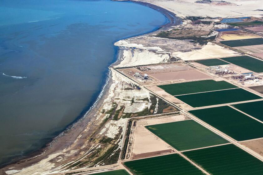
A drying Salton Sea may be helping delay the next Big One, but that could result in a more powerful quake when it does strike.
Southern California’s last “Big One” was in 1857, when an earthquake with a magnitude of roughly 7.9 ruptured 225 miles of fault on the San Andreas, between Monterey and San Bernardino counties. A hypothetical future magnitude 7.8 earthquake on the southern San Andreas fault, from the Mexican border to Los Angeles County, could result in 1,800 deaths and nearly 50,000 injuries, according to the U.S. Geological Survey’s “ShakeOut” scenario.
That scenario would result in the deadliest quake in modern Southern California history, with more than 1,000 of those fatalities possibly occurring in L.A. County alone.
The magnitude 7.8 ShakeOut quake would be more than 12 times bigger than the Northridge quake as measured on a seismogram. But a more important comparison shows that the ShakeOut scenario quake would be 45 times stronger, in terms of energy released, than Northridge. The 1994 earthquake resulted in perhaps seven to 15 seconds of shaking; many buildings would face nearly 2 minutes of shaking in a ShakeOut scenario quake, according to the USGS.
There’s now an entire generation of Californians who have grown up without experiencing the damaging earthquakes we saw in the 1980s and 1990s, even smaller ones that caused localized damage, such as the magnitude 5.9 Whittier Narrows earthquake, centered in the San Gabriel Valley, which killed eight people in 1987.
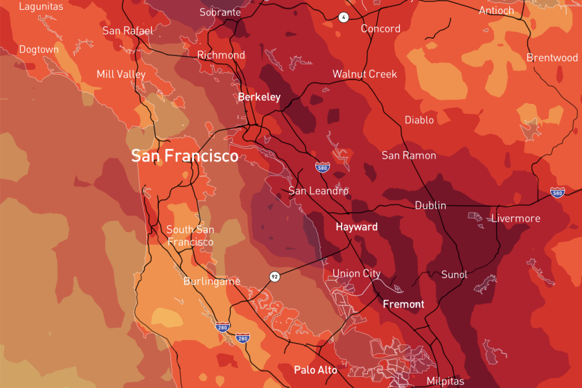
California has suffered some destructive earthquakes in the last few decades but much bigger quakes are possible. These maps show some scenarios.
Certainly, there have been a few earthquakes of magnitude 6 or greater in the last three decades that brought damage to California. Humboldt County saw them in 2010 and 2022; the Mojave Desert in 1999 and 2019; Napa County in 2014; Imperial County in 2010, resulting from an earthquake centered in Baja California; and in San Luis Obispo County in 2003.
Those were the most noteworthy of the 12 earthquakes of magnitude 6 or greater that have shaken up California and Nevada in the last 30 years.
But that tally is fewer than half of the 28 earthquakes of magnitude 6 or greater in the prior 30 years, between 1964 and 1994.
Puente Hills fault system could set off a devastating quake
Unfinished business
The earthquakes in the 1980s and 1990s brought a renewed wake-up call to California’s seismic vulnerabilities. Earlier quakes — the magnitude 6.4 Long Beach earthquake of 1933, centered just off the Huntington Beach coast, and the Sylmar earthquake — also sparked changes in building codes and led to a better understanding of seismic risks.
Officials responded to the 1989 and 1994 earthquakes with an unprecedented seismic safety campaign that remade California’s freeways and bridges and generally raised awareness about the financial and personal stakes.
More progress was made starting about a decade ago. In 2013, San Francisco ordered retrofits of “soft-story” apartments, which are vulnerable to collapse because their upper floors are held up by flimsy, skinny columns on top of carports or garages.
Los Angeles followed suit in 2015, and also ordered “non-ductile,” or brittle, concrete buildings to be retrofitted. Cities in Southern California that have recently passed retrofit laws include Torrance, Pasadena, Santa Monica, Culver City, West Hollywood and Beverly Hills. In Northern California, they include Oakland, Berkeley, Fremont and Mill Valley.
But not all of those cities have ordered retrofits of all of the types of buildings structural engineers are concerned about. There remain many other cities that have done nothing for decades to order vulnerable buildings be retrofitted or demolished. And experts say there is much more to do and fear the lack of a major urban quake since 1994 has made people forget.
When the Big One hits, will Californians be ready for a lack of modern communication connections? Extended periods without essential utilities such as water and gas? Damage to homes? The mental health effects that often follow disaster?
Apartment owners who fail to retrofit their quake-vulnerable buildings risk a total loss. About 200 soft-story apartment buildings in the L.A. area were seriously damaged or destroyed during the Northridge earthquake. At one of them, the Northridge Meadows complex, 16 people died when the ground story collapsed. Experts warn that the collapse of many of these buildings in a future quake would result in an increase in homelessness and threaten the limited stock of affordable housing, imperiling a community’s ability to rebound after the shaking fades.
And some cities remain decades behind in seismic safety laws compared with other jurisdictions, which began voting decades ago to order century-old brick buildings to be retrofitted or demolished. A particularly worrisome spot is the Inland Empire, through which the San Andreas fault runs. A Times investigation in 2018 reported how hundreds of old brick buildings in more than a dozen cities in the Inland Empire remained unretrofitted despite decades of warnings.
State officials are also taking steps to encourage owners of single-family homes to voluntarily retrofit their houses. Relatively simple fixes to protect homes can prevent owners from incurring hundreds of thousands of dollars in damage after a quake hits.
2024’s elevated seismic activity

For those who might wonder whether Southern California has felt more earthquakes than usual, it’s not just your imagination.
The magnitude 4.7 quake just north of Malibu on Thursday was the 14th seismic sequence so far this year in Southern California with at least one earthquake of magnitude 4 or higher, Jones said. That tally broke a record for the last 65 years.
In that time period in Southern California, there were an average of eight to 10 independent sequences of earthquakes that included at least one of magnitude 4 or greater. In some years, there was just one or two of those sequences. The prior record was in 1988, when there were 13 of those earthquake sequences, Jones said.
The activity is not necessarily an indication that a large, damaging earthquake is around the corner, scientists said. Some researchers have offered dueling theories — some say earthquake activity goes up in a region before a large earthquake, others say it goes down.
So the recent activity does not offer any hints of when the next large, destructive earthquake will occur, according to USGS seismologist Susan Hough.
“So, yes, this is a more active year than we’ve had in the past,” Jones said. But, she added, “We can’t quite say yet that whether or not that it is actually statistically significant to be seeing this.”
Earthquakes are a way of life if you live in Los Angeles. But what about when you never feel them — even as your Shake Alert is blaring and your friends are buzzing about the temblor?
The latest quakes are “a really good reminder that the quiet of the last couple of decades is not our long-term picture, and we do need to be prepared,” Jones said.
Why we’re talking more about quakes
Some people have noted how it seems like we might be talking about modest earthquakes more than we used to. That’s probably for a number of reasons — including the rise of the internet and social media, which make it quite easy for even people who never felt a given earthquake to talk about it.
Decades ago, “If you felt it, you talked about it with your friends,” Jones said. Now, even people who didn’t feel it can talk about how they didn’t feel it.
Today, “It’s so easy to get the information,” she said.
It’s also much faster to process seismic data nowadays. Decades ago, figuring out the magnitude and location of an earthquake was a time-intensive process.
Back then, “To figure out where an earthquake was, you had to get a seismologist to come into the lab and look, pull out the records and compute it,” Jones said.
Seismologists at the time relied on an alarm system triggered from six stations across Southern California, which made graphs etched by a mechanical pen; the alarm rang when at least two of them went off scale, indicating an earthquake of magnitude 4 or higher had occurred. If the alarm rang outside business hours, someone would need to call down a list of seismologists until someone agreed to come in.
That meant that earthquakes of magnitude 3 or lower weren’t prioritized for relatively quick analysis.
For the 1987 Whittier Narrows earthquake, it took roughly an hour to get a preliminary location and magnitude, Jones said, and something like three hours before she could begin talking to reporters formally about more details. Jones and other seismologists had to pore over paper records and measure them by hand, and had to initially guess at the magnitude.
And “shake maps” — maps that could quantify the intensity of shaking felt by location — weren’t available virtually instantaneously as they are today. Making those shake maps required sending out survey forms or obtaining strong-motion records. “We had to go pick up film chips and process them, so that took like a month or two,” Jones said.
Contrast that with Thursday, when some people got a preliminary magnitude on an earthquake early warning app seconds before they felt shaking, and Jones was available on a Zoom conference call with reporters just minutes after the quake.
‘A very good reminder’
The risks are all around us.
Take the Puente Hills thrust fault system, which was linked to several quakes this year centered in El Sereno, a neighborhood on Los Angeles’ Eastside. The USGS and the Southern California Earthquake Center in 2005 said that a magnitude 7.5 quake on that fault system, which runs underneath downtown and broad swaths of Southeast L.A. County, the San Gabriel Valley and northern Orange County, could kill as many as 18,000 people and cause as much as $250 billion in damage. Such a quake would be 15 times stronger, in terms of energy released, than the Northridge earthquake. It is impossible to say when such a large quake could occur.
The east-west faults that ran near Thursday’s Malibu quake also are a threat. Earthquakes in that area can reach up to magnitude 8, which is actually “pretty standard for anywhere in California,” said Morgan Page, a USGS geophysicist. That’s because individual faults can link up with others in the same seismic event to form a larger magnitude earthquake.
Officials worry that a huge temblor would cut off Southern California from vital utilities and communications for days, if not weeks. One vulnerable spot is the Cajon Pass, the narrow mountain pass where the San Andreas fault intersects with combustible natural gas and petroleum pipelines, electrical transmission lines, train tracks and Interstate 15 north of San Bernardino. Earthquakes also could cripple critical supplies of water to Los Angeles.
Hough, the USGS seismologist, said the Malibu quake offers another reason to prepare.
“It is a very good reminder to people that we live in earthquake country,” she said. “And we need to take the steps that will help keep us all safe if a bigger earthquake does occur.”
Learn more with Unshaken
Have you checked your earthquake supply pack and downloaded the early-warning app? Also, sign up for Unshaken, a six-week newsletter course on earthquake preparedness.
More to Read
Sign up for Essential California
The most important California stories and recommendations in your inbox every morning.
You may occasionally receive promotional content from the Los Angeles Times.
