Chat & Selfie: Hanksite, halite and me
Surrounded by rocks and the teetering stacks of more than 200,000 old maps, books and documents that clutter the Nevada Mineral and Book Company in Orange, the California section’s Louis Sahagun recently sat and yakked with the shop’s owner, Walter Lombardo, about cartography and what it means to him and to California. We later emailed him a few questions. We’ve crunched the conversation into this:
Just from looking at maps, what are California’s three ugliest cities?
There are no ugly cities judging from the way that they are portrayed in maps. Take Trona, Calif. At first glance, it looks mighty desolate, hot and dry. But a rock collector with a good map can track down big yellow crystals of hanksite and pink translucent cubes of halite.
MapQuest? Waze? The Internet? Ring a bell?
A lot of this information isn’t available online. Never will be. And while things may look disorganized around here, if a customer walked in with an arcane request, chances are I could dig it out of the stacks in less than an hour.
Google could do it in a nanosecond, and no need to touch that stuff — what’s it called — paper?
Some people, including myself, love the feel of the paper — especially in the field. We have a love of their maps’ mystique and an admiration of the work it took to prepare them.
So there’s a use for old maps?
Absolutely. New maps often don’t show what happened in a particular place over time. Yet urban planners and engineers, environmentalists and investors need to know where old waste pits and stream beds were located.
I have a very cool map specially made in 1910 of the Ajo mining district of southern Arizona. It’s covered with tiny symbols, including squares, each one representing an existing mine. If you overlay a current modern map of the area on top of this old map, most of its remarkable detail would be obliterated by the huge open-pit mine that operates there now.
The Department of the Interior in the 1990s began deliberately sanitizing maps of public lands for a variety of reasons. Many sites that people are keenly interested in visiting — old mines, unexplored caves, roads and petroglyphs — are nowhere to be found on new government maps.
Do you ever worry that the “Hoarders” folks are gonna come knocking?
I bought my first significant collection of maps and publications in 1982. It was from the U.S. Bureau of Mines. Since then, I’ve bought entire map libraries from historians, corporations, mining companies, company mergers, museums and universities, and state and federal agencies including the U.S. Bureau of Land Management. I just bought another big batch this week — 560 California topographical maps published between 1930 and 1985.
Maps can tell unpleasant stories, right? Segregation, etc.?
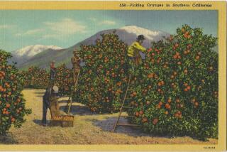
Sure. Maps chronicle successive waves of change: Orange groves gave way to urban sprawl. Meadows became shopping centers. Streams and wetlands paved over. Some of the same old maps contain information that planners could use to do it better the next time.
If you could magically redefine California by making a new map of the state, what would you change?
I’d make it an island, just as it was depicted in the maps of the earliest explorers. That would give all newcomers an equal opportunity to a stake in coastal property.
More to Read
Sign up for Essential California
The most important California stories and recommendations in your inbox every morning.
You may occasionally receive promotional content from the Los Angeles Times.


