Flood risk begins to ease along California rivers after six-month surge in water levels

For the first time in more than six months, no federally monitored rivers in California or Nevada are flooding or at risk of flooding, according to climate scientists.
From Jan. 4 to July 15, at least one California or Nevada river fed by the Sierra Nevada was at or above flood monitoring stage, following a historically wet winter.
For the record:
3:19 a.m. Nov. 25, 2024An earlier version of this story stated storms damaged state roads and bridges “to the tune of hundreds of billions of dollars.” Repairs were estimated to cost hundreds of millions of dollars.
A non-leveed river reaches monitor stage when it rises above its normal flow for that time of year, begins to wash over low-lying banks and causes minor flooding. Flood stage is when it’s a full inundation that causes significant damage to the area.
For a leveed river, monitor stage is when the water is several feet below the tops of the banks, but high enough where local officials are required to begin monitoring the river around the clock.
The streak started Jan. 4 in Sacramento County, when the Cosumnes River exceeded its monitor stage about 1:45 p.m., and it ended 193 days later on Saturday, when the Walker River in Nevada dropped below its monitor stage about 3 p.m., according to the California Nevada River Forecast Center, a branch of the National Weather Service.
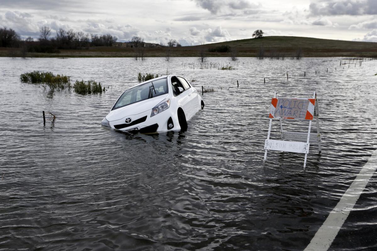
In between those events, California was at the mercy of at least 30 atmospheric rivers (compared with an annual average of six) that dumped unprecedented amounts of rain and snow across the West Coast. The storms flooded low-lying communities, buried mountain towns in snow and battered the state’s infrastructure.
At the peak of the floods in January, 42 of the forecast center’s 98 river-monitoring stations showed water levels were at least at monitor stage — and in some areas, actually flooding.
Conditions only worsened in February, when 51% of the center’s stations showed rivers were at risk of flooding or had already done so.
The storms led Gov. Jerry Brown to declare an emergency for 50 of California’s 58 counties, where reservoirs were filling to the brim and roads and bridges were crumbling, leaving an estimated repair bill of hundreds of millions of dollars.
Dozens of people died in weather-related mishaps involving car crashes, river drownings, falling trees and exposure to the elements.
When the storms subsided, Central Valley communities remained in the crosshairs.
The Sierra Nevada snowpack was among the largest ever recorded. When summer temperatures surged, hundreds of billions of gallons of snowmelt flowed into reservoirs and rivers, where it compromised levees.
Only in the last few weeks have counties in the Central Valley begun to reopen river access for recreation.
Though the threat of overflowing rivers may have faded for now, there’s still a risk that waters could rise again if the conditions are right, the National Weather Service said.
“There can always be the chance for a high-water event or flash flood. All it takes really is a thunderstorm to be stationary over the right point of the Sierra Nevada,” said Kris Mattarochia, a scientist and operations officer with the weather service.
For breaking California news, follow @JosephSerna on Twitter.
More to Read
Sign up for Essential California
The most important California stories and recommendations in your inbox every morning.
You may occasionally receive promotional content from the Los Angeles Times.


